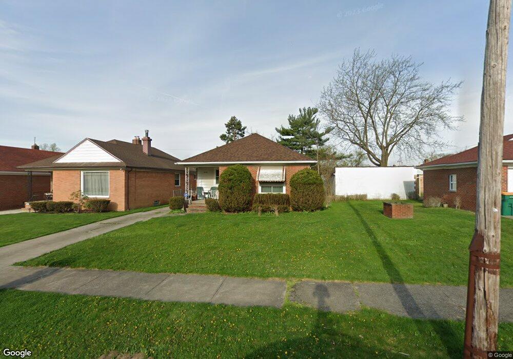
5032 Thomas St Maple Heights, OH 44137
Estimated Value: $115,196 - $163,000
3
Beds
1
Bath
1,167
Sq Ft
$114/Sq Ft
Est. Value
About This Home
This home is located at 5032 Thomas St, Maple Heights, OH 44137 and is currently estimated at $132,549, approximately $113 per square foot. 5032 Thomas St is a home located in Cuyahoga County with nearby schools including Abraham Lincoln Elementary School, Rockside/ J.F. Kennedy School, and Italy High School.
Ownership History
Date
Name
Owned For
Owner Type
Purchase Details
Closed on
May 15, 2000
Sold by
Bolden Esther B Revocable Living Trust and Bolden Norman
Bought by
Stallings Melissa
Current Estimated Value
Home Financials for this Owner
Home Financials are based on the most recent Mortgage that was taken out on this home.
Original Mortgage
$86,708
Outstanding Balance
$29,933
Interest Rate
8.13%
Mortgage Type
FHA
Estimated Equity
$102,616
Purchase Details
Closed on
Feb 1, 1993
Sold by
Kunar Laverne A
Bought by
Bolden Esther
Purchase Details
Closed on
Nov 28, 1979
Sold by
Pavelka Lillian
Bought by
Kunar Laverne A
Purchase Details
Closed on
Jun 29, 1977
Sold by
Pavelka Joseph
Bought by
Pavelka Lillian
Purchase Details
Closed on
May 2, 1977
Sold by
Pavelka Jos and Pavelka Lillian
Bought by
Pavelka Joseph
Purchase Details
Closed on
Jan 1, 1975
Bought by
Pavelka Jos and Pavelka Lillian
Create a Home Valuation Report for This Property
The Home Valuation Report is an in-depth analysis detailing your home's value as well as a comparison with similar homes in the area
Home Values in the Area
Average Home Value in this Area
Purchase History
| Date | Buyer | Sale Price | Title Company |
|---|---|---|---|
| Stallings Melissa | $87,500 | Title First Agency Inc | |
| Bolden Esther | $71,000 | -- | |
| Kunar Laverne A | $5,000 | -- | |
| Pavelka Lillian | -- | -- | |
| Pavelka Joseph | -- | -- | |
| Pavelka Jos | -- | -- |
Source: Public Records
Mortgage History
| Date | Status | Borrower | Loan Amount |
|---|---|---|---|
| Open | Stallings Melissa | $86,708 |
Source: Public Records
Tax History Compared to Growth
Tax History
| Year | Tax Paid | Tax Assessment Tax Assessment Total Assessment is a certain percentage of the fair market value that is determined by local assessors to be the total taxable value of land and additions on the property. | Land | Improvement |
|---|---|---|---|---|
| 2024 | $3,678 | $40,425 | $7,140 | $33,285 |
| 2023 | $2,706 | $25,270 | $4,340 | $20,930 |
| 2022 | $2,696 | $25,270 | $4,340 | $20,930 |
| 2021 | $2,880 | $25,270 | $4,340 | $20,930 |
| 2020 | $2,452 | $19,150 | $3,290 | $15,860 |
| 2019 | $2,441 | $54,700 | $9,400 | $45,300 |
| 2018 | $2,429 | $19,150 | $3,290 | $15,860 |
| 2017 | $2,212 | $16,770 | $3,010 | $13,760 |
| 2016 | $2,140 | $16,770 | $3,010 | $13,760 |
| 2015 | $2,146 | $16,770 | $3,010 | $13,760 |
| 2014 | $2,146 | $18,420 | $3,330 | $15,090 |
Source: Public Records
Map
Nearby Homes
- 5061 Philip Ave
- 5082 Philip Ave
- 5110 Philip Ave
- 5031 Cato St
- 5185 Clement Ave
- 5231 Philip Ave
- 5199 Arch St
- 5208 Clement Ave
- 5257 Philip Ave
- 5212 Catherine St
- 5239 Arch St
- 16712 Kollin Ave
- 5234 Erwin St
- 16706 Myrtle Ave
- 5210 Theodore St
- 5320 Clement Ave
- 16241 Glenburn Ave
- 17916 North Blvd
- 17912 North Blvd
- 4737 E 174th St
- 5036 Thomas St
- 5040 Thomas St
- 17512 Mccracken Rd
- 17516 Mccracken Rd
- 17508 Mccracken Rd
- 5046 Thomas St
- 5033 Philip Ave
- 5037 Philip Ave
- 17504 Mccracken Rd
- 5041 Philip Ave
- 5050 Thomas St
- 17700 Mccracken Rd
- 5045 Philip Ave
- 5035 Thomas St
- 5039 Thomas St
- 17500 Mccracken Rd
- 5054 Thomas St
- 17720 Mccracken Rd
- 5041 Thomas St
- 5049 Philip Ave