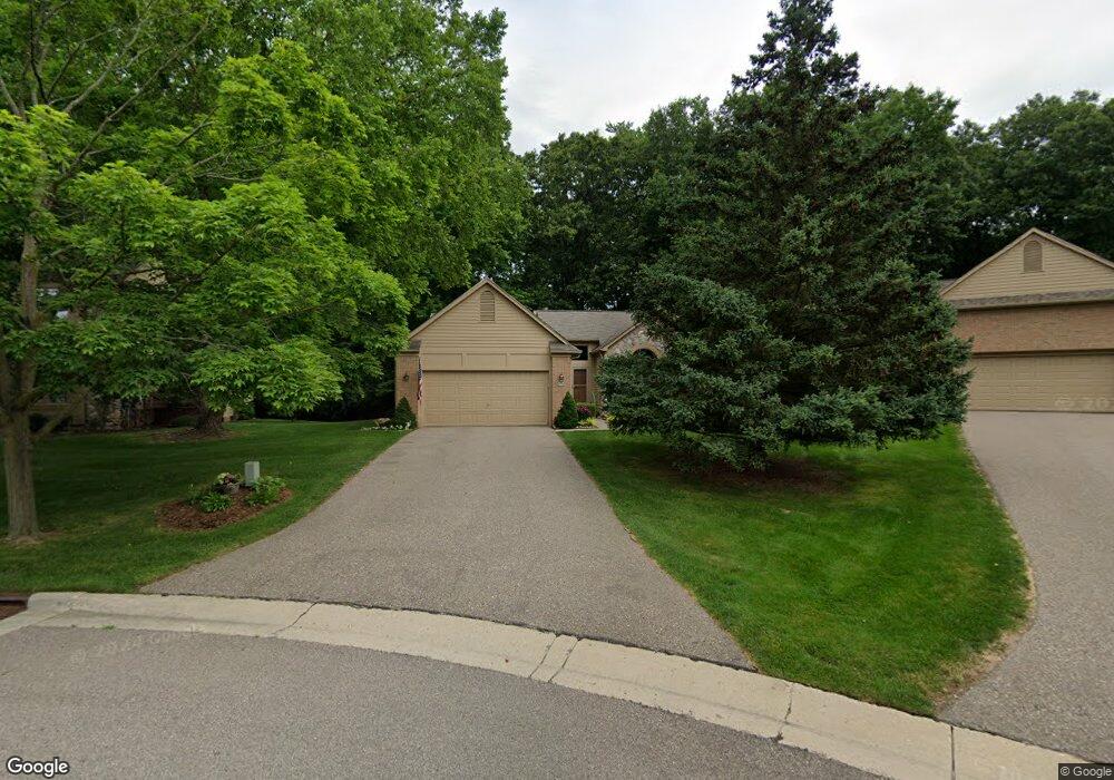
5035 Pheasant Cove Unit 6 West Bloomfield, MI 48323
Estimated Value: $419,344 - $458,000
2
Beds
2
Baths
1,842
Sq Ft
$234/Sq Ft
Est. Value
About This Home
This home is located at 5035 Pheasant Cove Unit 6, West Bloomfield, MI 48323 and is currently estimated at $431,586, approximately $234 per square foot. 5035 Pheasant Cove Unit 6 is a home located in Oakland County with nearby schools including Walled Lake Central High School, The Susan And Rabbi Harold Loss Ecc, and Brookfield Academy - West Bloomfield.
Ownership History
Date
Name
Owned For
Owner Type
Purchase Details
Closed on
Nov 9, 2017
Sold by
Charlip Barbara B and Charlip Barbara
Bought by
Charlip Barbara B and Barbara B Charlip Living Trust
Current Estimated Value
Purchase Details
Closed on
May 18, 2010
Sold by
Estate Of Margaret J Todd
Bought by
Charlip Barbara
Purchase Details
Closed on
Oct 15, 2001
Sold by
Polleiner Maria
Bought by
Todd Robert J
Create a Home Valuation Report for This Property
The Home Valuation Report is an in-depth analysis detailing your home's value as well as a comparison with similar homes in the area
Home Values in the Area
Average Home Value in this Area
Purchase History
| Date | Buyer | Sale Price | Title Company |
|---|---|---|---|
| Charlip Barbara B | -- | None Available | |
| Charlip Barbara | $163,000 | Devon Title Agency | |
| Todd Robert J | $312,000 | -- |
Source: Public Records
Tax History Compared to Growth
Tax History
| Year | Tax Paid | Tax Assessment Tax Assessment Total Assessment is a certain percentage of the fair market value that is determined by local assessors to be the total taxable value of land and additions on the property. | Land | Improvement |
|---|---|---|---|---|
| 2024 | $2,097 | $172,240 | $0 | $0 |
| 2022 | $1,977 | $147,490 | $35,450 | $112,040 |
| 2021 | $3,311 | $147,430 | $0 | $0 |
| 2020 | $1,954 | $154,260 | $35,450 | $118,810 |
| 2018 | $3,244 | $139,980 | $35,450 | $104,530 |
| 2015 | -- | $103,330 | $0 | $0 |
| 2014 | -- | $92,010 | $0 | $0 |
| 2011 | -- | $81,910 | $0 | $0 |
Source: Public Records
Map
Nearby Homes
- 7065 Deerwood Trail Unit 27
- 6980 Hambro St
- 6433 Walnut Lake Rd
- 4540 Rolling Pine Ct
- 5994 Glen Eagles Dr
- 6606 Leytonstone Blvd
- VL Leytonstone Blvd
- 5570 Wildrose Ave
- 0000 Blue Jay Way
- 4442 Borland St
- 7230 Walnut Lake Rd
- 7220 Essex Dr
- 5512 Essex Ct
- 4335 Crestdale Ave
- 7359 Woodlore Dr
- 7555 Windgate Cir
- 5676 Hillcrest Cir E
- 5608 Hillcrest Cir W Unit 80
- 6140 Pontiac Trail
- 000 Pontiac Trail
- 5029 Pheasant Cove Unit 5
- 5041 Pheasant Cove
- 5047 Pheasant Cove
- 5023 Pheasant Cove
- 5039 Lagoons Cir Unit 16
- 5053 Pheasant Cove
- 5053 Pheasant Cove Unit 94
- 5017 Lagoons Cir
- 5011 Lagoons Cir
- 5065 Pheasant Cove
- 5065 Pheasant Cove Unit 11
- 5055 Lagoons Cir
- 5005 Lagoons Cir
- 5071 Pheasant Cove
- 6712 Oyster Cove
- 6700 Oyster Cove
- 6700 Oyster Cove Unit 36
- 5077 Pheasant Cove Unit 13
- 5077 Pheasant Cove
- 6634 Torybrooke Cir