Estimated Value: $317,000 - $371,000
3
Beds
2
Baths
1,333
Sq Ft
$252/Sq Ft
Est. Value
About This Home
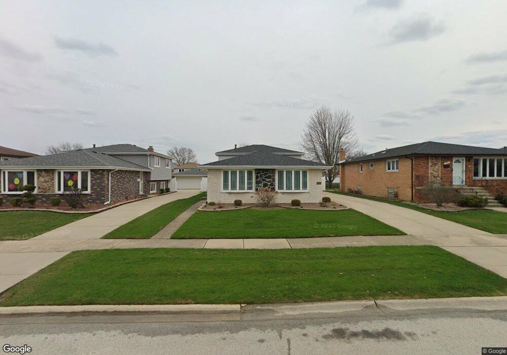
This home is located at 5035 W 121st St, Alsip, IL 60803 and is currently estimated at $335,569, approximately $251 per square foot. 5035 W 121st St is a home located in Cook County with nearby schools including Hazelgreen Elementary School, Prairie Jr High School, and A B Shepard High School.
Ownership History
Date
Name
Owned For
Owner Type
Purchase Details
Closed on
Apr 3, 2017
Sold by
Demauro Marietta and Demauro Michael J
Bought by
Demauro Michael J and Demauro Marietta
Current Estimated Value
Purchase Details
Closed on
May 5, 1999
Sold by
American National Bk & Tr Co Of Chicago
Bought by
Ford Karen
Home Financials for this Owner
Home Financials are based on the most recent Mortgage that was taken out on this home.
Original Mortgage
$98,301
Outstanding Balance
$25,399
Interest Rate
7.04%
Mortgage Type
FHA
Estimated Equity
$310,170
Purchase Details
Closed on
Nov 7, 1997
Sold by
Cannici Marietta and Demauro Marietta
Bought by
Demauro Michael J and Demauro Marietta
Home Financials for this Owner
Home Financials are based on the most recent Mortgage that was taken out on this home.
Original Mortgage
$114,750
Interest Rate
7.24%
Create a Home Valuation Report for This Property
The Home Valuation Report is an in-depth analysis detailing your home's value as well as a comparison with similar homes in the area
Home Values in the Area
Average Home Value in this Area
Purchase History
| Date | Buyer | Sale Price | Title Company |
|---|---|---|---|
| Demauro Michael J | -- | Attorney | |
| Ford Karen | $101,000 | -- | |
| Demauro Michael J | -- | Lawyers Title Insurance Corp |
Source: Public Records
Mortgage History
| Date | Status | Borrower | Loan Amount |
|---|---|---|---|
| Open | Ford Karen | $98,301 | |
| Previous Owner | Demauro Michael J | $114,750 | |
| Closed | Demauro Michael J | $14,000 |
Source: Public Records
Tax History Compared to Growth
Tax History
| Year | Tax Paid | Tax Assessment Tax Assessment Total Assessment is a certain percentage of the fair market value that is determined by local assessors to be the total taxable value of land and additions on the property. | Land | Improvement |
|---|---|---|---|---|
| 2024 | $7,848 | $27,000 | $4,550 | $22,450 |
| 2023 | $6,727 | $27,000 | $4,550 | $22,450 |
| 2022 | $6,727 | $20,170 | $3,575 | $16,595 |
| 2021 | $6,434 | $20,170 | $3,575 | $16,595 |
| 2020 | $6,445 | $20,170 | $3,575 | $16,595 |
| 2019 | $6,425 | $19,831 | $3,250 | $16,581 |
| 2018 | $6,183 | $19,831 | $3,250 | $16,581 |
| 2017 | $6,250 | $19,831 | $3,250 | $16,581 |
| 2016 | $5,322 | $16,225 | $2,762 | $13,463 |
| 2015 | $5,231 | $16,225 | $2,762 | $13,463 |
| 2014 | $5,071 | $16,225 | $2,762 | $13,463 |
| 2013 | $5,286 | $18,025 | $2,762 | $15,263 |
Source: Public Records
Map
Nearby Homes
- 5008 W 122nd St Unit 2B
- 12147 S Cicero Ave
- 11841 S Leamington Ave
- 4833 W 123rd Place
- 12211 S Spencer St
- 11906 S Cicero Ave
- 4808 W 118th St
- 4804 W 118th St
- 11756 S Leamington Ave
- 11601 S Lawler Ave
- 11608 S Leamington Ave
- 4511 W Howdy Ln
- 12417 S Orchard St
- 12421 S Orchard St
- 12715 S Laporte Ave
- 5544 W Cal Sag Rd
- 11553 S Joalyce Dr
- 11534 S Lee Rd
- 5311 W Mint Julip Dr Unit 301
- 12620 S Alpine Dr Unit 6
- 5033 W 121st St
- 5039 W 121st St
- 5043 W 121st St
- 5027 W 121st St
- 5028 W 121st Place
- 5032 W 121st Place
- 5024 W 121st Place
- 5047 W 121st St
- 5023 W 121st St
- 5036 W 121st Place
- 5020 W 121st Place
- 5040 W 121st Place
- 5016 W 121st Place
- 5019 W 121st St
- 5051 W 121st St
- 5034 W 121st St
- 5036 W 121st St
- 5030 W 121st St
- 5042 W 121st St
- 5026 W 121st St