Estimated Value: $427,255 - $523,000
3
Beds
2
Baths
2,030
Sq Ft
$227/Sq Ft
Est. Value
About This Home
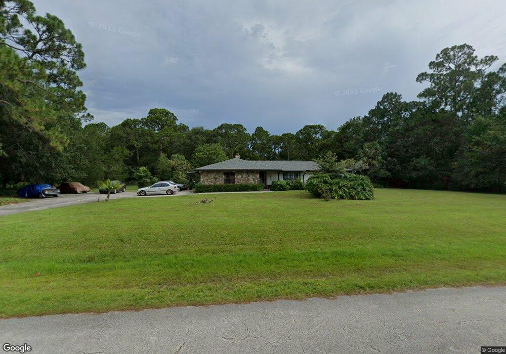
This home is located at 5035 Yorkshire Rd, Cocoa, FL 32926 and is currently estimated at $461,814, approximately $227 per square foot. 5035 Yorkshire Rd is a home located in Brevard County with nearby schools including Saturn Elementary School and Cocoa High School.
Ownership History
Date
Name
Owned For
Owner Type
Purchase Details
Closed on
Jun 24, 2024
Sold by
Moran-Harrison Cindy J
Bought by
Bell Dale and Bell Sarah E
Current Estimated Value
Home Financials for this Owner
Home Financials are based on the most recent Mortgage that was taken out on this home.
Original Mortgage
$221,133
Outstanding Balance
$218,561
Interest Rate
7.5%
Mortgage Type
Credit Line Revolving
Estimated Equity
$243,253
Purchase Details
Closed on
Nov 27, 1996
Sold by
Pratt John A and Pratt Betti Lou
Bought by
Harrison John Stewart and Moranharrison Cindy J
Home Financials for this Owner
Home Financials are based on the most recent Mortgage that was taken out on this home.
Original Mortgage
$92,600
Interest Rate
7.83%
Create a Home Valuation Report for This Property
The Home Valuation Report is an in-depth analysis detailing your home's value as well as a comparison with similar homes in the area
Home Values in the Area
Average Home Value in this Area
Purchase History
| Date | Buyer | Sale Price | Title Company |
|---|---|---|---|
| Bell Dale | $230,000 | Title Security | |
| Bell Dale | $230,000 | Title Security | |
| Harrison John Stewart | $115,800 | -- |
Source: Public Records
Mortgage History
| Date | Status | Borrower | Loan Amount |
|---|---|---|---|
| Open | Bell Dale | $221,133 | |
| Closed | Bell Dale | $221,133 | |
| Previous Owner | Harrison John Stewart | $92,600 |
Source: Public Records
Tax History Compared to Growth
Tax History
| Year | Tax Paid | Tax Assessment Tax Assessment Total Assessment is a certain percentage of the fair market value that is determined by local assessors to be the total taxable value of land and additions on the property. | Land | Improvement |
|---|---|---|---|---|
| 2025 | $2,038 | $286,900 | -- | -- |
| 2024 | $1,997 | $145,800 | -- | -- |
| 2023 | $1,997 | $141,560 | $0 | $0 |
| 2022 | $1,868 | $137,440 | $0 | $0 |
| 2021 | $1,886 | $133,440 | $0 | $0 |
| 2020 | $1,815 | $131,600 | $0 | $0 |
| 2019 | $1,755 | $128,650 | $0 | $0 |
| 2018 | $1,752 | $126,260 | $0 | $0 |
| 2017 | $1,754 | $123,670 | $0 | $0 |
| 2016 | $1,769 | $121,130 | $38,150 | $82,980 |
| 2015 | $1,786 | $120,290 | $38,150 | $82,140 |
| 2014 | $1,787 | $119,340 | $29,980 | $89,360 |
Source: Public Records
Map
Nearby Homes
- 5011 Dalehurst Dr
- TBD Rayburn Rd
- 2635 Wagon Rd
- 365 Outer Dr
- 494 Outer Dr
- 495 Outer Dr Unit 201
- 336 Horseshoe Bend Cir Unit 197
- 344 Outer Dr Unit 323
- 6341 Pony Cir
- 634 Outer Dr
- 0 No Access (Titusville Fruit) Unit 1037909
- 000000 Unknown
- 655 Outer Dr Unit 123
- 5221 Talbot Blvd
- 1701 Saxton Rd
- Sand Key Plan at Windward Preserve
- Aruba Plan at Windward Preserve
- Amelia Plan at Windward Preserve
- Bahama Plan at Windward Preserve
- Grenada Plan at Windward Preserve
- 5025 Yorkshire Rd
- 5045 Yorkshire Rd
- 5100 Dalehurst Dr
- 1991 Juniper Dr
- 5030 Yorkshire Rd
- 5040 Yorkshire Rd
- 2001 Juniper Dr
- 1981 Juniper Dr
- 5020 Yorkshire Rd
- 5050 Yorkshire Rd
- 5096 Dalehurst Dr
- 5111 Dalehurst Dr
- 5010 Yorkshire Rd
- 5101 Dalehurst Dr
- 5090 Dalehurst Dr
- 1990 Juniper Cir
- 5110 Dalehurst Dr
- 5005 Yorkshire Rd
- 2000 Juniper Dr
- 1960 Juniper Dr