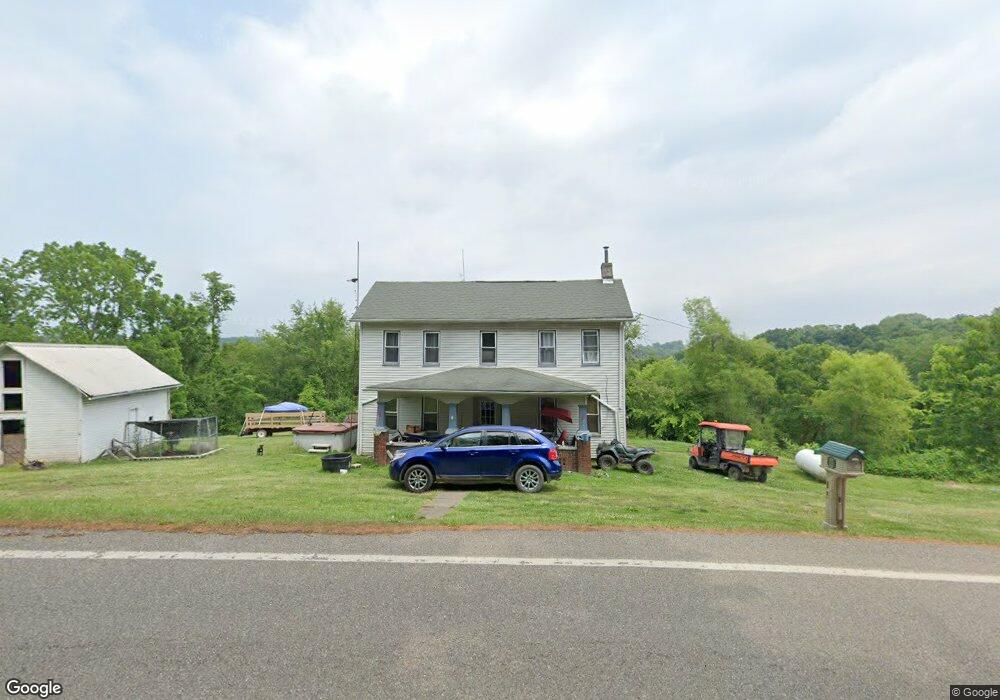
50350 State Route 556 Clarington, OH 43915
Estimated Value: $81,435 - $243,000
3
Beds
1
Bath
908
Sq Ft
$154/Sq Ft
Est. Value
About This Home
This home is located at 50350 State Route 556, Clarington, OH 43915 and is currently estimated at $139,859, approximately $154 per square foot. 50350 State Route 556 is a home located in Monroe County with nearby schools including River Elementary School, Powhatan Elementary School, and Beallsville High School.
Ownership History
Date
Name
Owned For
Owner Type
Purchase Details
Closed on
Jan 6, 2022
Sold by
Jamies Ankrom
Bought by
Phillips Casey and Phillips Cassandra
Current Estimated Value
Purchase Details
Closed on
Sep 30, 2021
Sold by
Stephens Sandra
Bought by
Potts Jamie S
Home Financials for this Owner
Home Financials are based on the most recent Mortgage that was taken out on this home.
Original Mortgage
$28,525
Interest Rate
2.8%
Mortgage Type
New Conventional
Purchase Details
Closed on
Sep 25, 2017
Sold by
Buck Wesley S
Bought by
Stephens Sandra
Purchase Details
Closed on
Dec 17, 2001
Bought by
Buck Wesley S
Purchase Details
Closed on
Oct 10, 1995
Bought by
Buck Wesley S
Purchase Details
Closed on
Jan 11, 1995
Bought by
Buck Wesley S
Create a Home Valuation Report for This Property
The Home Valuation Report is an in-depth analysis detailing your home's value as well as a comparison with similar homes in the area
Home Values in the Area
Average Home Value in this Area
Purchase History
| Date | Buyer | Sale Price | Title Company |
|---|---|---|---|
| Phillips Casey | $333 | Northwest Title | |
| Potts Jamie S | $38,000 | Northwest Ttl Fam Of Co Inc | |
| Stephens Sandra | $30,000 | None Available | |
| Buck Wesley S | -- | -- | |
| Buck Wesley S | $25,500 | -- | |
| Buck Wesley S | $35,000 | -- |
Source: Public Records
Mortgage History
| Date | Status | Borrower | Loan Amount |
|---|---|---|---|
| Previous Owner | Potts Jamie S | $28,525 |
Source: Public Records
Tax History Compared to Growth
Tax History
| Year | Tax Paid | Tax Assessment Tax Assessment Total Assessment is a certain percentage of the fair market value that is determined by local assessors to be the total taxable value of land and additions on the property. | Land | Improvement |
|---|---|---|---|---|
| 2024 | $521 | $18,410 | $7,700 | $10,710 |
| 2023 | $521 | $18,410 | $7,700 | $10,710 |
| 2022 | $508 | $18,410 | $7,700 | $10,710 |
| 2021 | $567 | $19,840 | $6,300 | $13,540 |
| 2020 | $567 | $19,840 | $6,300 | $13,540 |
| 2019 | $567 | $19,840 | $6,300 | $13,540 |
| 2018 | $525 | $17,730 | $5,250 | $12,480 |
| 2017 | $527 | $17,730 | $5,250 | $12,480 |
| 2016 | $536 | $17,730 | $5,250 | $12,480 |
| 2015 | $711 | $22,310 | $4,620 | $17,690 |
| 2014 | $711 | $22,310 | $4,620 | $17,690 |
| 2013 | $734 | $21,390 | $4,200 | $17,190 |
Source: Public Records
Map
Nearby Homes
- 50504 State Route 556
- 618 Market St
- 111 Main St
- 53263 E Captina Hwy
- 54360 Mount Victory Rd
- 103 Elm St
- 0 Mount Victory Rd
- 122 3rd St
- 122 2nd St
- 45725 Skyline Rd
- 46540 E Captina Highway Rd
- 56000 Crabapple Rd
- 50620 Otto Rd
- 0 Shepards Hill Rd
- 52876 Belmont Ave
- 52736 Fisher Hill Rd
- 4911 Roberts Ridge Rd
- 531 Shoe String Ln
- 00 Cr # 94
- 1246 Wren Dr
- 50352 State Route 556
- 50390 State Route 556
- 50255 State Route 556
- 50261 Orchard Ln
- 50254 Orchard Ln
- 50269 Orchard Ln
- 50255 Orchard Ln
- 50268 Orchard Ln
- 50256 Orchard Ln
- 50252 Orchard Ln
- 50250 Orchard Ln
- 50248 Orchard Ln
- 50246 Orchard Ln
- 50200 State Route 556
- 50172 State Route 556
- 52875 Township Road 2180
- 50110 State Route 556
- 50231 State Route 556
- 50575 Boltz Hill Rd
- 50517 Boltz Hill Rd