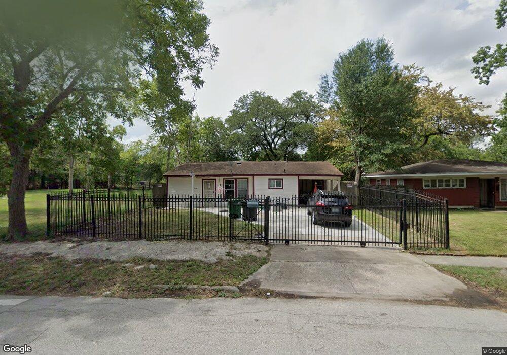
5038 Pershing St Unit 1 Houston, TX 77033
South Park NeighborhoodEstimated Value: $111,833 - $132,000
3
Beds
1
Bath
935
Sq Ft
$131/Sq Ft
Est. Value
About This Home
This home is located at 5038 Pershing St Unit 1, Houston, TX 77033 and is currently estimated at $122,458, approximately $130 per square foot. 5038 Pershing St Unit 1 is a home located in Harris County with nearby schools including Kelso Elementary School, Attucks Middle School, and Worthing High School.
Ownership History
Date
Name
Owned For
Owner Type
Purchase Details
Closed on
Jun 16, 2022
Sold by
Canales Elsa D
Bought by
Canalesle Yonarry Esperanza
Current Estimated Value
Purchase Details
Closed on
Sep 1, 2010
Sold by
Eisele Robert
Bought by
Bar Enterprises Inc
Purchase Details
Closed on
Jan 17, 2005
Sold by
Eisele Sylvia Sada
Bought by
Eisele Robert Ralph
Purchase Details
Closed on
Jul 21, 1993
Sold by
Ridgewood Svgs Bank
Bought by
Va
Create a Home Valuation Report for This Property
The Home Valuation Report is an in-depth analysis detailing your home's value as well as a comparison with similar homes in the area
Home Values in the Area
Average Home Value in this Area
Purchase History
| Date | Buyer | Sale Price | Title Company |
|---|---|---|---|
| Canalesle Yonarry Esperanza | -- | None Listed On Document | |
| Bar Enterprises Inc | -- | None Available | |
| Eisele Robert Ralph | -- | First American Title | |
| Va | -- | -- |
Source: Public Records
Tax History Compared to Growth
Tax History
| Year | Tax Paid | Tax Assessment Tax Assessment Total Assessment is a certain percentage of the fair market value that is determined by local assessors to be the total taxable value of land and additions on the property. | Land | Improvement |
|---|---|---|---|---|
| 2025 | $1,777 | $99,115 | $76,765 | $22,350 |
| 2024 | $1,777 | $84,929 | $64,955 | $19,974 |
| 2023 | $913 | $99,264 | $64,955 | $34,309 |
| 2022 | $1,975 | $89,713 | $59,050 | $30,663 |
| 2021 | $1,431 | $61,410 | $29,525 | $31,885 |
| 2020 | $1,510 | $62,342 | $16,239 | $46,103 |
| 2019 | $1,301 | $51,432 | $13,286 | $38,146 |
| 2018 | $779 | $30,792 | $10,334 | $20,458 |
| 2017 | $779 | $30,792 | $10,334 | $20,458 |
| 2016 | $779 | $30,792 | $10,334 | $20,458 |
| 2015 | $523 | $30,792 | $10,334 | $20,458 |
| 2014 | $523 | $20,334 | $10,334 | $10,000 |
Source: Public Records
Map
Nearby Homes
- 5105 Southwind St Unit A
- 5034 Pershing St
- 5106 Pershing St
- 7350 Hurtgen Forest Rd
- 7330 Hurtgen Forest Rd
- 7322 Iwo Jima Rd
- 7606 Darnay Dr
- 7338 Guadalcanal Rd
- 7318 Jutland Rd
- 7358 Forrestal St
- 4914 Pershing St
- 5021 Doolittle Blvd
- 7339 Eisenhower Rd
- 5033 Doolittle Blvd
- 5122 Longmeadow St
- 5238 Pershing St
- 4910 Southwind St
- 0000 Darnay Dr
- 5125 Doolittle Blvd
- 5225 Longmeadow St
- 5038 Pershing St
- 5030 Pershing St
- 5049 Southwind St
- 5101 Southwind St Unit A
- 5101 Southwind St Unit A-B
- 5101 Southwind St
- 7358 Iwo Jima Rd
- 5026 Pershing St
- 5102 Pershing St
- 5045 Southwind St
- 5105 Southwind St Unit B
- 5105 Southwind St Unit A-B
- 7359 Hurtgen Forest Rd
- 5109 Southwind St
- 5022 Pershing St
- 7354 Iwo Jima Rd
- 7355 Hurtgen Forest Rd
- 5113 Southwind St
- 5037 Southwind St
- 5037 Southwind St Unit B