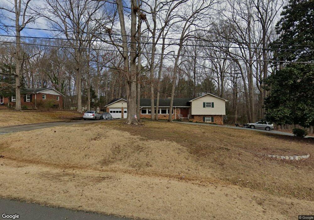
504 Andover Rd Durham, NC 27712
North Durham NeighborhoodEstimated Value: $415,000 - $470,997
4
Beds
3
Baths
2,545
Sq Ft
$175/Sq Ft
Est. Value
About This Home
This home is located at 504 Andover Rd, Durham, NC 27712 and is currently estimated at $444,749, approximately $174 per square foot. 504 Andover Rd is a home located in Durham County with nearby schools including Mangum Elementary School, Lucas Middle School, and Northern High School.
Ownership History
Date
Name
Owned For
Owner Type
Purchase Details
Closed on
Aug 14, 2003
Sold by
Livingston Helen W
Bought by
Reed David A and Reed Charlotte
Current Estimated Value
Home Financials for this Owner
Home Financials are based on the most recent Mortgage that was taken out on this home.
Original Mortgage
$126,400
Outstanding Balance
$54,850
Interest Rate
5.42%
Mortgage Type
Purchase Money Mortgage
Estimated Equity
$389,899
Create a Home Valuation Report for This Property
The Home Valuation Report is an in-depth analysis detailing your home's value as well as a comparison with similar homes in the area
Home Values in the Area
Average Home Value in this Area
Purchase History
| Date | Buyer | Sale Price | Title Company |
|---|---|---|---|
| Reed David A | $395,000 | -- |
Source: Public Records
Mortgage History
| Date | Status | Borrower | Loan Amount |
|---|---|---|---|
| Open | Reed David A | $126,400 |
Source: Public Records
Tax History Compared to Growth
Tax History
| Year | Tax Paid | Tax Assessment Tax Assessment Total Assessment is a certain percentage of the fair market value that is determined by local assessors to be the total taxable value of land and additions on the property. | Land | Improvement |
|---|---|---|---|---|
| 2025 | $3,079 | $433,712 | $92,625 | $341,087 |
| 2024 | $2,580 | $252,270 | $34,055 | $218,215 |
| 2023 | $2,447 | $252,270 | $34,055 | $218,215 |
| 2022 | $2,350 | $252,270 | $34,055 | $218,215 |
| 2021 | $2,137 | $252,270 | $34,055 | $218,215 |
| 2020 | $2,093 | $252,270 | $34,055 | $218,215 |
| 2019 | $2,093 | $252,270 | $34,055 | $218,215 |
| 2018 | $1,756 | $196,525 | $35,028 | $161,497 |
| 2017 | $1,736 | $196,525 | $35,028 | $161,497 |
| 2016 | $1,663 | $196,525 | $35,028 | $161,497 |
| 2015 | $2,067 | $214,355 | $40,103 | $174,252 |
| 2014 | $2,067 | $214,355 | $40,103 | $174,252 |
Source: Public Records
Map
Nearby Homes
- 512 W Bywood Dr
- 123 W Bywood Dr
- 206 Epperson Dr
- 816 Running Cedar Trail
- 5805 Prioress Dr
- 5809 Prioress Dr
- 5801 Prioress Dr
- 312 Mason Rd
- 5929 Guess Rd
- 155 Smith Dr
- 6423 Whitt Rd
- 145 Barclay Rd
- 600 Birchrun Dr
- 1019 Prologue Rd
- 310 Mickey Cir
- 6711 Johnson Mill Rd
- 5917 Scalybark Rd
- 309 Smith Dr
- 6052 Scalybark Rd
- 6044 Scalybark Rd
- 510 Andover Rd
- 6009 Olson Dr
- 523 Andover Rd
- 523 Andover Rd Unit 10
- 514 Andover Rd
- 6002 Olson Dr
- 503 Andover Rd
- 507 Andover Rd
- 501 Andover Rd
- 6012 Olson Dr
- 511 Andover Rd
- 409 Andover Rd
- 518 Andover Rd
- 515 Andover Rd
- 6016 Olson Dr
- 505 W Bywood Dr
- 501 W Bywood Dr
- 509 W Bywood Dr
- 6009 Baird St
- 405 Andover Rd
