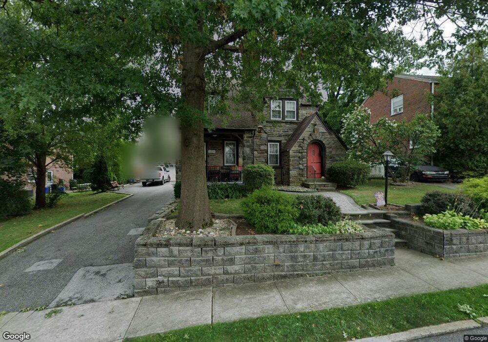
504 Broadview Rd Upper Darby, PA 19082
Estimated Value: $334,000 - $421,000
4
Beds
3
Baths
1,817
Sq Ft
$202/Sq Ft
Est. Value
About This Home
This home is located at 504 Broadview Rd, Upper Darby, PA 19082 and is currently estimated at $367,239, approximately $202 per square foot. 504 Broadview Rd is a home located in Delaware County with nearby schools including Upper Darby Kdg Center, Drexel Hill Middle School, and Upper Darby High School.
Ownership History
Date
Name
Owned For
Owner Type
Purchase Details
Closed on
Jun 28, 2013
Sold by
Neill Pauline C O and Neill Patrick J O
Bought by
Neill Pauline C O and Neill Patrick J O
Current Estimated Value
Purchase Details
Closed on
Mar 22, 2006
Sold by
Purdie Carol M and Purdie Sharon I
Bought by
Ragan Pauline C
Home Financials for this Owner
Home Financials are based on the most recent Mortgage that was taken out on this home.
Original Mortgage
$136,000
Outstanding Balance
$77,631
Interest Rate
6.34%
Mortgage Type
Purchase Money Mortgage
Estimated Equity
$289,608
Purchase Details
Closed on
Dec 20, 2002
Sold by
Purdie Carol M
Bought by
Purdie Carol M and Purdie Sharon I
Create a Home Valuation Report for This Property
The Home Valuation Report is an in-depth analysis detailing your home's value as well as a comparison with similar homes in the area
Home Values in the Area
Average Home Value in this Area
Purchase History
| Date | Buyer | Sale Price | Title Company |
|---|---|---|---|
| Neill Pauline C O | -- | None Available | |
| Ragan Pauline C | $170,000 | None Available | |
| Purdie Carol M | -- | -- |
Source: Public Records
Mortgage History
| Date | Status | Borrower | Loan Amount |
|---|---|---|---|
| Open | Ragan Pauline C | $136,000 |
Source: Public Records
Tax History
| Year | Tax Paid | Tax Assessment Tax Assessment Total Assessment is a certain percentage of the fair market value that is determined by local assessors to be the total taxable value of land and additions on the property. | Land | Improvement |
|---|---|---|---|---|
| 2025 | $6,918 | $163,590 | $42,320 | $121,270 |
| 2024 | $6,918 | $163,590 | $42,320 | $121,270 |
| 2023 | $6,853 | $163,590 | $42,320 | $121,270 |
| 2022 | $6,669 | $163,590 | $42,320 | $121,270 |
| 2021 | $8,992 | $163,590 | $42,320 | $121,270 |
| 2020 | $7,934 | $122,660 | $38,360 | $84,300 |
| 2019 | $7,795 | $122,660 | $38,360 | $84,300 |
| 2018 | $7,705 | $122,660 | $0 | $0 |
| 2017 | $7,505 | $122,660 | $0 | $0 |
| 2016 | $687 | $122,660 | $0 | $0 |
| 2015 | $687 | $122,660 | $0 | $0 |
| 2014 | $673 | $122,660 | $0 | $0 |
Source: Public Records
Map
Nearby Homes
- 1434 Bywood Ave
- 122 Crestview Rd
- 7124 Pennsylvania Ave
- 1806 Garrett Rd
- 7800 Beverly Blvd
- 367 Margate Rd
- 306 S State Rd
- 332 Springton Rd
- 341 Congress Ave
- 311 Margate Rd
- 329 Sanford Rd
- 309 Margate Rd
- 305 Margate Rd
- 341 Wayne Ave
- 327 Congress Ave
- 2007 Greenhill Rd
- 7819 Westview Ave
- 319 Avon Rd
- 207 Berbro Ave
- 306 S Carol Blvd
- 508 Broadview Rd
- X55 Broadview Rd
- 500 Broadview Rd
- 505 Netherwood Rd
- 514 Broadview Rd
- 509 Netherwood Rd
- 501 Netherwood Rd
- 505 Broadview Rd
- 509 Broadview Rd
- 513 Netherwood Rd
- 518 Broadview Rd
- 513 Broadview Rd
- 418 Broadview Rd
- 517 Broadview Rd
- 517 Netherwood Rd
- 419 Netherwood Rd
- 522 Broadview Rd
- 416 Broadview Rd
- 521 Broadview Rd
- 419 Broadview Rd
Your Personal Tour Guide
Ask me questions while you tour the home.