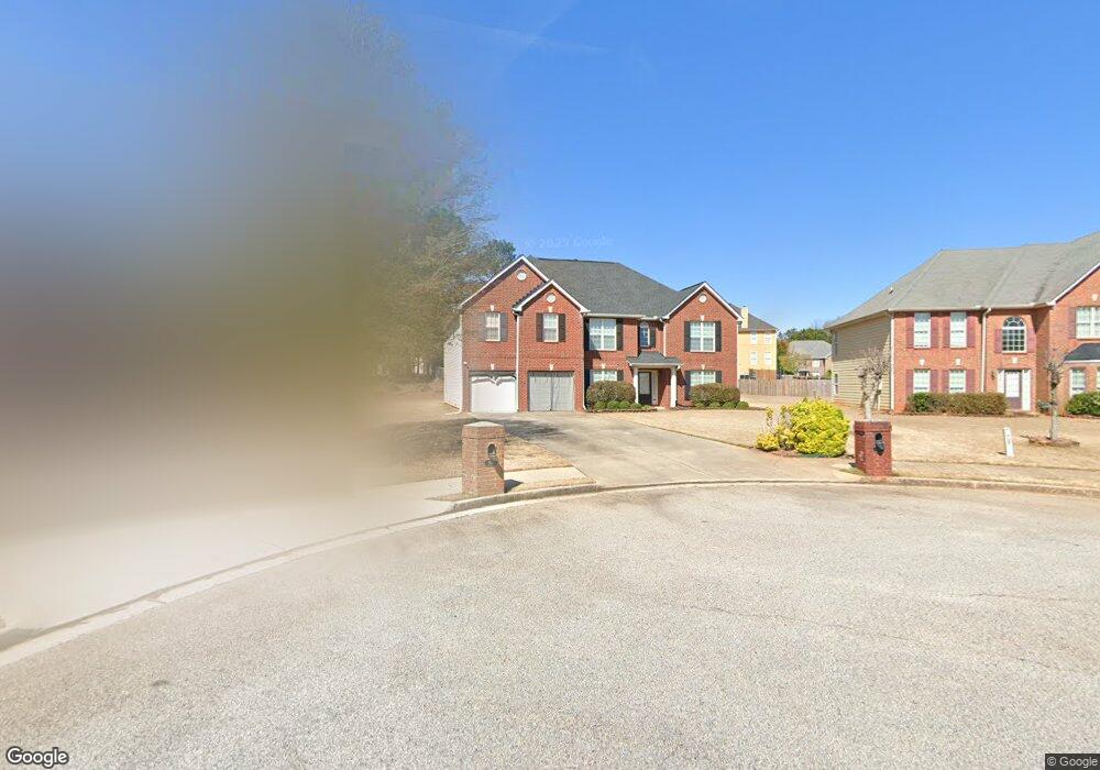
504 Chipwood Ct Unit 2 McDonough, GA 30253
Estimated Value: $377,664 - $416,000
5
Beds
4
Baths
3,591
Sq Ft
$110/Sq Ft
Est. Value
About This Home
This home is located at 504 Chipwood Ct Unit 2, McDonough, GA 30253 and is currently estimated at $394,166, approximately $109 per square foot. 504 Chipwood Ct Unit 2 is a home located in Henry County with nearby schools including Wesley Lakes Elementary School, McDonough Middle School, and Creekside Christian Academy.
Ownership History
Date
Name
Owned For
Owner Type
Purchase Details
Closed on
Sep 20, 2005
Sold by
First Dimension Hms Inc
Bought by
Mcgee Terrance and Mcgee Stacy
Current Estimated Value
Home Financials for this Owner
Home Financials are based on the most recent Mortgage that was taken out on this home.
Original Mortgage
$34,222
Outstanding Balance
$18,159
Interest Rate
5.72%
Mortgage Type
New Conventional
Estimated Equity
$376,007
Purchase Details
Closed on
Jun 28, 2005
Sold by
Dozier Dev Co Llc
Bought by
First Dimension Hms Inc
Home Financials for this Owner
Home Financials are based on the most recent Mortgage that was taken out on this home.
Original Mortgage
$169,200
Interest Rate
5.57%
Create a Home Valuation Report for This Property
The Home Valuation Report is an in-depth analysis detailing your home's value as well as a comparison with similar homes in the area
Home Values in the Area
Average Home Value in this Area
Purchase History
| Date | Buyer | Sale Price | Title Company |
|---|---|---|---|
| Mcgee Terrance | $229,000 | -- | |
| First Dimension Hms Inc | $12,000 | -- |
Source: Public Records
Mortgage History
| Date | Status | Borrower | Loan Amount |
|---|---|---|---|
| Open | Mcgee Terrance | $34,222 | |
| Open | Mcgee Terrance | $182,520 | |
| Previous Owner | First Dimension Hms Inc | $169,200 |
Source: Public Records
Tax History Compared to Growth
Tax History
| Year | Tax Paid | Tax Assessment Tax Assessment Total Assessment is a certain percentage of the fair market value that is determined by local assessors to be the total taxable value of land and additions on the property. | Land | Improvement |
|---|---|---|---|---|
| 2025 | $4,799 | $151,480 | $18,000 | $133,480 |
| 2024 | $4,799 | $160,440 | $18,000 | $142,440 |
| 2023 | $4,750 | $167,880 | $14,000 | $153,880 |
| 2022 | $4,496 | $134,880 | $14,000 | $120,880 |
| 2021 | $3,847 | $107,680 | $14,000 | $93,680 |
| 2020 | $3,642 | $99,440 | $12,800 | $86,640 |
| 2019 | $3,396 | $89,800 | $12,800 | $77,000 |
| 2018 | $3,040 | $80,840 | $8,000 | $72,840 |
| 2016 | $2,870 | $75,760 | $7,200 | $68,560 |
| 2015 | $2,276 | $59,120 | $7,200 | $51,920 |
| 2014 | $2,353 | $62,000 | $8,000 | $54,000 |
Source: Public Records
Map
Nearby Homes
- 505 Chipwood Ct
- 361 Navigator Ln
- 352 Navigator Ln
- 348 Navigator Ln
- 1130 Ivey Ln
- 190 Spyglass Cir
- 189 Spyglass Cir
- 1612 Fuma Leaf Way
- 1158 Folkstone Dr
- 625 Compton Ln
- 1601 Fuma Leaf Way
- 365 Emporia Loop
- 1597 Culpepper Ln
- 2761 Trebek Ct
- 715 Quail Cir
- 2513 Shropshire Place
- 161 Swindon Dr
- 245 Vaness Dr
- 645 Stadler Pointe Unit 75
- 2529 Shropshire Place
- 506 Chipwood Ct
- 506 Chipwood Ct Unit 2
- 502 Chipwood Ct
- 1124 Folkstone Dr
- 1120 Folkstone Dr
- 402 Edgemont Ln
- 500 Chipwood Ct
- 507 Chipwood Ct
- 605 Ivanhoe Close
- 603 Ivanhoe Close
- 603 Ivanhoe Close Unit 2
- 0 Ivanhoe Close
- 1118 Folkstone Dr
- 400 Edgemont Ln
- 400 Edgemont Ln Unit 2
- 410 Edgemont Ln Unit 122
- 410 Edgemont Ln
- 607 Ivanhoe Close
- 607 Ivanhoe Close Unit 105
- 503 Chipwood Ct Unit 2