
Seller's Agent in 2025
Katie Fish
Keller Williams Inspire - Geneva
(847) 560-3474
7 in this area
317 Total Sales
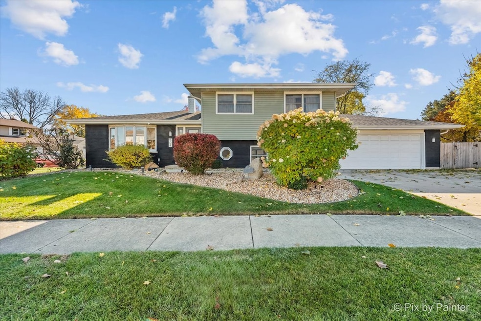
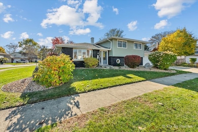
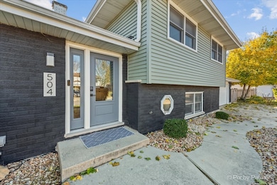
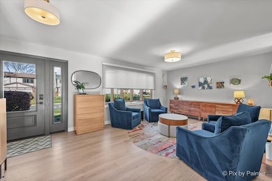
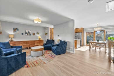
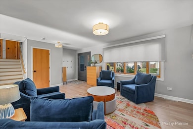
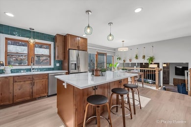
Fantastic, updated split-level home with 3 bedrooms, 2 baths, office and 2-car garage on a spacious corner lot in the Western Trails subdivision is lovely inside and out! Step inside to an open living room with a big bay window bringing in tons of natural light and LVP floors that flow through the main level. The updated kitchen has ample custom slow close cabinets with huge lazy susan, pull out drawers and amazing storage, quartz counters, stainless steel appliances, center island with seating space and eat-in area with glass sliders that lead to the back patio. A few steps down is the family room with a beautiful wood-burning fireplace. Private office with great built-ins and a full bath with step-in shower completes the lower level. Head upstairs to the master bedroom with hardwood floor, walk-in closet, and private access to the shared bathroom with dual sinks and shower over tub combo. 2 additional roomy bedrooms with hardwood floors and fresh paint. Relax outdoors on the brick paver patio or in the greenspace of the fully fenced in backyard. Walking distance to elementary and high schools, Armstrong Park and nearby endless shopping and dining!
Last Agent to Sell the Property
Keller Williams Inspire - Geneva License #475130544 Listed on: 11/13/2025
| Date | Type | Sale Price | Title Company |
|---|---|---|---|
| Deed | $435,000 | Chicago Title Company | |
| Contract Of Sale | $435,000 | None Listed On Document | |
| Interfamily Deed Transfer | -- | None Available | |
| Interfamily Deed Transfer | -- | None Available | |
| Warranty Deed | $240,000 | Premier Title |
| Date | Status | Loan Amount | Loan Type |
|---|---|---|---|
| Previous Owner | $228,000 | No Value Available |
| Date | Event | Price | List to Sale | Price per Sq Ft |
|---|---|---|---|---|
| 12/17/2025 12/17/25 | Sold | $435,000 | +11.8% | $219 / Sq Ft |
| 11/18/2025 11/18/25 | Pending | -- | -- | -- |
| 11/13/2025 11/13/25 | For Sale | $389,108 | -- | $196 / Sq Ft |
| Year | Tax Paid | Tax Assessment Tax Assessment Total Assessment is a certain percentage of the fair market value that is determined by local assessors to be the total taxable value of land and additions on the property. | Land | Improvement |
|---|---|---|---|---|
| 2024 | $9,464 | $118,316 | $32,903 | $85,413 |
| 2023 | $8,953 | $108,200 | $30,090 | $78,110 |
| 2022 | $9,363 | $107,500 | $29,890 | $77,610 |
| 2021 | $8,931 | $102,140 | $28,400 | $73,740 |
| 2020 | $8,461 | $96,200 | $27,710 | $68,490 |
| 2019 | $8,140 | $92,450 | $26,630 | $65,820 |
| 2018 | $7,906 | $91,100 | $25,930 | $65,170 |
| 2017 | $7,474 | $84,430 | $24,030 | $60,400 |
| 2016 | $7,078 | $78,140 | $22,240 | $55,900 |
| 2015 | $6,915 | $72,910 | $20,750 | $52,160 |
| 2014 | $6,872 | $71,290 | $20,290 | $51,000 |
| 2013 | $6,911 | $73,730 | $20,980 | $52,750 |
Seller's Agent in 2025
Katie Fish
Keller Williams Inspire - Geneva
(847) 560-3474
7 in this area
317 Total Sales
Buyer's Agent in 2025
Manuel Pineda
Compass
(312) 730-6428
1 in this area
77 Total Sales
Source: Midwest Real Estate Data (MRED)
MLS Number: 12514402
APN: 02-30-207-013
Disclaimer: Certain information contained herein is derived from information provided by parties other than Homes.com. All information provided is deemed reliable, but is not guaranteed to be accurate and should be independently verified.
![]() Based on information submitted to the MLS GRID. All data is obtained from various sources and may not have been verified by broker or MLS GRID. Supplied Open House Information is subject to change without notice. All information should be independently reviewed and verified for accuracy. Properties may or may not be listed by the office/agent presenting the information. Some IDX listings have been excluded from this website.
Based on information submitted to the MLS GRID. All data is obtained from various sources and may not have been verified by broker or MLS GRID. Supplied Open House Information is subject to change without notice. All information should be independently reviewed and verified for accuracy. Properties may or may not be listed by the office/agent presenting the information. Some IDX listings have been excluded from this website.
Based on information submitted to the MLS GRID
Ask me questions while you tour the home.