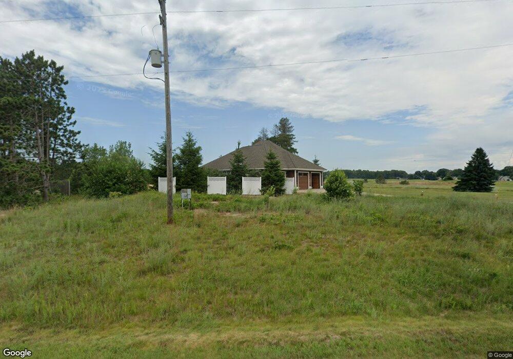
504 Hawksnest Dr South Haven, MI 49090
Estimated Value: $699,515 - $870,000
4
Beds
3
Baths
2,408
Sq Ft
$326/Sq Ft
Est. Value
About This Home
This home is located at 504 Hawksnest Dr, South Haven, MI 49090 and is currently estimated at $784,758, approximately $325 per square foot. 504 Hawksnest Dr is a home located in Allegan County with nearby schools including South Haven High School.
Ownership History
Date
Name
Owned For
Owner Type
Purchase Details
Closed on
Nov 18, 2010
Sold by
Ruppert Alfred F
Bought by
Ruppert Alfred F and Alfred F Ruppert Trust
Current Estimated Value
Purchase Details
Closed on
Feb 27, 2003
Sold by
Ruppert Alfred F
Bought by
Ruppert Alfred F and Ruppert Jon A
Home Financials for this Owner
Home Financials are based on the most recent Mortgage that was taken out on this home.
Original Mortgage
$398,000
Interest Rate
5.37%
Create a Home Valuation Report for This Property
The Home Valuation Report is an in-depth analysis detailing your home's value as well as a comparison with similar homes in the area
Home Values in the Area
Average Home Value in this Area
Purchase History
| Date | Buyer | Sale Price | Title Company |
|---|---|---|---|
| Ruppert Alfred F | -- | None Available | |
| Ruppert Alfred F | -- | None Available | |
| Ruppert Alfred F | -- | Metropolitan Title Company |
Source: Public Records
Mortgage History
| Date | Status | Borrower | Loan Amount |
|---|---|---|---|
| Closed | Ruppert Alfred F | $398,000 |
Source: Public Records
Tax History Compared to Growth
Tax History
| Year | Tax Paid | Tax Assessment Tax Assessment Total Assessment is a certain percentage of the fair market value that is determined by local assessors to be the total taxable value of land and additions on the property. | Land | Improvement |
|---|---|---|---|---|
| 2025 | $5,024 | $381,100 | $25,500 | $355,600 |
| 2024 | -- | $380,700 | $16,800 | $363,900 |
| 2023 | -- | $305,500 | $16,800 | $288,700 |
| 2022 | $0 | $258,200 | $15,300 | $242,900 |
| 2021 | $2,279 | $272,400 | $15,300 | $257,100 |
| 2020 | $2,279 | $255,100 | $15,300 | $239,800 |
| 2019 | $0 | $224,600 | $15,300 | $209,300 |
| 2018 | $0 | $181,500 | $9,000 | $172,500 |
| 2017 | $0 | $192,700 | $9,000 | $183,700 |
| 2016 | $0 | $147,600 | $9,000 | $138,600 |
| 2015 | -- | $147,600 | $9,000 | $138,600 |
| 2014 | -- | $117,200 | $5,200 | $112,000 |
| 2013 | -- | $138,100 | $5,200 | $132,900 |
Source: Public Records
Map
Nearby Homes
- 02 Hawks Nest Dr
- 00 Hawks Nest Dr
- 7146 Lakeview Ave
- 7230 Maple St
- VL Highfield Beach Dr Unit 43
- VL Highfield Beach Dr Unit Lot 6
- 7241 A St
- 4490 103rd Ave
- V/L Miami Ave
- V/L Miami Ave Unit Lots 21-24
- 000 Miami Ave
- 500 Blue Star Hwy Unit 21 Acres
- 637 Lantern Watch Dr Unit 35
- 7251 Beverly Dr
- 665 Lantern Watch Dr Unit 28
- 7255 Miami Ave
- 475 Lakeshore Dr
- 688 Waters Edge Unit 15
- 688 Waters Edge
- 684 Waters Edge Unit 14
- 6147 105th Ave
- 6057 105th Ave
- 6982 105th Ave
- 6982 105th Ave
- 507 Kitty Hawk Ln
- 6072 105th Ave
- 0 105th Ave
- 6106 105th Ave
- 523 Hawksnest Dr Unit 25
- 0 Silverhawk Dr Unit 23017384
- 0 Silverhawk Dr Unit 69022038617
- 0 Silverhawk Dr Unit 22038617
- 0 Silverhawk Dr Unit 69022004745
- 0 Silverhawk Dr Unit 22004745
- 514 Kitty Hawk Ln
- 024800200 Silverhawk Dr
- 539 Hawksnest Dr Unit 22
- 543 Hawksnest Dr
- 0 Hawks Nest Dr Unit 69002813588
- 0 Hawks Nest Dr Unit 69012021539