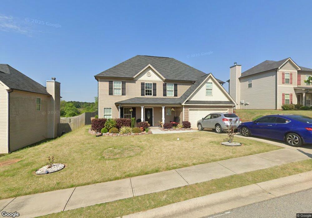
504 Highpoint Cir Winder, GA 30680
Estimated Value: $378,000 - $411,000
4
Beds
3
Baths
2,621
Sq Ft
$151/Sq Ft
Est. Value
About This Home
This home is located at 504 Highpoint Cir, Winder, GA 30680 and is currently estimated at $394,561, approximately $150 per square foot. 504 Highpoint Cir is a home located in Barrow County with nearby schools including County Line Elementary School, Russell Middle School, and Winder-Barrow High School.
Ownership History
Date
Name
Owned For
Owner Type
Purchase Details
Closed on
Aug 4, 2015
Sold by
South Point Construction Llc
Bought by
Delacruz Jose G and Delacruz Johanna M
Current Estimated Value
Home Financials for this Owner
Home Financials are based on the most recent Mortgage that was taken out on this home.
Original Mortgage
$176,122
Outstanding Balance
$138,801
Interest Rate
4.09%
Mortgage Type
Commercial
Estimated Equity
$255,760
Purchase Details
Closed on
May 19, 2015
Sold by
White Dewey C
Bought by
South Point Construction Llc
Purchase Details
Closed on
Aug 31, 2012
Sold by
Fdic
Bought by
White Dewey C
Purchase Details
Closed on
Jun 13, 2011
Sold by
Montana Land Development Inc
Bought by
Fdic As Receiver For
Purchase Details
Closed on
Oct 31, 2007
Sold by
Montanna Development Inc
Bought by
Montana Land Development Inc
Purchase Details
Closed on
May 9, 2005
Sold by
Craft James A
Bought by
Montanna Development Inc
Create a Home Valuation Report for This Property
The Home Valuation Report is an in-depth analysis detailing your home's value as well as a comparison with similar homes in the area
Home Values in the Area
Average Home Value in this Area
Purchase History
| Date | Buyer | Sale Price | Title Company |
|---|---|---|---|
| Delacruz Jose G | $172,600 | -- | |
| South Point Construction Llc | $71,670 | -- | |
| White Dewey C | $50,000 | -- | |
| Fdic As Receiver For | -- | -- | |
| Montana Land Development Inc | -- | -- | |
| Montanna Development Inc | $2,172,400 | -- |
Source: Public Records
Mortgage History
| Date | Status | Borrower | Loan Amount |
|---|---|---|---|
| Open | Delacruz Jose G | $176,122 |
Source: Public Records
Tax History Compared to Growth
Tax History
| Year | Tax Paid | Tax Assessment Tax Assessment Total Assessment is a certain percentage of the fair market value that is determined by local assessors to be the total taxable value of land and additions on the property. | Land | Improvement |
|---|---|---|---|---|
| 2024 | $3,707 | $151,978 | $28,800 | $123,178 |
| 2023 | $2,546 | $121,448 | $18,400 | $103,048 |
| 2022 | $2,597 | $92,373 | $18,400 | $73,973 |
| 2021 | $2,742 | $92,373 | $18,400 | $73,973 |
| 2020 | $2,483 | $83,593 | $16,000 | $67,593 |
| 2019 | $2,434 | $80,394 | $16,000 | $64,394 |
| 2018 | $2,267 | $75,780 | $14,000 | $61,780 |
| 2017 | $1,941 | $66,664 | $13,000 | $53,664 |
| 2016 | $2,106 | $67,207 | $16,000 | $51,207 |
| 2015 | $158 | $5,200 | $5,200 | $0 |
| 2014 | $163 | $5,351 | $5,351 | $0 |
| 2013 | -- | $5,350 | $5,350 | $0 |
Source: Public Records
Map
Nearby Homes
- 796 Pinnacle Dr
- 415 Knightsbridge Ln
- 133 Cedar Wood Trace
- 109 Cedar Wood Trace
- 678 Knightsbridge Ln
- 71 Carnaby St
- 84 Carnaby St
- 300 Hyde Park
- 290 Hyde Park
- 240 Cedar Wood Trace
- 261 Cedar Wood Trace
- 264 Cedar Wood Trace
- 273 Cedar Wood Trace
- 276 Cedar Wood Trace
- 295 Cedar Wood Trace
- 101 Carnaby St
- 94 Garrison Dr
- 654 Huntington Trace
- 486 Jasmine Dr
- 719 Overlook Dr
- 502 Highpoint Cir
- 523 Highpoint Cir
- 523 Highpoint Cir
- 506 Highpoint Cir Unit 4
- 508 Highpoint Cir Unit 5
- 262 Stillwood Dr Unit 1
- 262 Stillwood Dr
- 505 Highpoint Cir
- 503 Highpoint Cir
- 507 Highpoint Cir
- 501 Highpoint Cir
- 510 Highpoint Cir
- 509 Highpoint Cir Unit 24
- 509 Highpoint Cir
- 274 Stillwood Dr Unit 29
- 274 Stillwood Dr
- 276 Stillwood Dr Unit 30
- 276 Stillwood Dr
- 512 Highpoint Cir Unit 7
- 512 Highpoint Cir