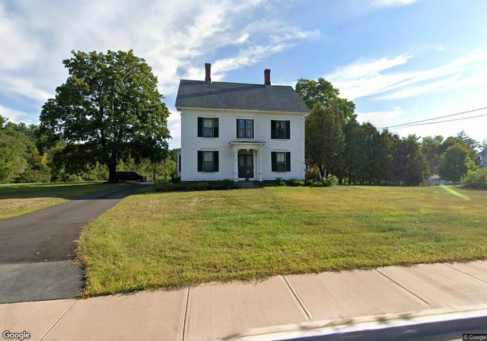
504 Main St Dunstable, MA 01827
Estimated Value: $935,979 - $1,469,000
Studio
3
Baths
3,806
Sq Ft
$304/Sq Ft
Est. Value
About This Home
This home is located at 504 Main St, Dunstable, MA 01827 and is currently estimated at $1,156,995, approximately $303 per square foot. 504 Main St is a home located in Middlesex County with nearby schools including Groton Dunstable Regional High School, World Academy, and Academy of Notre Dame - Upper School.
Ownership History
Date
Name
Owned For
Owner Type
Purchase Details
Closed on
Nov 1, 2000
Sold by
Crandall Jon N and Crandall Elaine P
Bought by
Fenochetti Robert P and Fenochetti Anne M
Current Estimated Value
Home Financials for this Owner
Home Financials are based on the most recent Mortgage that was taken out on this home.
Original Mortgage
$385,000
Interest Rate
7.83%
Mortgage Type
Purchase Money Mortgage
Purchase Details
Closed on
Feb 3, 1995
Sold by
Crandall Jon N and Crandall Elaine
Bought by
Crandall Jon N
Home Financials for this Owner
Home Financials are based on the most recent Mortgage that was taken out on this home.
Original Mortgage
$42,500
Interest Rate
9.18%
Create a Home Valuation Report for This Property
The Home Valuation Report is an in-depth analysis detailing your home's value as well as a comparison with similar homes in the area
Home Values in the Area
Average Home Value in this Area
Purchase History
| Date | Buyer | Sale Price | Title Company |
|---|---|---|---|
| Fenochetti Robert P | $550,000 | -- | |
| Crandall Jon N | $42,500 | -- |
Source: Public Records
Mortgage History
| Date | Status | Borrower | Loan Amount |
|---|---|---|---|
| Open | Crandall Jon N | $272,000 | |
| Closed | Crandall Jon N | $275,000 | |
| Closed | Crandall Jon N | $385,000 | |
| Previous Owner | Crandall Jon N | $42,500 |
Source: Public Records
Tax History Compared to Growth
Tax History
| Year | Tax Paid | Tax Assessment Tax Assessment Total Assessment is a certain percentage of the fair market value that is determined by local assessors to be the total taxable value of land and additions on the property. | Land | Improvement |
|---|---|---|---|---|
| 2025 | $12,620 | $917,800 | $279,800 | $638,000 |
| 2024 | $11,119 | $796,500 | $256,100 | $540,400 |
| 2023 | $11,364 | $759,100 | $256,100 | $503,000 |
| 2022 | $10,477 | $687,000 | $256,100 | $430,900 |
| 2021 | $10,785 | $657,200 | $234,100 | $423,100 |
| 2020 | $11,131 | $661,000 | $234,100 | $426,900 |
| 2019 | $11,278 | $661,100 | $234,100 | $427,000 |
| 2018 | $11,027 | $628,700 | $232,400 | $396,300 |
| 2017 | $10,700 | $628,700 | $232,400 | $396,300 |
| 2016 | $10,152 | $613,400 | $222,200 | $391,200 |
| 2015 | $9,769 | $583,900 | $187,600 | $396,300 |
| 2014 | $9,208 | $583,900 | $187,600 | $396,300 |
Source: Public Records
Map
Nearby Homes
- 4 Thorndike St
- 0 Lowell St
- 319 Pleasant St
- 62 Brook St
- 153 Off Pond St
- 446 Westford St
- 11 Lojko Dr
- 38 Georgetown Dr
- 91 Century Way
- 8 Strawberry Bank Rd Unit 16
- 5 Doucet Ave
- 1 Doucet Ave
- 58 Wilderness Dr
- 65 Wilderness Dr
- 1 Wilderness Dr
- 2 Wilderness Dr
- 4 Wilderness Dr
- 79 Wilderness Dr
- 4 Strawberry Bank Rd Unit 1
- 4 Strawberry Bank Rd Unit 12
- 493 Main St
- 493 Main St Unit C
- 493 Main St Unit E
- 493 Main St Unit D
- 493 Main St Unit A
- 493 Main St Unit B
- 493 Main St Unit 2
- 486 Main St
- 503 Main St
- 519 Main St
- 485 Main St
- 1 Pleasant St
- 1 Pleasant St Unit Left
- 529 Main St
- 11 Pleasant St
- 22 Pleasant St
- 17 Pleasant St
- 35 High St
- 104 High St
- 13 Hillcrest St