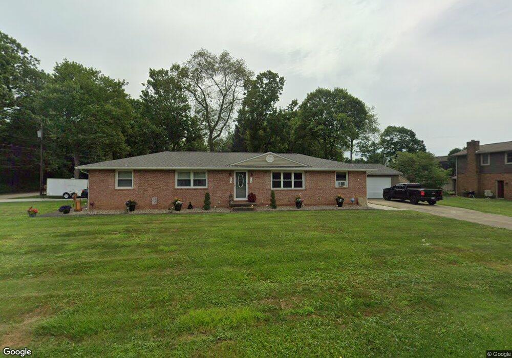
504 S Marion Ave Louisville, OH 44641
Estimated Value: $197,000 - $282,000
4
Beds
2
Baths
1,755
Sq Ft
$128/Sq Ft
Est. Value
About This Home
This home is located at 504 S Marion Ave, Louisville, OH 44641 and is currently estimated at $224,892, approximately $128 per square foot. 504 S Marion Ave is a home located in Stark County with nearby schools including Louisville High School and St. Thomas Aquinas High School & Middle School.
Ownership History
Date
Name
Owned For
Owner Type
Purchase Details
Closed on
Jun 29, 2005
Sold by
Ferguson Gary W and Ferguson Vickie L
Bought by
Schott Jamie Thomas
Current Estimated Value
Home Financials for this Owner
Home Financials are based on the most recent Mortgage that was taken out on this home.
Original Mortgage
$124,800
Outstanding Balance
$65,987
Interest Rate
5.86%
Mortgage Type
Fannie Mae Freddie Mac
Estimated Equity
$158,905
Purchase Details
Closed on
Nov 12, 1993
Purchase Details
Closed on
Jan 29, 1991
Create a Home Valuation Report for This Property
The Home Valuation Report is an in-depth analysis detailing your home's value as well as a comparison with similar homes in the area
Home Values in the Area
Average Home Value in this Area
Purchase History
| Date | Buyer | Sale Price | Title Company |
|---|---|---|---|
| Schott Jamie Thomas | $156,000 | Grimsley Title Agency | |
| -- | $91,000 | -- | |
| -- | -- | -- |
Source: Public Records
Mortgage History
| Date | Status | Borrower | Loan Amount |
|---|---|---|---|
| Open | Schott Jamie Thomas | $124,800 | |
| Closed | Schott Jamie Thomas | $31,200 |
Source: Public Records
Tax History Compared to Growth
Tax History
| Year | Tax Paid | Tax Assessment Tax Assessment Total Assessment is a certain percentage of the fair market value that is determined by local assessors to be the total taxable value of land and additions on the property. | Land | Improvement |
|---|---|---|---|---|
| 2025 | -- | $53,770 | $16,700 | $37,070 |
| 2024 | -- | $53,770 | $16,700 | $37,070 |
| 2023 | $2,207 | $50,930 | $15,750 | $35,180 |
| 2022 | $2,213 | $50,930 | $15,750 | $35,180 |
| 2021 | $2,219 | $50,930 | $15,750 | $35,180 |
| 2020 | $1,761 | $43,820 | $14,210 | $29,610 |
| 2019 | $1,769 | $44,560 | $14,210 | $30,350 |
| 2018 | $1,792 | $44,560 | $14,210 | $30,350 |
| 2017 | $1,707 | $40,930 | $12,500 | $28,430 |
| 2016 | $1,742 | $40,930 | $12,500 | $28,430 |
| 2015 | $1,747 | $40,930 | $12,500 | $28,430 |
| 2014 | $1,625 | $35,390 | $10,780 | $24,610 |
| 2013 | $816 | $35,390 | $10,780 | $24,610 |
Source: Public Records
Map
Nearby Homes
- 1715 High St
- 1812 E Broad St
- 641 S Nickelplate St
- 308 Superior St
- 2110 Edmar St
- 520 S Silver St
- 0 Michigan Blvd
- 2015 E Main St
- 728 E Broad St
- 204 E Broad St
- 908 Sand Lot Cir
- 107 E Broad St
- 325 Lincoln Ave
- 1170 Winding Ridge Ave
- 3390 Meese Rd NE
- 910 Crosswyck Cir
- 1702 View Pointe Ave
- 1639 Horizon Dr
- 428 Honeycrisp Dr NE
- 3047 Mcintosh Dr NE
- 1714 E Broad St
- 0 S Marion Ave Unit 4075814
- 0 S Marion Ave Unit 3768342
- 0 S Marion Ave
- 520 S Marion Ave
- 1620 E Broad St
- 513 S Marion Ave
- 1724 E Broad St
- 525 S Marion Ave
- 1725 High St
- 1734 E Broad St
- 603 S Marion Ave
- 1606 E Broad St
- 1626 Monter Ave
- 516 Hazel Ave
- 1735 High St
- 608 S Marion Ave
- 1614 Monter Ave
- 518 Hazel Ave
- 1714 High St