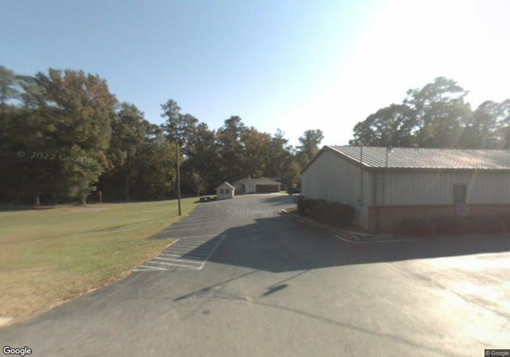
5040 Bloomfield Rd Macon, GA 31206
Estimated Value: $149,000 - $320,000
3
Beds
2
Baths
2,551
Sq Ft
$83/Sq Ft
Est. Value
About This Home
This home is located at 5040 Bloomfield Rd, Macon, GA 31206 and is currently estimated at $210,907, approximately $82 per square foot. 5040 Bloomfield Rd is a home located in Bibb County with nearby schools including Veterans Elementary School, Southwest High School, and Gilead Christian Academy.
Ownership History
Date
Name
Owned For
Owner Type
Purchase Details
Closed on
Feb 5, 2025
Sold by
Vision Of Jesus United Methodist Church and Board Of Trustees Of The South Georgia A
Bought by
Board Of Truste
Current Estimated Value
Purchase Details
Closed on
Jun 8, 2015
Sold by
Walton Edward and Hatfield Ellen
Bought by
North Central District Union Of The Unit
Purchase Details
Closed on
Nov 1, 2005
Sold by
The World Of Faith Inc
Bought by
Grier James and Hobbs John
Create a Home Valuation Report for This Property
The Home Valuation Report is an in-depth analysis detailing your home's value as well as a comparison with similar homes in the area
Home Values in the Area
Average Home Value in this Area
Purchase History
| Date | Buyer | Sale Price | Title Company |
|---|---|---|---|
| Board Of Truste | -- | None Listed On Document | |
| Board Of Truste | -- | None Listed On Document | |
| North Central District Union Of The Unit | -- | None Available | |
| Grier James | $490,000 | None Available |
Source: Public Records
Tax History Compared to Growth
Tax History
| Year | Tax Paid | Tax Assessment Tax Assessment Total Assessment is a certain percentage of the fair market value that is determined by local assessors to be the total taxable value of land and additions on the property. | Land | Improvement |
|---|---|---|---|---|
| 2025 | -- | $64,404 | $7,050 | $57,354 |
| 2024 | -- | $64,404 | $7,050 | $57,354 |
| 2023 | $0 | $63,922 | $7,050 | $56,872 |
| 2022 | $2,047 | $53,874 | $7,050 | $46,824 |
| 2021 | $2,047 | $53,874 | $7,050 | $46,824 |
| 2020 | $2,153 | $53,874 | $7,050 | $46,824 |
| 2019 | $1,756 | $53,874 | $7,050 | $46,824 |
| 2018 | $120 | $53,874 | $7,050 | $46,824 |
| 2017 | $0 | $53,874 | $7,050 | $46,824 |
| 2016 | $2,006 | $57,968 | $7,050 | $50,918 |
| 2015 | -- | $57,968 | $7,050 | $50,918 |
| 2014 | -- | $57,968 | $7,050 | $50,918 |
Source: Public Records
Map
Nearby Homes
- 3842 Wynnwood Dr
- 4738 Bloomfield Rd
- 3913 Blair Ct
- 5060 Pinefield Dr
- 4742 Bloomfield Rd
- 4940 Pinefield Dr
- 140 Spencer Hill Ct
- 197 Camden Trace
- 165 Camden Trace
- 189 Camden Trace
- 120 Camden Trace
- 124 Camden Trace
- 193 Camden Trace
- 177 Camden Trace
- 3607 Pineland Trail
- 4500 Chambers Rd
- 3771 Walker Ave
- 3850 Gadson Dr
- 2868 Barrett Ave
- 246 Beaumont Heights
- 3859 Wynnwood Dr
- 3851 Wynnwood Dr
- 5058 Bloomfield Rd
- 3843 Wynnwood Dr
- 3867 Wynnwood Dr
- 3835 Wynnwood Dr
- 3820 Brownley Dr
- 3845 Brownley Dr
- 3827 Wynnwood Dr
- 5037 Bloomfield Rd
- 3814 Brownley Dr
- 5064 Bloomfield Rd
- 3837 Brownley Dr
- 0 Wynnwood Dr Unit 8745548
- 0 Wynnwood Dr Unit 8227411
- 0 Wynnwood Dr
- 3860 Wynnwood Dr
- 3852 Wynnwood Dr
- 3834 Wynnwood Dr
- 3819 Wynnwood Dr