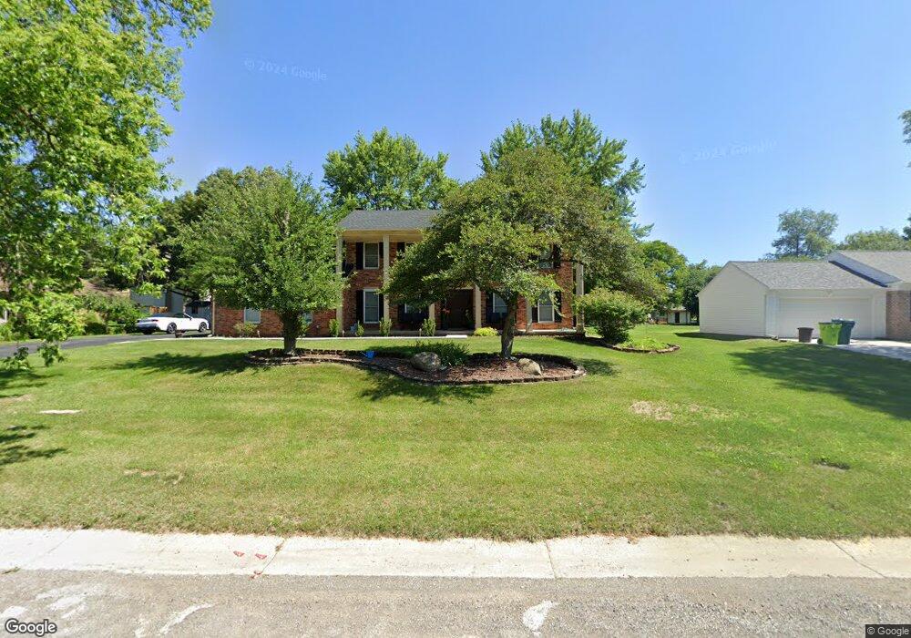
5040 Patrick Rd West Bloomfield, MI 48322
West Bloomfield Township NeighborhoodEstimated Value: $383,658 - $434,000
4
Beds
3
Baths
2,040
Sq Ft
$196/Sq Ft
Est. Value
About This Home
This home is located at 5040 Patrick Rd, West Bloomfield, MI 48322 and is currently estimated at $399,165, approximately $195 per square foot. 5040 Patrick Rd is a home located in Oakland County with nearby schools including Sheiko Elementary School, Brookfield Academy - West Bloomfield, and The Susan And Rabbi Harold Loss Ecc.
Ownership History
Date
Name
Owned For
Owner Type
Purchase Details
Closed on
Apr 10, 2002
Sold by
Financi Cendant Mobility
Bought by
Yousif Samer Y
Current Estimated Value
Purchase Details
Closed on
May 1, 1998
Sold by
Mony Michael
Bought by
Walker John R
Home Financials for this Owner
Home Financials are based on the most recent Mortgage that was taken out on this home.
Original Mortgage
$152,000
Interest Rate
7.27%
Create a Home Valuation Report for This Property
The Home Valuation Report is an in-depth analysis detailing your home's value as well as a comparison with similar homes in the area
Home Values in the Area
Average Home Value in this Area
Purchase History
| Date | Buyer | Sale Price | Title Company |
|---|---|---|---|
| Yousif Samer Y | $244,000 | -- | |
| Walker John R | $200,000 | -- |
Source: Public Records
Mortgage History
| Date | Status | Borrower | Loan Amount |
|---|---|---|---|
| Previous Owner | Walker John R | $152,000 |
Source: Public Records
Tax History
| Year | Tax Paid | Tax Assessment Tax Assessment Total Assessment is a certain percentage of the fair market value that is determined by local assessors to be the total taxable value of land and additions on the property. | Land | Improvement |
|---|---|---|---|---|
| 2025 | $4,164 | $178,900 | $60,750 | $118,150 |
| 2024 | $2,595 | $166,010 | $0 | $0 |
| 2022 | $2,484 | $146,070 | $45,000 | $101,070 |
| 2021 | $3,775 | $135,130 | $0 | $0 |
| 2020 | $2,434 | $132,560 | $40,550 | $92,010 |
| 2018 | $3,640 | $125,010 | $28,700 | $96,310 |
| 2015 | -- | $103,460 | $0 | $0 |
| 2014 | -- | $93,950 | $0 | $0 |
| 2011 | -- | $81,920 | $0 | $0 |
Source: Public Records
Map
Nearby Homes
- 5634 Stratford Dr
- 5731 Farmington Rd
- 4819 Thorntree Dr
- 4817 Faircourt Dr
- 4623 Patrick Rd
- 5585 Culpepper Dr
- 6076 Dunmore Dr
- 5865 Dunmore Ct
- 5549 Perrytown Dr
- 6323 Potomac Cir Unit 22
- 5226 Brett Ct
- 5256 Wright Way E Unit 64
- 5353 Wright Way W
- 5956 Pinecroft Dr
- 5292 Pond Bluff Dr
- 5590 Bayswater Rd
- 6121 Westbrooke Dr Unit 7
- 6129 Westbrooke Dr Unit 10
- 4205 Pinehurst Dr
- 6298 Aspen Ridge Blvd Unit 34
- 5028 Patrick Rd
- 5907 Shillingham Dr
- 5921 Shillingham Dr
- 5893 Shillingham Dr
- 5870 Shilo Ct
- 5043 Patrick Rd
- 5031 Patrick Rd
- 5878 Shilo Ct
- 5055 Patrick Rd
- 5021 Patrick Rd
- 5879 Shillingham Dr
- 2474 Lone Pine Rd Shillingham Dr
- 5004 Patrick Rd
- 5912 Shillingham Dr
- 5070 Patrick Rd
- 5900 Shillingham Dr
- 5030 Meadowbrook Dr
- 5007 Patrick Rd
- 5884 Shilo Ct
- 5018 Meadowbrook Dr
Your Personal Tour Guide
Ask me questions while you tour the home.