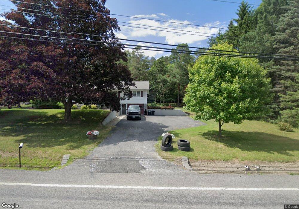
5040 State Route 10 Cobleskill, NY 12043
Estimated Value: $237,767 - $306,000
4
Beds
2
Baths
1,712
Sq Ft
$164/Sq Ft
Est. Value
About This Home
This home is located at 5040 State Route 10, Cobleskill, NY 12043 and is currently estimated at $280,692, approximately $163 per square foot. 5040 State Route 10 is a home located in Schoharie County with nearby schools including George D Ryder Elementary School, Cobleskill Richmondville High School, and Joseph B Radez Elementary School.
Ownership History
Date
Name
Owned For
Owner Type
Purchase Details
Closed on
Oct 8, 2021
Sold by
Borthwick Bonnie L and Moyster Patricia D
Bought by
Moyster Adam J
Current Estimated Value
Home Financials for this Owner
Home Financials are based on the most recent Mortgage that was taken out on this home.
Original Mortgage
$95,800
Outstanding Balance
$87,361
Interest Rate
2.8%
Mortgage Type
Purchase Money Mortgage
Estimated Equity
$193,331
Purchase Details
Closed on
Apr 28, 2011
Sold by
Boynton David
Bought by
Boynton Alice
Create a Home Valuation Report for This Property
The Home Valuation Report is an in-depth analysis detailing your home's value as well as a comparison with similar homes in the area
Home Values in the Area
Average Home Value in this Area
Purchase History
| Date | Buyer | Sale Price | Title Company |
|---|---|---|---|
| Moyster Adam J | $180,000 | None Available | |
| Boynton Alice | -- | Michael Shultes |
Source: Public Records
Mortgage History
| Date | Status | Borrower | Loan Amount |
|---|---|---|---|
| Open | Moyster Adam J | $95,800 |
Source: Public Records
Tax History Compared to Growth
Tax History
| Year | Tax Paid | Tax Assessment Tax Assessment Total Assessment is a certain percentage of the fair market value that is determined by local assessors to be the total taxable value of land and additions on the property. | Land | Improvement |
|---|---|---|---|---|
| 2024 | $5,211 | $128,400 | $12,100 | $116,300 |
| 2023 | $4,882 | $128,400 | $12,100 | $116,300 |
| 2022 | $4,518 | $128,400 | $12,100 | $116,300 |
| 2021 | $4,545 | $128,400 | $12,100 | $116,300 |
| 2020 | $3,439 | $128,400 | $12,100 | $116,300 |
| 2019 | $3,452 | $128,400 | $12,100 | $116,300 |
| 2018 | $3,452 | $128,400 | $12,100 | $116,300 |
| 2017 | $3,315 | $128,400 | $12,100 | $116,300 |
| 2016 | $3,425 | $128,400 | $12,100 | $116,300 |
| 2015 | -- | $128,400 | $12,100 | $116,300 |
| 2014 | -- | $128,400 | $12,100 | $116,300 |
Source: Public Records
Map
Nearby Homes
- 110 Madison Terrace
- 122 Lincoln Ave
- 172 Elm St
- 162 Elm St
- 113 Harder Ave
- 179 Patrick Rd
- 150 Washington Ave
- 109 High St
- 111 Park Place
- 242 N Grand St
- 573 E Main St
- 616 E Main St
- L14 New York 7
- 125 Prospect St
- L11 New York 7
- 427 Patrick Rd
- 113 East St
- L6.12 Mineral Springs Rd
- L1.22 New York 145
- L1 New York 145
- 5043 State Route 10
- 5036 State Route 10
- 5028 State Route 10
- 5027 State Route 10
- 5057 State Route 10
- 5062 State Route 10
- 5020 State Route 10
- 5066 New York 10
- 5066 State Route 10
- 5014 State Route 10
- 5070 State Route 10
- 5075 State Route 10
- 5074 State Route 10
- 5074 State Route 10
- 5008 State Route 10
- 5008 New York 10
- 116 Heron Rd
- 5080 State Route 10
- 151 Heron Rd
- 121 Heron Rd