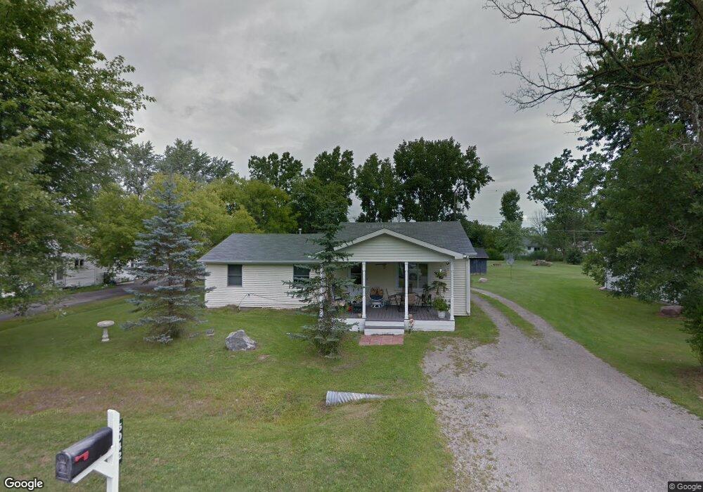
5042 Burma Rd Kimball, MI 48074
Estimated Value: $159,000 - $219,000
3
Beds
1
Bath
1,181
Sq Ft
$163/Sq Ft
Est. Value
About This Home
This home is located at 5042 Burma Rd, Kimball, MI 48074 and is currently estimated at $192,636, approximately $163 per square foot. 5042 Burma Rd is a home located in St. Clair County with nearby schools including Kimball Elementary School, Central Middle School, and Port Huron High School.
Ownership History
Date
Name
Owned For
Owner Type
Purchase Details
Closed on
Dec 8, 2008
Sold by
Nelson Robert W and Nelson Elsie K
Bought by
Smith Dianne
Current Estimated Value
Purchase Details
Closed on
Apr 22, 2008
Sold by
Nelson Robert W and Nelson Elsie K
Bought by
Nelson Robert W and Nelson Elsie K
Purchase Details
Closed on
Nov 14, 1991
Sold by
Nelson Rebecca L and Nelson Robert W
Bought by
Smith Dianne
Create a Home Valuation Report for This Property
The Home Valuation Report is an in-depth analysis detailing your home's value as well as a comparison with similar homes in the area
Home Values in the Area
Average Home Value in this Area
Purchase History
| Date | Buyer | Sale Price | Title Company |
|---|---|---|---|
| Smith Dianne | -- | None Available | |
| Nelson Robert W | -- | None Available | |
| Smith Dianne | $9,100 | None Available |
Source: Public Records
Tax History Compared to Growth
Tax History
| Year | Tax Paid | Tax Assessment Tax Assessment Total Assessment is a certain percentage of the fair market value that is determined by local assessors to be the total taxable value of land and additions on the property. | Land | Improvement |
|---|---|---|---|---|
| 2025 | $1,225 | $81,500 | $0 | $0 |
| 2024 | $643 | $81,500 | $0 | $0 |
| 2023 | $589 | $77,700 | $0 | $0 |
| 2022 | $1,070 | $70,200 | $0 | $0 |
| 2021 | $917 | $64,700 | $0 | $0 |
| 2020 | $917 | $63,000 | $63,000 | $0 |
| 2019 | $903 | $49,200 | $0 | $0 |
| 2018 | $885 | $41,400 | $0 | $0 |
| 2017 | $871 | $43,100 | $0 | $0 |
| 2016 | $448 | $43,100 | $0 | $0 |
| 2015 | -- | $19,400 | $19,400 | $0 |
| 2014 | -- | $31,500 | $31,500 | $0 |
| 2013 | -- | $44,000 | $0 | $0 |
Source: Public Records
Map
Nearby Homes
- 1604 Allen Rd
- 1091 Allen Rd
- 1701 Allen Rd
- V/L Allen
- 0 Ravenswood Rd Unit 20251017048
- 0000 Ravenswood Rd
- 00 Range Rd
- 4632 Cloverdale Ln
- 1979 Allen Rd
- 1405 Range Rd
- 183 Nevada Ave
- 4595 Griswold Rd
- 5510 Griswold Rd
- 1876 Morningstar Ave
- 174 Meadow Ln
- 153 Meadow Ln
- 0000 Wisconsin Ave
- 250 Oregon Ave
- 104 Oldbrook Ln
- 4745 Smiths Creek Rd