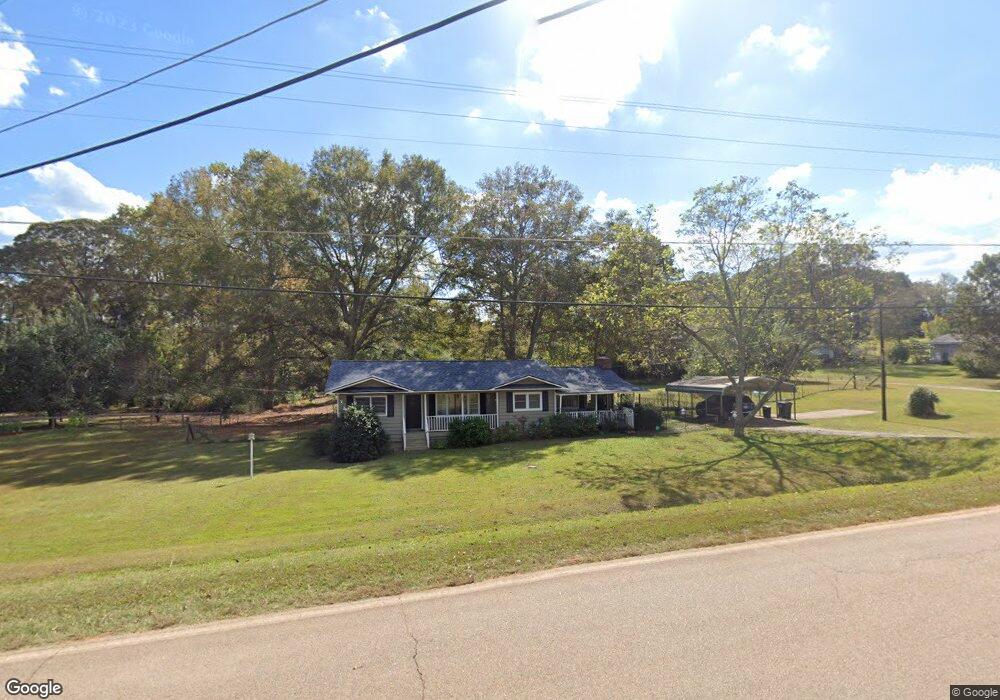
5043 Old West Point Rd Lagrange, GA 30240
Estimated Value: $163,000 - $200,000
2
Beds
1
Bath
1,256
Sq Ft
$148/Sq Ft
Est. Value
About This Home
This home is located at 5043 Old West Point Rd, Lagrange, GA 30240 and is currently estimated at $185,834, approximately $147 per square foot. 5043 Old West Point Rd is a home located in Troup County with nearby schools including Long Cane Elementary School, Berta Weathersbee Elementary School, and Whitesville Road Elementary School.
Ownership History
Date
Name
Owned For
Owner Type
Purchase Details
Closed on
Dec 20, 2018
Sold by
Duran Jeffrey B
Bought by
Degennaro Rachel E
Current Estimated Value
Home Financials for this Owner
Home Financials are based on the most recent Mortgage that was taken out on this home.
Original Mortgage
$97,000
Outstanding Balance
$85,459
Interest Rate
4.8%
Mortgage Type
New Conventional
Estimated Equity
$100,375
Purchase Details
Closed on
Aug 14, 2003
Sold by
Short Douglas E
Bought by
Short Douglas E and Short Donna
Purchase Details
Closed on
Aug 13, 2003
Sold by
Barnes Helen
Bought by
Short Douglas E
Purchase Details
Closed on
Apr 13, 1999
Sold by
Joel Barnes and Cindy Forbus
Bought by
Barnes Helen
Purchase Details
Closed on
Jan 1, 1972
Bought by
Joel Barnes and Cindy Forbus
Purchase Details
Closed on
Jan 1, 1968
Create a Home Valuation Report for This Property
The Home Valuation Report is an in-depth analysis detailing your home's value as well as a comparison with similar homes in the area
Home Values in the Area
Average Home Value in this Area
Purchase History
| Date | Buyer | Sale Price | Title Company |
|---|---|---|---|
| Degennaro Rachel E | $97,000 | -- | |
| Short Douglas E | -- | -- | |
| Short Douglas E | $85,000 | -- | |
| Barnes Helen | -- | -- | |
| Joel Barnes | -- | -- | |
| -- | -- | -- |
Source: Public Records
Mortgage History
| Date | Status | Borrower | Loan Amount |
|---|---|---|---|
| Open | Degennaro Rachel E | $97,000 |
Source: Public Records
Tax History Compared to Growth
Tax History
| Year | Tax Paid | Tax Assessment Tax Assessment Total Assessment is a certain percentage of the fair market value that is determined by local assessors to be the total taxable value of land and additions on the property. | Land | Improvement |
|---|---|---|---|---|
| 2024 | $1,501 | $55,040 | $16,080 | $38,960 |
| 2023 | $1,511 | $55,400 | $16,080 | $39,320 |
| 2022 | $1,353 | $48,480 | $11,480 | $37,000 |
| 2021 | $1,215 | $40,280 | $11,480 | $28,800 |
| 2020 | $1,076 | $35,680 | $6,880 | $28,800 |
| 2019 | $1,044 | $34,600 | $6,880 | $27,720 |
| 2018 | $788 | $28,120 | $6,800 | $21,320 |
| 2017 | $788 | $28,120 | $6,800 | $21,320 |
| 2016 | $766 | $27,391 | $6,800 | $20,591 |
| 2015 | $763 | $27,221 | $6,800 | $20,421 |
| 2014 | $731 | $26,146 | $6,800 | $19,346 |
| 2013 | -- | $27,363 | $6,800 | $20,563 |
Source: Public Records
Map
Nearby Homes
- 0 Hanson Dr Unit 10641272
- 275 Hanson Dr
- 22 Freeman Rd
- 266 Glass Bridge Rd
- 1248 Cannonville Rd
- 103 Hawthorne Cir
- 288 Bradfield Dr
- 110 Hawthorne Cir
- 808 S Fling Rd
- 114 Westgate Dr
- 0 Robert Hayes Rd Unit 10611067
- 0 Bradfield Dr Unit 10568803
- 102 Foxdale Dr
- 102 Franklin Place
- 610 Ginger Cir
- 509 Connie Dr
- 119 Plymouth Dr
- 190 Hill Rd
- 345 Robert Taylor Rd
- 124 Foxdale Dr
- 5041 Old West Point Rd
- 6003 Old West Point Rd
- 5042 Old West Point Rd
- 6000 Old West Point Rd
- 5037 Old West Point Rd
- 5040 Old West Point Rd
- 6002 Old West Point Rd
- 6015 Old West Point Rd
- 5038 Old West Point Rd
- 6004 Old West Point Rd
- 5036 Old Point W
- 5036 Old West Point Rd
- 35 Maefield Dr
- 40 Maefield Dr
- 6006 Old West Point Rd
- 147 Rob Roy Rd
- 6035 Old West Point Rd
- 5034 Old West Point Rd
- 5031 Old West Point Rd
- 1922 Cannonville Rd