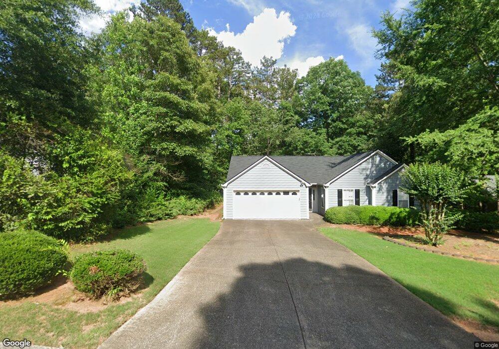
5043 River Rock Way Unit 6 Woodstock, GA 30188
Union Hill NeighborhoodEstimated Value: $378,758 - $387,000
3
Beds
2
Baths
1,585
Sq Ft
$242/Sq Ft
Est. Value
About This Home
This home is located at 5043 River Rock Way Unit 6, Woodstock, GA 30188 and is currently estimated at $382,879, approximately $241 per square foot. 5043 River Rock Way Unit 6 is a home located in Cherokee County with nearby schools including Arnold Mill Elementary School, Mill Creek Middle School, and River Ridge High School.
Ownership History
Date
Name
Owned For
Owner Type
Purchase Details
Closed on
Nov 12, 1993
Sold by
Colony Homes Lp
Bought by
Awtry Steven M Lynne
Current Estimated Value
Home Financials for this Owner
Home Financials are based on the most recent Mortgage that was taken out on this home.
Original Mortgage
$96,665
Interest Rate
6.81%
Mortgage Type
FHA
Create a Home Valuation Report for This Property
The Home Valuation Report is an in-depth analysis detailing your home's value as well as a comparison with similar homes in the area
Home Values in the Area
Average Home Value in this Area
Purchase History
| Date | Buyer | Sale Price | Title Company |
|---|---|---|---|
| Awtry Steven M Lynne | $98,300 | -- |
Source: Public Records
Mortgage History
| Date | Status | Borrower | Loan Amount |
|---|---|---|---|
| Closed | Awtry Steven M Lynne | $96,665 |
Source: Public Records
Tax History Compared to Growth
Tax History
| Year | Tax Paid | Tax Assessment Tax Assessment Total Assessment is a certain percentage of the fair market value that is determined by local assessors to be the total taxable value of land and additions on the property. | Land | Improvement |
|---|---|---|---|---|
| 2025 | $704 | $146,444 | $32,000 | $114,444 |
| 2024 | $681 | $138,120 | $30,400 | $107,720 |
| 2023 | $537 | $136,392 | $28,800 | $107,592 |
| 2022 | $677 | $125,828 | $23,600 | $102,228 |
| 2021 | $631 | $97,184 | $18,000 | $79,184 |
| 2020 | $590 | $85,656 | $14,000 | $71,656 |
| 2019 | $2,058 | $78,720 | $14,000 | $64,720 |
| 2018 | $1,870 | $70,240 | $14,000 | $56,240 |
| 2017 | $1,804 | $167,100 | $14,000 | $52,840 |
| 2016 | $1,665 | $150,600 | $12,800 | $47,440 |
| 2015 | $1,613 | $143,300 | $12,800 | $44,520 |
| 2014 | $1,431 | $127,200 | $12,800 | $38,080 |
Source: Public Records
Map
Nearby Homes
- 636 Arnold Mill Rd
- 632 Arnold Mill Rd
- 624 Arnold Mill Rd
- Dahlonega Elite Plan at Vista Ridge - The Meadows Collection
- Chatuge Plan at Vista Ridge - The Meadows Collection
- Allatoona Plan at Vista Ridge - The Meadows Collection
- Allatoona Elite Plan at Vista Ridge - The Meadows Collection
- Barnsley Plan at Vista Ridge - The Meadows Collection
- 130 Mooney Rd
- Barnsley Elite Plan at Vista Ridge - The Meadows Collection
- Chatuge Elite Plan at Vista Ridge - The Meadows Collection
- 203 Mooney Rd
- 522 Watercress Dr
- Hendricks Plan at Vista Ridge - Highlands Collection
- Serenity Plan at Vista Ridge - Heritage Collection
- Hillside Plan at Vista Ridge - Highlands Collection
- Acworth Plan at Vista Ridge - Heritage Collection
- Antioch Plan at Vista Ridge - Highlands Collection
- Sweetwater w Bsmt Brandywine Plan at Vista Ridge - Heritage Collection
- Wieuca Plan at Vista Ridge - Heritage Collection
- 5041 River Rock Way
- 5045 River Rock Way
- 5032 River Rock Way Unit 6
- 5039 River Rock Way
- 6032 Woodcreek Dr
- 5030 River Rock Way
- 6030 Woodcreek Dr
- 6021 Woodcreek Dr
- 6021 Woodcreek Dr
- 6021 Woodcreek Dr Unit 6021
- 5037 River Rock Way
- 5028 River Rock Way
- 547 Air Acres Ln
- 6028 Woodcreek Dr
- 6019 Woodcreek Dr Unit 6
- 5035 River Rock Way
- 5026 River Rock Way
- 517 Air Acres Ln
- 7002 Woodfield Way
- 7000 Woodfield Way