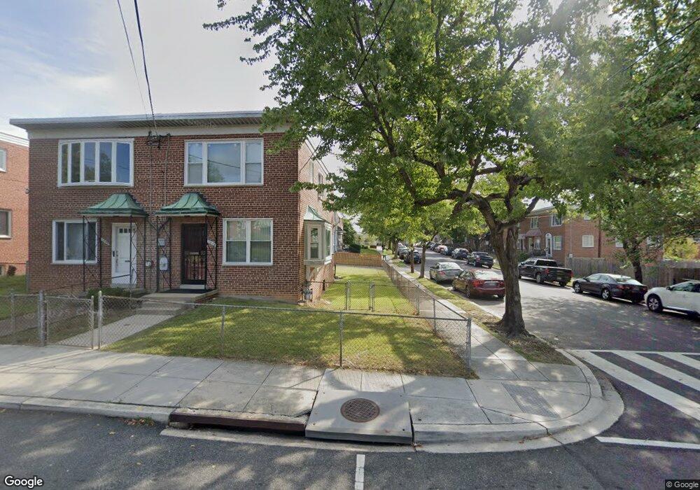
5043 Sargent Rd NE Washington, DC 20017
Michigan Park NeighborhoodEstimated Value: $444,548 - $552,000
3
Beds
2
Baths
1,120
Sq Ft
$428/Sq Ft
Est. Value
About This Home
This home is located at 5043 Sargent Rd NE, Washington, DC 20017 and is currently estimated at $478,887, approximately $427 per square foot. 5043 Sargent Rd NE is a home located in District of Columbia with nearby schools including Bunker Hill Elementary School, Brookland Middle School, and Dunbar High School.
Ownership History
Date
Name
Owned For
Owner Type
Purchase Details
Closed on
Oct 26, 1999
Sold by
Ravenscroft Leah S
Bought by
Allen Roxanna
Current Estimated Value
Home Financials for this Owner
Home Financials are based on the most recent Mortgage that was taken out on this home.
Original Mortgage
$129,199
Outstanding Balance
$38,185
Interest Rate
7.78%
Estimated Equity
$440,702
Create a Home Valuation Report for This Property
The Home Valuation Report is an in-depth analysis detailing your home's value as well as a comparison with similar homes in the area
Home Values in the Area
Average Home Value in this Area
Purchase History
| Date | Buyer | Sale Price | Title Company |
|---|---|---|---|
| Allen Roxanna | $129,900 | -- |
Source: Public Records
Mortgage History
| Date | Status | Borrower | Loan Amount |
|---|---|---|---|
| Open | Allen Roxanna | $129,199 |
Source: Public Records
Tax History Compared to Growth
Tax History
| Year | Tax Paid | Tax Assessment Tax Assessment Total Assessment is a certain percentage of the fair market value that is determined by local assessors to be the total taxable value of land and additions on the property. | Land | Improvement |
|---|---|---|---|---|
| 2025 | $1,132 | $444,430 | $295,060 | $149,370 |
| 2024 | $1,121 | $435,030 | $293,590 | $141,440 |
| 2023 | $1,112 | $427,680 | $286,700 | $140,980 |
| 2022 | $1,112 | $401,950 | $272,050 | $129,900 |
| 2021 | $1,069 | $387,000 | $268,030 | $118,970 |
| 2020 | $1,020 | $381,250 | $263,710 | $117,540 |
| 2019 | $1,951 | $359,030 | $242,300 | $116,730 |
| 2018 | $1,785 | $338,260 | $0 | $0 |
| 2017 | $1,630 | $309,370 | $0 | $0 |
| 2016 | $1,487 | $271,470 | $0 | $0 |
| 2015 | $1,354 | $230,770 | $0 | $0 |
| 2014 | $1,241 | $216,250 | $0 | $0 |
Source: Public Records
Map
Nearby Homes
- 5035 Sargent Rd NE
- 1261 Gallatin St NE
- 1324 Galloway St NE
- 1251 Emerson St NE
- 5047 13th St NE
- 4956 Sargent Rd NE
- 5008 11th St NE
- 4937 11th St NE
- 5133 12th St NE
- 4911 Sargent Rd NE
- 5024 10th St NE
- 4913 12th St NE
- 5008 10th St NE
- 5051 8th St NE
- 5031 S Dakota Ave NE
- 5213 12th St NE
- 5403 14th Place
- 4822 S Dakota Ave NE
- 832 Delafield St NE
- 5402 15th Ave
- 5045 Sargent Rd NE
- 5047 Sargent Rd NE
- 1224 Farragut Place NE
- 5049 Sargent Rd NE
- 1226 Farragut Place NE
- 5051 Sargent Rd NE
- 5033 Sargent Rd NE
- 5053 Sargent Rd NE
- 1228 Farragut Place NE
- 1225 Farragut Place NE
- 5031 Sargent Rd NE
- 1227 Farragut Place NE
- 1230 Farragut Place NE
- 5057 Sargent Rd NE
- 5029 Sargent Rd NE
- 5055 Sargent Rd NE
- 1232 Farragut Place NE
- 1229 Farragut Place NE
- 5040 Sargent Rd NE
- 1231 Farragut Place NE