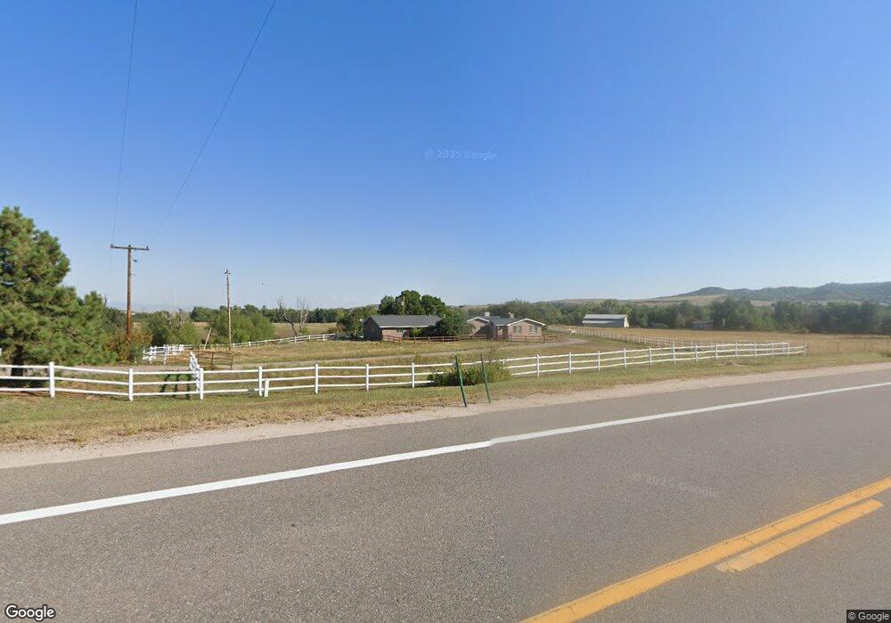
5045 N State Highway 67 Sedalia, CO 80135
Estimated Value: $782,256 - $1,485,000
3
Beds
3
Baths
1,319
Sq Ft
$790/Sq Ft
Est. Value
About This Home
This home is located at 5045 N State Highway 67, Sedalia, CO 80135 and is currently estimated at $1,041,752, approximately $789 per square foot. 5045 N State Highway 67 is a home located in Douglas County with nearby schools including Sedalia Elementary School, Castle Rock Middle School, and Castle View High School.
Ownership History
Date
Name
Owned For
Owner Type
Purchase Details
Closed on
Dec 11, 1998
Sold by
Kent Kelly G
Bought by
Sanderson Jackie Lynn
Current Estimated Value
Home Financials for this Owner
Home Financials are based on the most recent Mortgage that was taken out on this home.
Original Mortgage
$125,000
Interest Rate
6.74%
Mortgage Type
Balloon
Purchase Details
Closed on
Jul 22, 1991
Sold by
Kent John G
Bought by
Kent Kelly G
Create a Home Valuation Report for This Property
The Home Valuation Report is an in-depth analysis detailing your home's value as well as a comparison with similar homes in the area
Home Values in the Area
Average Home Value in this Area
Purchase History
| Date | Buyer | Sale Price | Title Company |
|---|---|---|---|
| Sanderson Jackie Lynn | $370,000 | -- | |
| Kent Kelly G | -- | -- |
Source: Public Records
Mortgage History
| Date | Status | Borrower | Loan Amount |
|---|---|---|---|
| Closed | Sanderson Jackie Lynn | $125,000 |
Source: Public Records
Tax History Compared to Growth
Tax History
| Year | Tax Paid | Tax Assessment Tax Assessment Total Assessment is a certain percentage of the fair market value that is determined by local assessors to be the total taxable value of land and additions on the property. | Land | Improvement |
|---|---|---|---|---|
| 2024 | $1,556 | $29,330 | $200 | $29,130 |
| 2023 | $1,574 | $29,330 | $200 | $29,130 |
| 2022 | $1,576 | $19,890 | $200 | $19,690 |
| 2021 | $1,642 | $19,890 | $200 | $19,690 |
| 2020 | $1,791 | $22,210 | $210 | $22,000 |
| 2019 | $1,799 | $22,210 | $210 | $22,000 |
| 2018 | $1,555 | $19,100 | $200 | $18,900 |
| 2017 | $1,436 | $19,100 | $200 | $18,900 |
| 2016 | $1,401 | $18,230 | $190 | $18,040 |
| 2015 | $1,435 | $18,230 | $190 | $18,040 |
| 2014 | $1,343 | $15,870 | $170 | $15,700 |
Source: Public Records
Map
Nearby Homes
- 2367 Keep Dr
- 3330 Tweet Place
- 3248 Tweet Place Unit Parcel 9
- 3120 Bears Den Dr
- 3013 Bears Den Dr
- 4279 Sanctuary Way
- 3878 Turret Ln Unit 37
- 5740 Lambert Ranch Trail
- 2810 Bartizan Ln Unit 19
- 2814 Charlford Ln
- 6751 Cherokee Dr
- 2301 Keep Dr Unit 46
- 2327 Keep Dr
- 2360 Charlford Ln Unit 60
- 3223 Country Club Pkwy
- 3224 Country Club Pkwy
- 3228 Country Club Pkwy
- 1170 Lost Elk Cir
- 3122 Ramshorn Dr
- 4665 Bobolink Dr
- 5085 N State Highway 67
- 5088 N State Highway 67
- 4975 N State Highway 67
- 5066 N Highway 67
- 4943 N State Highway 67
- 4941 N State Highway 67
- 4970 N Highway 67
- 4939 N State Highway 67
- 4970 N State Highway 67
- 4990 N State Highway 67
- 1600 N State Highway 67 Unit 1
- 4945 N State Highway 67
- 4930 Woodley Ave
- 4947 N State Highway 67
- 5008 N State Highway 67
- 4909 Woodley Ave
- 4910 N State Highway 67
- 4950 Woodley Ave
- 4961 Woodley Ave
- 4587 N Perry Park Rd