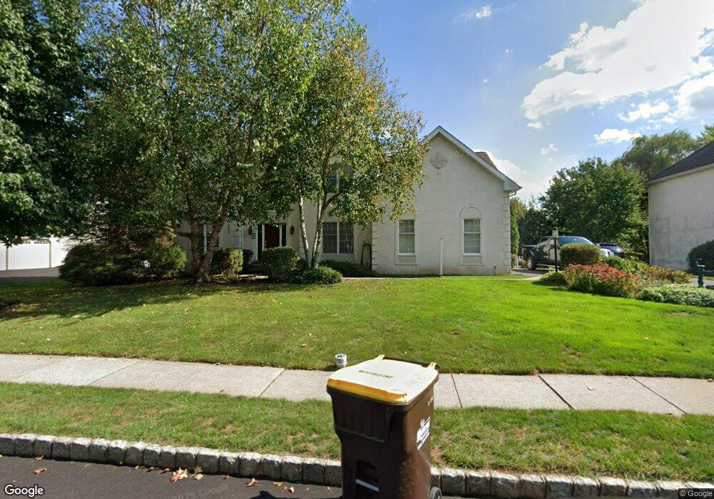
5045 Redfield Rd Doylestown, PA 18902
Estimated Value: $885,355 - $1,015,000
4
Beds
3
Baths
3,153
Sq Ft
$295/Sq Ft
Est. Value
About This Home
This home is located at 5045 Redfield Rd, Doylestown, PA 18902 and is currently estimated at $931,089, approximately $295 per square foot. 5045 Redfield Rd is a home located in Bucks County with nearby schools including Cold Spring Elementary School, Holicong Middle School, and Central Bucks High School - East.
Ownership History
Date
Name
Owned For
Owner Type
Purchase Details
Closed on
Aug 31, 2006
Sold by
Palmer Michael C and Palmer Elizabeth B
Bought by
Macleman Susan Walsh and Macleman John Jay
Current Estimated Value
Home Financials for this Owner
Home Financials are based on the most recent Mortgage that was taken out on this home.
Original Mortgage
$417,000
Outstanding Balance
$248,372
Interest Rate
6.52%
Mortgage Type
Purchase Money Mortgage
Estimated Equity
$682,717
Purchase Details
Closed on
Apr 27, 1999
Sold by
Schwartz Matthew C and Schwartz Donna A
Bought by
Palmer Michael C and Palmer Elizabeth B
Home Financials for this Owner
Home Financials are based on the most recent Mortgage that was taken out on this home.
Original Mortgage
$272,800
Interest Rate
7.49%
Purchase Details
Closed on
Apr 16, 1998
Sold by
Cold Spring Hunt Lp
Bought by
Schwartz Matthew C and Schwartz Donna A
Create a Home Valuation Report for This Property
The Home Valuation Report is an in-depth analysis detailing your home's value as well as a comparison with similar homes in the area
Home Values in the Area
Average Home Value in this Area
Purchase History
| Date | Buyer | Sale Price | Title Company |
|---|---|---|---|
| Macleman Susan Walsh | $582,000 | None Available | |
| Palmer Michael C | $341,000 | -- | |
| Schwartz Matthew C | $304,989 | -- |
Source: Public Records
Mortgage History
| Date | Status | Borrower | Loan Amount |
|---|---|---|---|
| Open | Macleman Susan Walsh | $417,000 | |
| Previous Owner | Palmer Michael C | $272,800 |
Source: Public Records
Tax History Compared to Growth
Tax History
| Year | Tax Paid | Tax Assessment Tax Assessment Total Assessment is a certain percentage of the fair market value that is determined by local assessors to be the total taxable value of land and additions on the property. | Land | Improvement |
|---|---|---|---|---|
| 2025 | $8,626 | $52,980 | $10,120 | $42,860 |
| 2024 | $8,626 | $52,980 | $10,120 | $42,860 |
| 2023 | $8,333 | $52,980 | $10,120 | $42,860 |
| 2022 | $8,234 | $52,980 | $10,120 | $42,860 |
| 2021 | $8,135 | $52,980 | $10,120 | $42,860 |
| 2020 | $8,135 | $52,980 | $10,120 | $42,860 |
| 2019 | $8,082 | $52,980 | $10,120 | $42,860 |
| 2018 | $8,082 | $52,980 | $10,120 | $42,860 |
| 2017 | $8,016 | $52,980 | $10,120 | $42,860 |
| 2016 | $8,095 | $52,980 | $10,120 | $42,860 |
| 2015 | -- | $52,980 | $10,120 | $42,860 |
| 2014 | -- | $52,980 | $10,120 | $42,860 |
Source: Public Records
Map
Nearby Homes
- 4250 Aly Dr
- 4925 Redfield Rd
- 4936 Davis Dr
- 3975 Amberton Ct
- 5063 Sagewood Ct
- 5115 Sugar Hill Ct
- 5184 Lovering Dr
- 5281 Harrington Ct
- 4605 Twinbrook Cir
- 5491 Long Ln
- 4542 Deep Creek Way
- 4221 Sir Andrew Cir
- 3689 Hancock Ln
- 4190 Milords Ln
- 5182 Point Pleasant Pike
- 4964 Point Pleasant Pike
- 6680 Point Pleasant Pike
- 3865 Burnt House Hill Rd
- 3468 Holicong Rd
- 3479 Durham Rd
- 5035 Redfield Rd
- 5055 Redfield Rd
- 4180 Leslie Dr
- 5040 Redfield Rd
- 5025 Redfield Rd
- 5065 Redfield Rd
- 4175 Leslie Dr
- 5030 Redfield Rd
- 5015 Redfield Rd
- 5075 Redfield Rd
- 5061 Mead Dr
- 4185 Leslie Dr
- 5051 Mead Dr
- 5020 Redfield Rd
- 5041 Mead Dr
- 5090 Redfield Rd
- 5005 Redfield Rd
- 4195 Leslie Dr
- 5008 Davis Dr
- 5012 Davis Dr