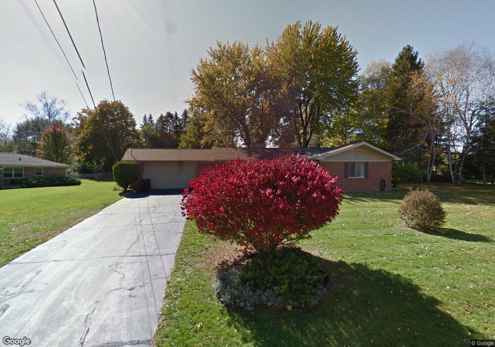
5046 Brookside Dr Jackson, MI 49203
Estimated Value: $276,000 - $303,000
3
Beds
3
Baths
1,726
Sq Ft
$170/Sq Ft
Est. Value
About This Home
This home is located at 5046 Brookside Dr, Jackson, MI 49203 and is currently estimated at $293,508, approximately $170 per square foot. 5046 Brookside Dr is a home located in Jackson County with nearby schools including Sharp Park Academy, Cascades School, and Middle School at Parkside.
Ownership History
Date
Name
Owned For
Owner Type
Purchase Details
Closed on
Dec 21, 2021
Sold by
Thayer Jane
Bought by
Thayer Jane M and Jane M Thayer Trust
Current Estimated Value
Purchase Details
Closed on
Apr 2, 2018
Sold by
Choate Beverly Kay and Hempel Barbara Joan
Bought by
Thayer Jane
Home Financials for this Owner
Home Financials are based on the most recent Mortgage that was taken out on this home.
Original Mortgage
$87,500
Outstanding Balance
$75,178
Interest Rate
4.4%
Mortgage Type
New Conventional
Estimated Equity
$218,330
Create a Home Valuation Report for This Property
The Home Valuation Report is an in-depth analysis detailing your home's value as well as a comparison with similar homes in the area
Home Values in the Area
Average Home Value in this Area
Purchase History
| Date | Buyer | Sale Price | Title Company |
|---|---|---|---|
| Thayer Jane M | -- | None Available | |
| Thayer Jane | $125,000 | Devon Title Co |
Source: Public Records
Mortgage History
| Date | Status | Borrower | Loan Amount |
|---|---|---|---|
| Open | Thayer Jane | $87,500 |
Source: Public Records
Tax History
| Year | Tax Paid | Tax Assessment Tax Assessment Total Assessment is a certain percentage of the fair market value that is determined by local assessors to be the total taxable value of land and additions on the property. | Land | Improvement |
|---|---|---|---|---|
| 2025 | $3,737 | $123,300 | $0 | $0 |
| 2024 | $25 | $119,600 | $0 | $0 |
| 2023 | $2,363 | $108,400 | $0 | $0 |
| 2022 | $3,434 | $96,400 | $0 | $0 |
| 2021 | $3,381 | $94,800 | $0 | $0 |
| 2020 | $3,342 | $92,800 | $0 | $0 |
| 2019 | $3,309 | $89,800 | $0 | $0 |
| 2018 | $3,040 | $90,700 | $0 | $0 |
| 2017 | $3,905 | $90,100 | $0 | $0 |
| 2016 | $1,668 | $88,500 | $88,500 | $0 |
| 2015 | $2,281 | $83,300 | $83,300 | $0 |
| 2014 | $2,281 | $79,700 | $0 | $0 |
| 2013 | -- | $79,700 | $79,700 | $0 |
Source: Public Records
Map
Nearby Homes
- 3825 W Walmont Rd
- 3657 Roosevelt Cir
- 2000 Evergreen Trail
- 615 Sioux St
- 411 Hinckley Blvd
- 108 S Cove St
- 118 Ridge St
- 6076 Browns Lake Rd
- 206 W Vandercook Dr
- 1910 Horton Rd
- 3457 Cambridge Ave
- 204 Meyers Ave
- 4900 Nantucket Dr Unit 1
- VL Spring Arbor Rd
- 4600 Nantucket Dr Unit 12
- 4600 Nantucket Dr Unit 9
- 4700 Nantucket Dr Unit 15
- 4700 Nantucket Dr Unit 13
- 4600 Nantucket Dr Unit 10
- 4700 Nantucket Dr Unit 6
- 0 Brookside Unit Lot 15 20026158
- 0 Brookside Unit M21039710
- 5042 Brookside Dr
- 5027 Harriett Dr
- 5048 Brookside Dr
- Lot 15 Brookside Dr
- 5029 Harriett Dr
- 5045 Brookside Dr
- 5040 Brookside Dr
- 5043 Brookside Dr
- 5031 Harriett Dr
- 5041 Brookside Dr
- 5053 Brookside Dr
- 5038 Brookside Dr
- 5033 Harriett Dr
- 5026 Harriett Dr
- 5024 Harriett Dr
- 5028 Harriett Dr
- 5022 Harriett Dr
- 5030 Harriett Dr
Your Personal Tour Guide
Ask me questions while you tour the home.