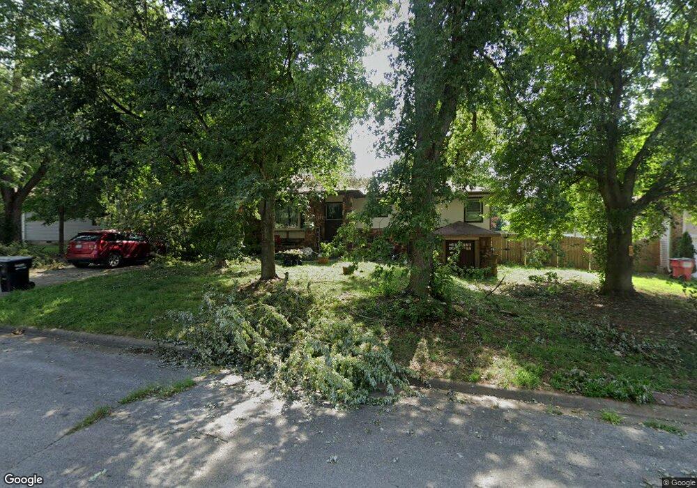
5046 S Walnut Hill Rd Springfield, MO 65810
Southwest Springfield NeighborhoodEstimated Value: $246,000 - $329,714
3
Beds
2
Baths
1,760
Sq Ft
$175/Sq Ft
Est. Value
About This Home
This home is located at 5046 S Walnut Hill Rd, Springfield, MO 65810 and is currently estimated at $307,179, approximately $174 per square foot. 5046 S Walnut Hill Rd is a home located in Greene County with nearby schools including McBride Elementary School, Wilson's Creek Intermediate School, and Cherokee Middle School.
Ownership History
Date
Name
Owned For
Owner Type
Purchase Details
Closed on
Dec 15, 2011
Sold by
Fannie Mae
Bought by
Kozeny & Mccubbin Lc
Current Estimated Value
Home Financials for this Owner
Home Financials are based on the most recent Mortgage that was taken out on this home.
Original Mortgage
$2,916
Outstanding Balance
$1,997
Interest Rate
4.03%
Mortgage Type
Stand Alone Second
Estimated Equity
$305,182
Purchase Details
Closed on
Apr 24, 2006
Sold by
Hedgpeth Latricia and Kerley Latricia
Bought by
Hedgpeth Latricia and Hedgpeth Kinley
Home Financials for this Owner
Home Financials are based on the most recent Mortgage that was taken out on this home.
Original Mortgage
$141,600
Interest Rate
7.5%
Mortgage Type
Adjustable Rate Mortgage/ARM
Create a Home Valuation Report for This Property
The Home Valuation Report is an in-depth analysis detailing your home's value as well as a comparison with similar homes in the area
Home Values in the Area
Average Home Value in this Area
Purchase History
| Date | Buyer | Sale Price | Title Company |
|---|---|---|---|
| Kozeny & Mccubbin Lc | -- | None Available | |
| Hedgpeth Latricia | -- | Transcontinental Title Co |
Source: Public Records
Mortgage History
| Date | Status | Borrower | Loan Amount |
|---|---|---|---|
| Open | Kozeny & Mccubbin Lc | $2,916 | |
| Previous Owner | Hedgpeth Latricia | $141,600 |
Source: Public Records
Tax History Compared to Growth
Tax History
| Year | Tax Paid | Tax Assessment Tax Assessment Total Assessment is a certain percentage of the fair market value that is determined by local assessors to be the total taxable value of land and additions on the property. | Land | Improvement |
|---|---|---|---|---|
| 2025 | $2,239 | $45,570 | $7,130 | $38,440 |
| 2024 | $2,239 | $40,430 | $4,750 | $35,680 |
| 2023 | $2,227 | $40,430 | $4,750 | $35,680 |
| 2022 | $2,083 | $38,760 | $4,750 | $34,010 |
| 2021 | $2,083 | $38,760 | $4,750 | $34,010 |
| 2020 | $2,046 | $36,100 | $4,750 | $31,350 |
| 2019 | $1,987 | $36,100 | $4,750 | $31,350 |
| 2018 | $1,833 | $33,230 | $4,750 | $28,480 |
| 2017 | $1,815 | $30,530 | $4,750 | $25,780 |
| 2016 | $1,668 | $30,530 | $4,750 | $25,780 |
| 2015 | $1,655 | $30,530 | $4,750 | $25,780 |
| 2014 | $1,608 | $29,430 | $4,750 | $24,680 |
Source: Public Records
Map
Nearby Homes
- 4933 S Sycamore Ave
- 5065 S Sycamore Ave
- 3019 W Marty St
- 3031 W Marty St
- 5023 S Burrows Ave
- 5125 S Walnut Hill Rd
- 3005 W Teton Dr
- Lot 43 W Teton Dr
- 2983 W Teton Dr
- 3039 W Teton Dr
- 3017 W Teton Dr
- Lot 65 W Marty St
- 3032 W Allen Dr
- 3021 W Allen Dr
- 5021 S Farm Road 137
- 5135 S Deborah Ct
- 2642 W Blakey St
- 5389 S Clifton Ave
- 5349 S Aaron Ave
- 5361 S Aaron Ave
- 5054 S Walnut Hill Rd
- 5036 S Walnut Hill Rd
- 5045 S Sycamore Ave
- 5035 S Sycamore Ave
- 5055 S Sycamore Ave
- 5064 S Walnut Hill Rd
- 5045 S Walnut Hill Rd
- 5035 S Walnut Hill Rd
- Lot 14 S Sycamore Ave
- Lot 15 S Sycamore Ave
- 1106 S Sycamore Ave
- 5104 S Walnut Hill Rd
- 5065 S Walnut Hill Rd
- 5105 S Sycamore Ave
- 5070 S Burrows Ave
- 5046 S Sycamore Ave
- 2960 W Farm Road 178
- 5082 S Burrows Ave
- 5036 S Sycamore Ave
- 5026 S Sycamore Ave