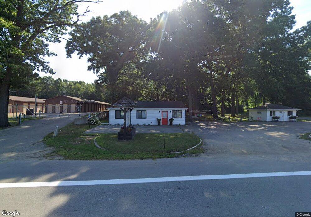
50463 M 152 Dowagiac, MI 49047
Estimated Value: $122,000 - $203,000
--
Bed
--
Bath
1,328
Sq Ft
$122/Sq Ft
Est. Value
About This Home
This home is located at 50463 M 152, Dowagiac, MI 49047 and is currently estimated at $162,500, approximately $122 per square foot. 50463 M 152 is a home located in Cass County with nearby schools including Sister Lakes Elementary School, Dowagiac Middle School, and Union High School.
Ownership History
Date
Name
Owned For
Owner Type
Purchase Details
Closed on
Aug 30, 2019
Sold by
Merkel Phillip S
Bought by
Maymay S Cones & Dogs Llc
Current Estimated Value
Purchase Details
Closed on
Jul 30, 2014
Sold by
Mitchell Family Limited Partnership Six
Bought by
Merkel Phillip S and Phillip S Merkel Employees Profit Sharin
Purchase Details
Closed on
Apr 16, 2004
Sold by
Dickson Lorene E
Bought by
Mitchell Family Lp #1
Home Financials for this Owner
Home Financials are based on the most recent Mortgage that was taken out on this home.
Original Mortgage
$73,000
Interest Rate
5.46%
Purchase Details
Closed on
Jan 2, 2004
Sold by
Dickson William K and Dickson Lorene E
Bought by
Dickson Lorene E
Create a Home Valuation Report for This Property
The Home Valuation Report is an in-depth analysis detailing your home's value as well as a comparison with similar homes in the area
Home Values in the Area
Average Home Value in this Area
Purchase History
| Date | Buyer | Sale Price | Title Company |
|---|---|---|---|
| Maymay S Cones & Dogs Llc | $45,000 | Fat | |
| Merkel Phillip S | $37,300 | First American Title | |
| Mitchell Family Lp #1 | -- | -- | |
| Dickson Lorene E | -- | -- |
Source: Public Records
Mortgage History
| Date | Status | Borrower | Loan Amount |
|---|---|---|---|
| Previous Owner | Mitchell Family Lp #1 | $73,000 |
Source: Public Records
Tax History Compared to Growth
Tax History
| Year | Tax Paid | Tax Assessment Tax Assessment Total Assessment is a certain percentage of the fair market value that is determined by local assessors to be the total taxable value of land and additions on the property. | Land | Improvement |
|---|---|---|---|---|
| 2025 | $146 | $10,500 | $10,500 | $0 |
| 2024 | $36 | $9,900 | $9,900 | $0 |
| 2023 | $34 | $9,000 | $0 | $0 |
| 2022 | $32 | $6,000 | $0 | $0 |
| 2021 | $130 | $3,800 | $0 | $0 |
| 2020 | $31 | $2,900 | $0 | $0 |
| 2019 | $73 | $2,500 | $0 | $0 |
| 2018 | $17 | $2,600 | $0 | $0 |
| 2017 | $16 | $2,600 | $0 | $0 |
| 2016 | $16 | $1,500 | $0 | $0 |
| 2015 | -- | $2,600 | $0 | $0 |
| 2011 | -- | $6,200 | $0 | $0 |
Source: Public Records
Map
Nearby Homes
- VL W Lakeshore Dr
- 32314 Hilltop Rd
- 50177 3rd St
- 32286 Center St
- 6 Forest Rd
- 5 Forest Rd
- 4 Forest Rd
- 3 Forest Rd
- 2 Forest Rd
- 1 Forest Rd
- 31701 Karl St
- 50040 South St
- 31273 County Line Rd
- 31161 County Line Rd
- 93810 Lake Ct
- 67560 95th Ave
- 93402 Lee Dr Unit 1
- 93459 M 152
- 66368 Timmons Rd
- 67023 Lakeshore Dr
- 31934 Brooks Dr
- 31934 Brooks Dr Unit 6
- 31934 Brooks Dr Unit 5
- 31934 W Lakeshore Dr
- 50651 Garrett Rd
- 50537 M 152
- 50660 M 152
- 50655 Garrett Rd
- 50617 W Lakeshore Dr
- 32000 Jones Dr
- 50660 Garrett Rd
- 31934 Terry Dr
- 31975 W Lakeshore Dr
- 31999 Jones Dr
- 31941 Terry Dr
- 31917 Terry Dr
- 31889 North Ct
- 31886 W Lakeshore Dr
- 31889 N Court St
- 31941 W Lakeshore Dr