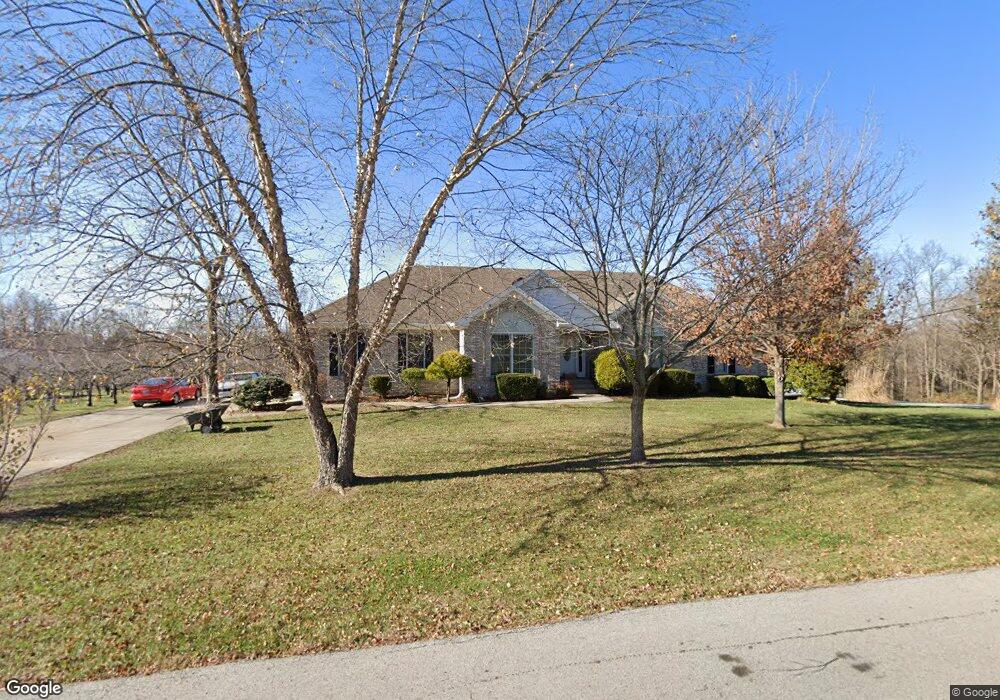
505 Alpar Ln Shepherdsville, KY 40165
Estimated Value: $389,000 - $439,000
3
Beds
2
Baths
1,910
Sq Ft
$215/Sq Ft
Est. Value
About This Home
This home is located at 505 Alpar Ln, Shepherdsville, KY 40165 and is currently estimated at $410,691, approximately $215 per square foot. 505 Alpar Ln is a home with nearby schools including Pleasant Grove Elementary School, Eastside Middle School, and Bullitt East High School.
Ownership History
Date
Name
Owned For
Owner Type
Purchase Details
Closed on
Apr 29, 2024
Sold by
Armstrong Louise and Armstrong Katherlne Louise
Bought by
Griffith Gregory Bryan
Current Estimated Value
Home Financials for this Owner
Home Financials are based on the most recent Mortgage that was taken out on this home.
Original Mortgage
$305,000
Outstanding Balance
$300,608
Interest Rate
6.74%
Mortgage Type
New Conventional
Estimated Equity
$110,083
Purchase Details
Closed on
Jul 29, 2022
Sold by
Armstrong and Louise
Bought by
Mulloy Michael and Mulloy Michelle
Create a Home Valuation Report for This Property
The Home Valuation Report is an in-depth analysis detailing your home's value as well as a comparison with similar homes in the area
Home Values in the Area
Average Home Value in this Area
Purchase History
| Date | Buyer | Sale Price | Title Company |
|---|---|---|---|
| Griffith Gregory Bryan | $450,000 | Louisville Title | |
| Mulloy Michael | $500 | Wooldridge John | |
| Mulloy Michael | $500 | Wooldridge John |
Source: Public Records
Mortgage History
| Date | Status | Borrower | Loan Amount |
|---|---|---|---|
| Open | Griffith Gregory Bryan | $305,000 |
Source: Public Records
Tax History Compared to Growth
Tax History
| Year | Tax Paid | Tax Assessment Tax Assessment Total Assessment is a certain percentage of the fair market value that is determined by local assessors to be the total taxable value of land and additions on the property. | Land | Improvement |
|---|---|---|---|---|
| 2024 | $3,474 | $275,500 | $50,000 | $225,500 |
| 2023 | $2,432 | $239,546 | $50,000 | $189,546 |
| 2022 | $2,290 | $220,567 | $220,567 | $0 |
| 2021 | $2,294 | $220,567 | $0 | $0 |
| 2020 | $2,060 | $220,567 | $0 | $0 |
| 2019 | $2,024 | $218,516 | $0 | $0 |
| 2018 | $2,084 | $218,516 | $0 | $0 |
| 2017 | $2,053 | $218,516 | $0 | $0 |
| 2016 | $2,028 | $218,761 | $0 | $0 |
| 2015 | $1,930 | $181,861 | $0 | $0 |
| 2014 | $1,834 | $218,761 | $0 | $0 |
Source: Public Records
Map
Nearby Homes
- 193 Pare Ct
- 429 Highland Ridge Dr
- 429 Highland Ridge
- 389 Williamsburg Dr
- 399 Williamsburg Dr
- 5080 Highway 44 E
- 140 Ridge Brook Dr
- 182 Washington Commons Dr
- 152 Williamsburg Ct
- 569 Williamsburg Dr
- 124 Preserves Blvd
- The McPherson Plan at River Crest - Designer Collection
- Winston Plan at River Crest - Designer Collection
- Carrington Plan at River Crest - Designer Collection
- Emmett Plan at River Crest - Designer Collection
- Breckenridge Plan at River Crest - Maple Street Collection
- Yosemite Plan at River Crest - Maple Street Collection
- Greenbriar Plan at River Crest - Maple Street Collection
- Magnolia Plan at River Crest - Designer Collection
- Wyatt Plan at River Crest - Designer Collection
- 984 Alpar Ln
- 555 Alpar Ln
- 411 Alpar Ln
- 2 Alpar Ln Unit LOT
- 6 Alpar Ln
- 2 Alpar Ln
- Lot 3E Alpar Ln
- Lot 3A Alpar Ln
- 329 Alpar Ln
- 164 Beagle Run
- 568 Alpar Ln
- 164 Beagle Run
- 610 Alpar Ln
- 207 Beagle Run
- 192 Beagle Run
- 273 Old Highway 44 E
- 267 Old Highway 44 E
- 236 Pleasant View Ct
- 210 Pleasant View Ct
- 13 Pleasant View Ct