Estimated Value: $443,000 - $509,156
3
Beds
2
Baths
1,370
Sq Ft
$353/Sq Ft
Est. Value
About This Home
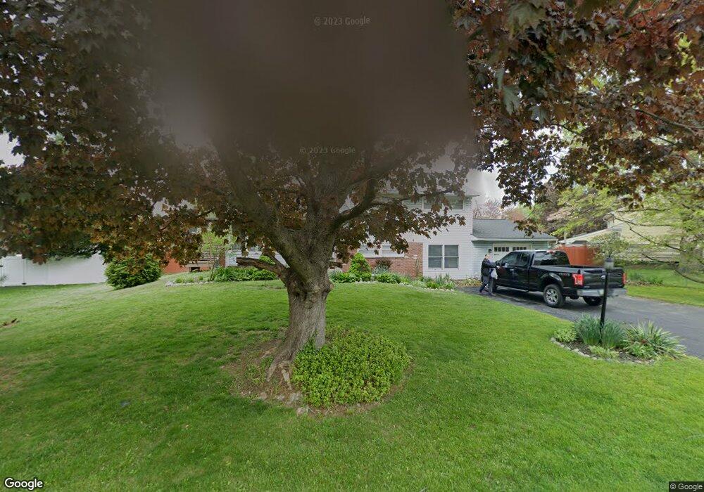
This home is located at 505 Briar Rd, Exton, PA 19341 and is currently estimated at $484,039, approximately $353 per square foot. 505 Briar Rd is a home located in Chester County with nearby schools including Exton Elementary School, J.R. Fugett Middle School, and West Chester East High School.
Ownership History
Date
Name
Owned For
Owner Type
Purchase Details
Closed on
Mar 25, 2003
Sold by
Spence Andrew C and Clark Sandra L
Bought by
Spence Andrew C and Spence Sandra L
Current Estimated Value
Home Financials for this Owner
Home Financials are based on the most recent Mortgage that was taken out on this home.
Original Mortgage
$135,000
Outstanding Balance
$57,485
Interest Rate
5.75%
Mortgage Type
Purchase Money Mortgage
Estimated Equity
$426,554
Purchase Details
Closed on
Apr 27, 1998
Sold by
Reitz Michael D and Reitz Miriam Anna
Bought by
Spence Andrew C and Clark Sandra L
Home Financials for this Owner
Home Financials are based on the most recent Mortgage that was taken out on this home.
Original Mortgage
$140,050
Interest Rate
7.04%
Mortgage Type
FHA
Create a Home Valuation Report for This Property
The Home Valuation Report is an in-depth analysis detailing your home's value as well as a comparison with similar homes in the area
Home Values in the Area
Average Home Value in this Area
Purchase History
| Date | Buyer | Sale Price | Title Company |
|---|---|---|---|
| Spence Andrew C | -- | Fidelity Natl Title Ins Co O | |
| Spence Andrew C | $142,000 | -- |
Source: Public Records
Mortgage History
| Date | Status | Borrower | Loan Amount |
|---|---|---|---|
| Open | Spence Andrew C | $135,000 | |
| Closed | Spence Andrew C | $140,050 |
Source: Public Records
Tax History
| Year | Tax Paid | Tax Assessment Tax Assessment Total Assessment is a certain percentage of the fair market value that is determined by local assessors to be the total taxable value of land and additions on the property. | Land | Improvement |
|---|---|---|---|---|
| 2025 | $3,692 | $127,370 | $38,400 | $88,970 |
| 2024 | $3,692 | $127,370 | $38,400 | $88,970 |
| 2023 | $3,528 | $127,370 | $38,400 | $88,970 |
| 2022 | $3,480 | $127,370 | $38,400 | $88,970 |
| 2021 | $3,430 | $127,370 | $38,400 | $88,970 |
| 2020 | $3,407 | $127,370 | $38,400 | $88,970 |
| 2019 | $3,358 | $127,370 | $38,400 | $88,970 |
| 2018 | $3,283 | $127,370 | $38,400 | $88,970 |
| 2017 | $3,208 | $127,370 | $38,400 | $88,970 |
| 2016 | $2,704 | $127,370 | $38,400 | $88,970 |
| 2015 | $2,704 | $127,370 | $38,400 | $88,970 |
| 2014 | $2,704 | $127,370 | $38,400 | $88,970 |
Source: Public Records
Map
Nearby Homes
- 167 Brazier Ln
- 218 Hendricks Ave
- 300 Bell Ct
- 226 Red Leaf Ln
- 108 Mountain View Dr
- 377 Lynetree Dr Unit 5A
- 596 Coach Hill Ct Unit C
- 603 Coach Hill Ct Unit B
- 431 Lynetree Dr
- 521 Astor Square Unit 45
- 1 Timber Mill Ln Unit SARTO
- 1406 Timber Mill Ln
- 5 Timber Mill Ln Unit BISCOTTO
- 3 Timber Mill Ln Unit SILENZIO
- 2 Timber Mill Ln Unit SERENO
- 839 Durant Ct Unit 21
- 143 Birchwood Dr
- 351 Huntington Ct Unit 15
- 230 Smallwood Ct Unit 230
- 236 Silverbell Ct
Your Personal Tour Guide
Ask me questions while you tour the home.