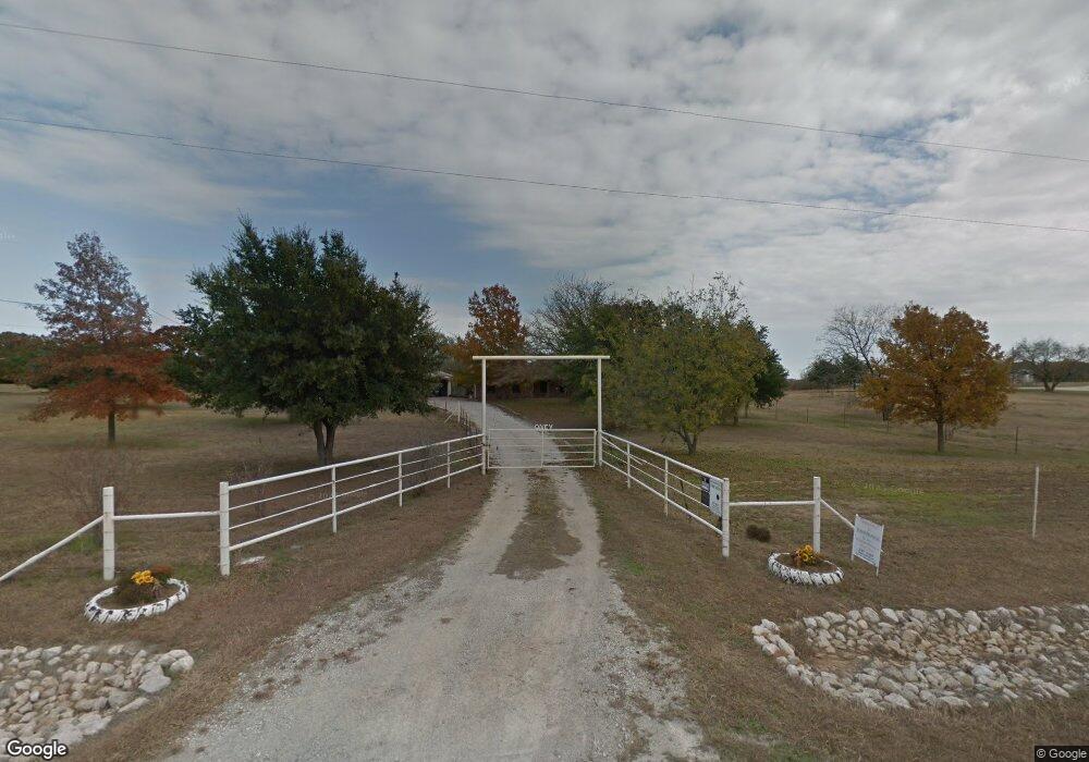
505 County Road 2590 Alvord, TX 76225
Estimated Value: $490,842 - $785,000
3
Beds
2
Baths
2,030
Sq Ft
$314/Sq Ft
Est. Value
About This Home
This home is located at 505 County Road 2590, Alvord, TX 76225 and is currently estimated at $637,921, approximately $314 per square foot. 505 County Road 2590 is a home located in Wise County with nearby schools including Alvord Elementary School, Alvord Middle School, and Alvord High School.
Ownership History
Date
Name
Owned For
Owner Type
Purchase Details
Closed on
Oct 14, 2024
Sold by
Stevenson Rodney R and Stevenson Kathleene S
Bought by
Rodney And Kathleene Stevenson Revocable Trus and Stevenson
Current Estimated Value
Purchase Details
Closed on
Aug 21, 2014
Sold by
Oney Robert C and Oney Mariorie A
Bought by
Stevenson Rodney R and Stevenson Kathleen S
Home Financials for this Owner
Home Financials are based on the most recent Mortgage that was taken out on this home.
Original Mortgage
$201,600
Interest Rate
4.19%
Mortgage Type
New Conventional
Purchase Details
Closed on
Jan 1, 1901
Bought by
Stevenson Rodney and Stevenson Kathleene
Create a Home Valuation Report for This Property
The Home Valuation Report is an in-depth analysis detailing your home's value as well as a comparison with similar homes in the area
Home Values in the Area
Average Home Value in this Area
Purchase History
| Date | Buyer | Sale Price | Title Company |
|---|---|---|---|
| Rodney And Kathleene Stevenson Revocable Trus | -- | None Listed On Document | |
| Stevenson Rodney R | -- | None Available | |
| Stevenson Rodney | -- | -- |
Source: Public Records
Mortgage History
| Date | Status | Borrower | Loan Amount |
|---|---|---|---|
| Previous Owner | Stevenson Rodney R | $201,600 |
Source: Public Records
Tax History Compared to Growth
Tax History
| Year | Tax Paid | Tax Assessment Tax Assessment Total Assessment is a certain percentage of the fair market value that is determined by local assessors to be the total taxable value of land and additions on the property. | Land | Improvement |
|---|---|---|---|---|
| 2025 | $4,183 | $376,053 | $24,487 | $351,566 |
| 2024 | $4,183 | $350,059 | $24,411 | $325,648 |
| 2023 | $4,061 | $342,023 | $0 | $0 |
| 2022 | $4,388 | $284,384 | $0 | $0 |
| 2021 | $3,746 | $384,740 | $175,860 | $208,880 |
| 2020 | $3,392 | $330,810 | $141,600 | $189,210 |
| 2019 | $3,564 | $327,620 | $141,600 | $186,020 |
| 2018 | $3,470 | $296,710 | $115,650 | $181,060 |
| 2017 | $3,221 | $262,750 | $93,230 | $169,520 |
| 2016 | $3,080 | $255,670 | $86,150 | $169,520 |
| 2015 | -- | $233,390 | $79,070 | $154,320 |
| 2014 | -- | $125,320 | $5,580 | $119,740 |
Source: Public Records
Map
Nearby Homes
- Lot 9 BLK 3 Sienna Dr
- Lot 11 BLK 3 Sienna Dr
- Lot 3A BLK 3 Sienna Dr
- LOT 14 BLK 3 Sienna Dr
- Lot 7 BLK 3 Sienna Dr
- Lot 1O BLK 3 Sienna Dr
- Lot 12 BLK 3 Sienna Dr
- Lot 230 Luna Ct
- Lot 6 BLK 3 Sienna Dr
- 117 Beth Ave
- Lot 5 BLK 3 Sienna Dr
- Lot 8 BLK 3 Sienna Dr
- Lot 3B BLK 3 Sienna Dr
- Lot 2B BLK 3 Sienna Dr
- Lot 4B BLK 3 Sienna Dr
- Lot 13 Blk 3 Sienna Dr
- Lot 4A BLK 3 Sienna Dr
- Roosevelt Plan at Whispering Winds - Liberty Series
- Lincoln Plan at Whispering Winds - Liberty Series
- Madison Plan at Whispering Winds - Liberty Series
- 519 County Road 2590
- 500 County Road 2590
- 449 County Road 2590
- 441 County Road 2590
- 0 Highway 287 Unit 20790518
- 0 Highway 287 Unit 20737224
- No Box County Rd 2798
- Tr D Cr 1590
- Tr C Fm 2265
- Tr B Fm 2265
- Tr A Cr 1590
- 000 County Rd 1670
- 0 Highway 287 Unit 13357811
- 0 Wise St Unit 13238221
- 0 W Elm St Unit 13238239
- 00 Old Decatur Rd
- 0 County Rd 1691 Unit 11843627
- 00 County Road 2585
- TBD County Rd 1691
- 02 Old Decatur Rd