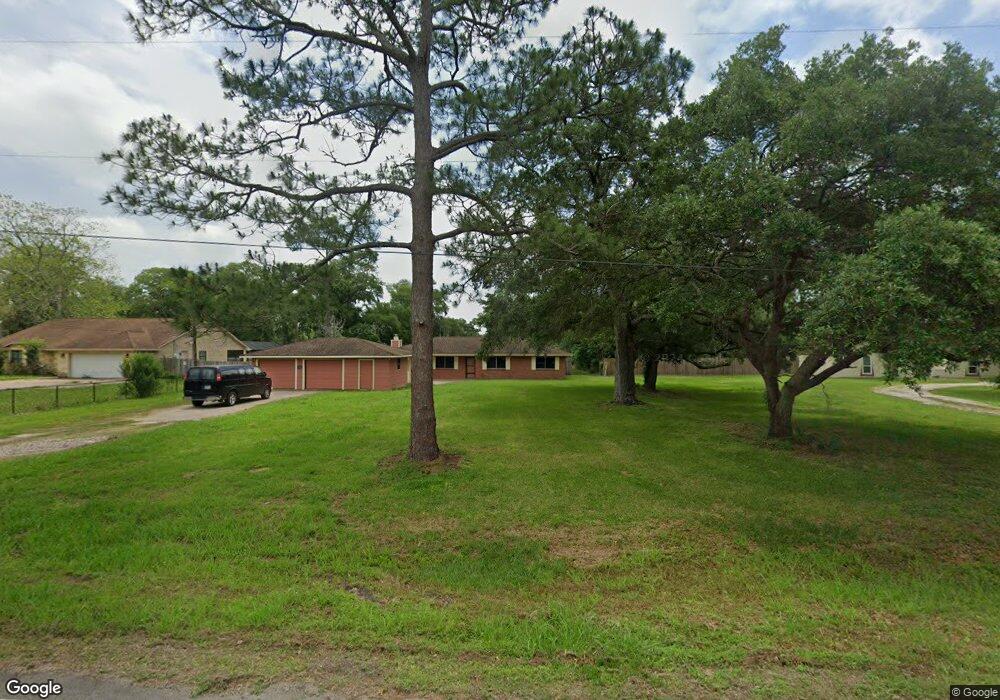
505 County Road 912a Brazoria, TX 77422
Estimated Value: $219,177 - $244,000
--
Bed
2
Baths
1,536
Sq Ft
$152/Sq Ft
Est. Value
About This Home
This home is located at 505 County Road 912a, Brazoria, TX 77422 and is currently estimated at $233,726, approximately $152 per square foot. 505 County Road 912a is a home located in Brazoria County.
Ownership History
Date
Name
Owned For
Owner Type
Purchase Details
Closed on
Oct 13, 2010
Sold by
Powell William H
Bought by
Jordan Lamar
Current Estimated Value
Purchase Details
Closed on
Oct 1, 2010
Sold by
Poulsen Tracey
Bought by
Powell William H
Purchase Details
Closed on
Dec 6, 1996
Sold by
Federal National Mortgage Association
Bought by
Powell William H
Home Financials for this Owner
Home Financials are based on the most recent Mortgage that was taken out on this home.
Original Mortgage
$39,900
Interest Rate
7.77%
Purchase Details
Closed on
Oct 1, 1996
Sold by
Cornett Clay A
Bought by
Federal National Mortgage Association
Create a Home Valuation Report for This Property
The Home Valuation Report is an in-depth analysis detailing your home's value as well as a comparison with similar homes in the area
Home Values in the Area
Average Home Value in this Area
Purchase History
| Date | Buyer | Sale Price | Title Company |
|---|---|---|---|
| Jordan Lamar | -- | Great American Title | |
| Powell William H | -- | Great American Title | |
| Powell William H | -- | -- | |
| Federal National Mortgage Association | $45,000 | -- |
Source: Public Records
Mortgage History
| Date | Status | Borrower | Loan Amount |
|---|---|---|---|
| Previous Owner | Powell William H | $39,900 |
Source: Public Records
Tax History Compared to Growth
Tax History
| Year | Tax Paid | Tax Assessment Tax Assessment Total Assessment is a certain percentage of the fair market value that is determined by local assessors to be the total taxable value of land and additions on the property. | Land | Improvement |
|---|---|---|---|---|
| 2025 | $1,992 | $166,050 | $28,270 | $137,780 |
| 2023 | $1,992 | $132,880 | $39,250 | $93,630 |
| 2022 | $2,450 | $85,500 | $23,520 | $61,980 |
| 2021 | $1,428 | $85,200 | $14,000 | $71,200 |
| 2020 | $1,591 | $88,730 | $23,800 | $64,930 |
| 2019 | $1,465 | $80,000 | $25,520 | $54,480 |
| 2018 | $1,325 | $71,820 | $12,460 | $59,360 |
| 2017 | $1,339 | $71,820 | $12,460 | $59,360 |
| 2016 | $1,339 | $71,820 | $12,460 | $59,360 |
| 2015 | $1,133 | $65,000 | $10,380 | $54,620 |
| 2014 | $1,133 | $59,230 | $4,990 | $54,240 |
Source: Public Records
Map
Nearby Homes
- 338 County Road 912a
- 10186 County Road 400
- 307 Avenue G
- 441 County Road 849
- 519 County Road 849
- 145
- 523 Lazy Ln
- 549 E New York St
- 706 E New York St
- 409 Carlton St
- 4773 County Road 652
- 232 Magnolia St
- 0 Pecan Dr
- 229 Yaupon Dr
- 230 E New York St
- 401 E Texas St
- 310 E Texas St
- 1208 S Brooks St
- 34654 Fm 521 Rd
- 8922 Fm 521 Rd
- 435 County Road 912a
- 535 County Road 912a
- 432 County Road 912a
- 411 County Road 912a
- 411 Cr 912a
- 550 County Road 912a
- 550 County Road 912a
- 550 County Road 912a
- 550 Cr 912a
- 327 County Road 912a
- 327 Cr 912a
- 332 County Road 912a
- 322 County Road 912a
- 319 County Road 912a
- 319 Cr 912a
- 433 County Road 912
- 433 Cr 912
- 409 County Road 912
- 427 County Road 912
- 409 Cr 912