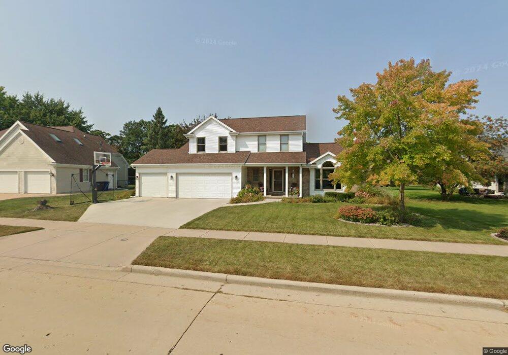
505 Fox Fire Dr Oshkosh, WI 54904
Estimated Value: $393,000 - $441,000
4
Beds
3
Baths
2,148
Sq Ft
$193/Sq Ft
Est. Value
About This Home
This home is located at 505 Fox Fire Dr, Oshkosh, WI 54904 and is currently estimated at $414,406, approximately $192 per square foot. 505 Fox Fire Dr is a home located in Winnebago County with nearby schools including Traeger Elementary School, Traeger Middle School, and West High School.
Ownership History
Date
Name
Owned For
Owner Type
Purchase Details
Closed on
May 9, 2022
Sold by
Dana Keas Revocable Trust
Bought by
Norman Jason B and Norman Fawnda J
Current Estimated Value
Purchase Details
Closed on
Mar 6, 2020
Sold by
Keas Karl R
Bought by
T Karl
Purchase Details
Closed on
Apr 27, 2007
Sold by
Wegner Mark D and Schuster Mary F
Bought by
Keas Karl R
Home Financials for this Owner
Home Financials are based on the most recent Mortgage that was taken out on this home.
Original Mortgage
$22,900
Interest Rate
6.18%
Mortgage Type
Purchase Money Mortgage
Create a Home Valuation Report for This Property
The Home Valuation Report is an in-depth analysis detailing your home's value as well as a comparison with similar homes in the area
Home Values in the Area
Average Home Value in this Area
Purchase History
| Date | Buyer | Sale Price | Title Company |
|---|---|---|---|
| Norman Jason B | $350,000 | None Listed On Document | |
| T Karl | -- | None Listed On Document | |
| T Karl | -- | None Listed On Document | |
| Keas Karl R | $229,000 | None Available |
Source: Public Records
Mortgage History
| Date | Status | Borrower | Loan Amount |
|---|---|---|---|
| Previous Owner | Keas Karl R | $22,900 |
Source: Public Records
Tax History Compared to Growth
Tax History
| Year | Tax Paid | Tax Assessment Tax Assessment Total Assessment is a certain percentage of the fair market value that is determined by local assessors to be the total taxable value of land and additions on the property. | Land | Improvement |
|---|---|---|---|---|
| 2024 | $6,701 | $368,400 | $45,600 | $322,800 |
| 2023 | $6,481 | $229,500 | $35,100 | $194,400 |
| 2022 | $6,064 | $216,500 | $35,100 | $181,400 |
| 2021 | $5,697 | $216,500 | $35,100 | $181,400 |
| 2020 | $5,441 | $216,500 | $35,100 | $181,400 |
| 2019 | $5,241 | $216,500 | $35,100 | $181,400 |
| 2018 | $5,178 | $216,500 | $35,100 | $181,400 |
| 2017 | $5,284 | $216,500 | $35,100 | $181,400 |
| 2016 | $5,615 | $225,500 | $35,100 | $190,400 |
| 2015 | $5,467 | $225,500 | $35,100 | $190,400 |
| 2014 | $5,513 | $225,500 | $35,100 | $190,400 |
| 2013 | $5,528 | $225,500 | $35,100 | $190,400 |
Source: Public Records
Map
Nearby Homes
- 0 Quail Run Dr Unit 50290414
- 0 Quail Run Dr Unit 50290413
- 0 Quail Run Dr Unit 50290411
- 0 Quail Run Dr Unit 50290410
- 3140 Bailey Ct
- 1217 Wheatfield Way
- 3009 Wylde Oak Ct
- 352 Wyldewood Dr
- 1175 Maricopa Dr
- 2470 Arcadia Ave
- 2575 Gaslight Ct
- 2450 Arcadia Ave
- 2534 Village Ln Unit D
- 845 Greenfield Trail
- 2455 Blake Ct
- 2515 Village Ln
- 2505 Village Ln
- 1325 S Westhaven Dr
- 2450 Noel Ct
- 468 Oak Crest Dr
- 525 Fox Fire Dr
- 500 Fox Fire Dr
- 450 Fox Fire Dr
- 2955 W Pheasant Ct
- 550 Fox Fire Dr
- 2965 W Pheasant Ct
- 575 Fox Fire Dr
- 2950 W Pheasant Ct
- 400 Fox Fire Dr
- 600 Fox Fire Dr
- 2925 E Pheasant Ct
- 2975 W Pheasant Ct
- 625 Fox Fire Dr
- 2970 W Pheasant Ct
- 650 Fox Fire Dr
- 380 Fox Fire Dr
- 375 Fox Fire Dr
- 2960 W Pheasant Ct
- 325 Fox Fire Dr
- 2915 E Pheasant Ct