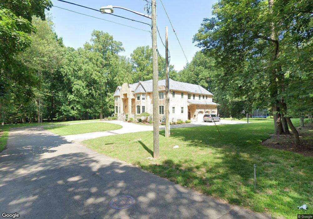
505 Harland Ave Haworth, NJ 07641
Estimated Value: $2,167,276 - $3,024,000
--
Bed
--
Bath
5,864
Sq Ft
$449/Sq Ft
Est. Value
About This Home
This home is located at 505 Harland Ave, Haworth, NJ 07641 and is currently estimated at $2,635,069, approximately $449 per square foot. 505 Harland Ave is a home located in Bergen County with nearby schools including Haworth Elementary School, Northern Valley Regional High School at Demarest, and St. Joseph School.
Ownership History
Date
Name
Owned For
Owner Type
Purchase Details
Closed on
Mar 12, 2012
Sold by
Sprague Jean B and Davies Lynn
Bought by
Ceylan John and Ceylan Samantha
Current Estimated Value
Purchase Details
Closed on
Jul 16, 2007
Sold by
Sprague Irene and Sprague Philip
Bought by
Sprague Philip
Purchase Details
Closed on
Apr 8, 1999
Sold by
Sprague Philip and Sprague Irene M
Bought by
Sprague Philip
Create a Home Valuation Report for This Property
The Home Valuation Report is an in-depth analysis detailing your home's value as well as a comparison with similar homes in the area
Home Values in the Area
Average Home Value in this Area
Purchase History
| Date | Buyer | Sale Price | Title Company |
|---|---|---|---|
| Ceylan John | $535,000 | -- | |
| Sprague Philip | -- | -- | |
| Sprague Philip | -- | -- | |
| Sprague Philip | -- | -- |
Source: Public Records
Tax History Compared to Growth
Tax History
| Year | Tax Paid | Tax Assessment Tax Assessment Total Assessment is a certain percentage of the fair market value that is determined by local assessors to be the total taxable value of land and additions on the property. | Land | Improvement |
|---|---|---|---|---|
| 2025 | $42,432 | $1,372,300 | $351,000 | $1,021,300 |
| 2024 | $41,745 | $1,372,300 | $351,000 | $1,021,300 |
| 2023 | $40,881 | $1,372,300 | $351,000 | $1,021,300 |
| 2022 | $40,881 | $1,372,300 | $351,000 | $1,021,300 |
| 2021 | $40,401 | $1,372,300 | $351,000 | $1,021,300 |
| 2020 | $40,057 | $1,372,300 | $351,000 | $1,021,300 |
| 2019 | $39,948 | $1,372,300 | $351,000 | $1,021,300 |
| 2018 | $39,344 | $1,372,300 | $351,000 | $1,021,300 |
| 2017 | $39,563 | $1,372,300 | $351,000 | $1,021,300 |
| 2016 | $39,934 | $1,372,300 | $351,000 | $1,021,300 |
| 2015 | $38,356 | $1,372,300 | $351,000 | $1,021,300 |
| 2014 | $41,368 | $351,000 | $351,000 | $0 |
Source: Public Records
Map
Nearby Homes
- 204 Brook St
- 490 Harland Ave
- 501 Haworth Ave
- 511 Haworth Ave
- 450 Harland Ave
- 481 Haworth Ave
- 479 Haworth Ave
- 523 Haworth Ave
- 471 Haworth Ave
- 207 Haworth Dr
- 202 Myrtle St
- 539 Haworth Ave
- 459 Haworth Ave
- 541 Haworth Ave
- 500 Haworth Ave
- 510 Haworth Ave
- 550 Harland Ave
- 484 Haworth Ave
- 215 Myrtle St
- 474 Haworth Ave