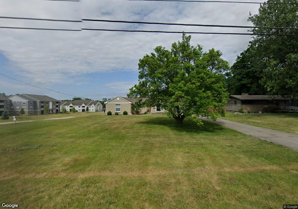
505 Maynard Ave NW Grand Rapids, MI 49504
Westside Connection NeighborhoodEstimated Value: $333,000 - $344,000
3
Beds
1
Bath
1,320
Sq Ft
$256/Sq Ft
Est. Value
About This Home
This home is located at 505 Maynard Ave NW, Grand Rapids, MI 49504 and is currently estimated at $338,457, approximately $256 per square foot. 505 Maynard Ave NW is a home located in Kent County with nearby schools including Shawmut Hills School, Westwood Middle School, and Union High School.
Ownership History
Date
Name
Owned For
Owner Type
Purchase Details
Closed on
Jan 11, 2017
Sold by
Dodge John and Dodge Suzanne
Bought by
Lmbbp Llc
Current Estimated Value
Purchase Details
Closed on
Aug 22, 2013
Sold by
Slaughter Clarence S
Bought by
Dodge John
Purchase Details
Closed on
Jan 11, 2013
Sold by
Potts William F and Murphy Michael D
Bought by
Murphy Michael D and William F Potts Trust #1
Purchase Details
Closed on
Apr 23, 1993
Sold by
Potts Alma M
Bought by
Dodge John
Create a Home Valuation Report for This Property
The Home Valuation Report is an in-depth analysis detailing your home's value as well as a comparison with similar homes in the area
Home Values in the Area
Average Home Value in this Area
Purchase History
| Date | Buyer | Sale Price | Title Company |
|---|---|---|---|
| Lmbbp Llc | -- | Sun Title Agency Ofmichigan | |
| Dodge John | -- | None Available | |
| Murphy Michael D | -- | None Available | |
| Dodge John | -- | -- |
Source: Public Records
Tax History Compared to Growth
Tax History
| Year | Tax Paid | Tax Assessment Tax Assessment Total Assessment is a certain percentage of the fair market value that is determined by local assessors to be the total taxable value of land and additions on the property. | Land | Improvement |
|---|---|---|---|---|
| 2025 | $4,992 | $158,400 | $0 | $0 |
| 2024 | $4,992 | $142,200 | $0 | $0 |
| 2023 | $4,848 | $115,300 | $0 | $0 |
| 2022 | $4,608 | $103,400 | $0 | $0 |
| 2021 | $4,489 | $96,300 | $0 | $0 |
| 2020 | $4,339 | $90,900 | $0 | $0 |
| 2019 | $4,443 | $85,500 | $0 | $0 |
| 2018 | $4,307 | $81,300 | $0 | $0 |
| 2017 | $3,374 | $71,900 | $0 | $0 |
| 2016 | $3,391 | $66,600 | $0 | $0 |
| 2015 | $3,231 | $66,600 | $0 | $0 |
| 2013 | -- | $62,700 | $0 | $0 |
Source: Public Records
Map
Nearby Homes
- 775 Maynard NW
- 3020 Burritt St NW
- 2957 Burritt St NW
- 709 Cashew Ct NW
- 701 Kommer Ct NW
- 658 Clover Ridge Ave NW
- 2883 Burritt St NW
- 621 Waterford Village Dr
- 548 Lincoln Lawns Dr NW
- The Austen Plan at Waterford Village
- The Poppy Plan at Waterford Village
- The Oakwood Plan at Waterford Village
- The McKinley Plan at Waterford Village
- The Whitney Plan at Waterford Village
- The Harper Plan at Waterford Village
- The Breckenridge Plan at Waterford Village
- The Sierra Plan at Waterford Village
- The Yukon Plan at Waterford Village
- The Dickenson Plan at Waterford Village
- 3518 Sunrise Ln NW
- 513 Maynard Ave NW
- 449 Maynard Ave NW
- 523 Maynard Ave NW
- 533 Maynard Ave NW
- 439 Maynard Ave NW
- 429 Maynard Ave NW
- 545 Maynard Ave NW
- 3233 Lake Michigan Dr NW
- 3251 Lake Michigan Dr NW
- 530 Bayberry Pointe Dr NW
- 555 Maynard Ave NW
- 3215 Lake Michigan Dr NW
- 755 Maynard NW
- 563 Maynard Ave NW
- 560 Maynard Ave NW
- 3281 Lake Michigan Dr NW
- 607 Maynard Ave NW
- 3112 Burritt St NW
- 5405 Lake Michigan Dr NW
- 526 Maynard Ave NW