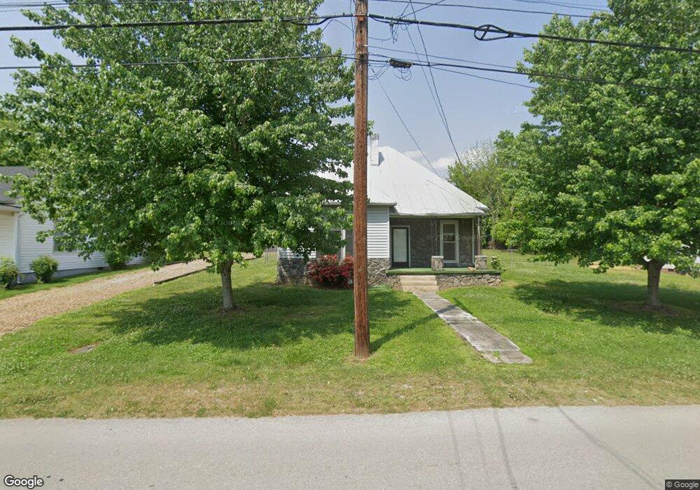
505 N High St Franklin, KY 42134
Estimated Value: $89,000 - $163,000
2
Beds
1
Bath
1,024
Sq Ft
$122/Sq Ft
Est. Value
About This Home
This home is located at 505 N High St, Franklin, KY 42134 and is currently estimated at $125,121, approximately $122 per square foot. 505 N High St is a home located in Simpson County with nearby schools including Franklin Elementary School, Lincoln Elementary School, and Simpson Elementary School.
Ownership History
Date
Name
Owned For
Owner Type
Purchase Details
Closed on
Oct 27, 2022
Sold by
Spears Eric Wayne and Shelley Groves
Bought by
Gooch Pamela
Current Estimated Value
Home Financials for this Owner
Home Financials are based on the most recent Mortgage that was taken out on this home.
Original Mortgage
$52,000
Outstanding Balance
$20,205
Interest Rate
6.7%
Mortgage Type
New Conventional
Estimated Equity
$104,916
Purchase Details
Closed on
Jan 18, 2022
Sold by
Lynn Dinkens Ricky and Lynn Darlene Brenda
Bought by
Spears Eric Wayne and Spears Shelley Groves
Create a Home Valuation Report for This Property
The Home Valuation Report is an in-depth analysis detailing your home's value as well as a comparison with similar homes in the area
Home Values in the Area
Average Home Value in this Area
Purchase History
| Date | Buyer | Sale Price | Title Company |
|---|---|---|---|
| Gooch Pamela | $65,000 | -- | |
| Spears Eric Wayne | $55,000 | Leach And Cummins |
Source: Public Records
Mortgage History
| Date | Status | Borrower | Loan Amount |
|---|---|---|---|
| Open | Gooch Pamela | $52,000 |
Source: Public Records
Tax History
| Year | Tax Paid | Tax Assessment Tax Assessment Total Assessment is a certain percentage of the fair market value that is determined by local assessors to be the total taxable value of land and additions on the property. | Land | Improvement |
|---|---|---|---|---|
| 2025 | $570 | $65,000 | $0 | $0 |
| 2024 | $575 | $65,000 | $0 | $0 |
| 2023 | $605 | $65,000 | $0 | $0 |
| 2022 | $481 | $55,000 | $0 | $0 |
| 2021 | $477 | $55,000 | $0 | $0 |
| 2020 | $482 | $55,000 | $0 | $0 |
| 2019 | $429 | $48,000 | $0 | $0 |
| 2018 | $427 | $48,000 | $0 | $0 |
| 2017 | $418 | $48,000 | $0 | $0 |
| 2016 | $414 | $48,000 | $0 | $0 |
| 2015 | -- | $48,000 | $0 | $0 |
| 2013 | -- | $48,000 | $0 | $0 |
Source: Public Records
Map
Nearby Homes
- 518 Brevard St
- 419 N Main St
- 611 N High St
- 306 John J Johnson Ave
- 301 N College St
- 504 Jefferson St
- 625 Brevard St
- 528 W Washington St
- 208 Morgantown Rd
- 503 Jackson St
- 0 Jackson St Unit RA20260515
- 0 Jackson St Unit RA20255959
- 305 Mcgoodwin Ave
- 319 Sunset Cir
- 301 W Cedar St
- 0 Avalon Ct
- 306 W Madison St
- 309 Mcgoodwin Ave
- 311 W Madison St
- 628 Jefferson St
Your Personal Tour Guide
Ask me questions while you tour the home.