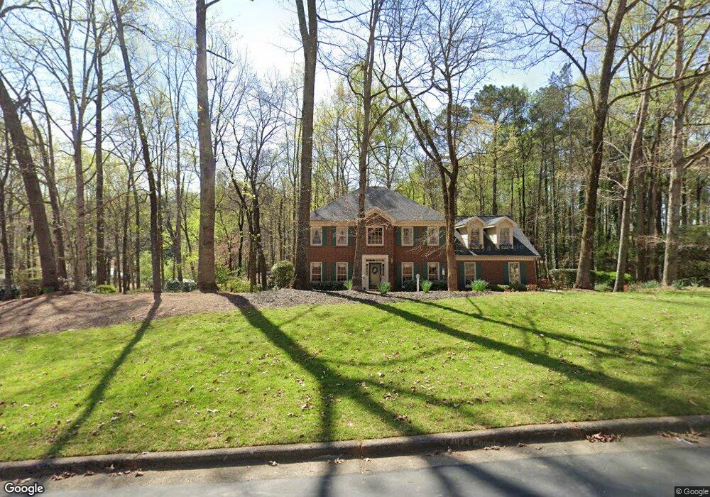
505 N Link Rd Unit 2 Alpharetta, GA 30022
Estimated Value: $716,821 - $880,000
4
Beds
4
Baths
2,766
Sq Ft
$281/Sq Ft
Est. Value
About This Home
This home is located at 505 N Link Rd Unit 2, Alpharetta, GA 30022 and is currently estimated at $776,705, approximately $280 per square foot. 505 N Link Rd Unit 2 is a home located in Fulton County with nearby schools including State Bridge Crossing Elementary School, Autrey Mill Middle School, and Johns Creek High School.
Ownership History
Date
Name
Owned For
Owner Type
Purchase Details
Closed on
Nov 4, 2011
Sold by
Russo Lisa D
Bought by
Savastano Anthony and Savastano Diana R
Current Estimated Value
Purchase Details
Closed on
Mar 24, 2005
Sold by
Savastano Anthony and Savastano Diana
Bought by
Savastano Anthony
Home Financials for this Owner
Home Financials are based on the most recent Mortgage that was taken out on this home.
Original Mortgage
$170,580
Interest Rate
5.66%
Mortgage Type
New Conventional
Purchase Details
Closed on
Mar 9, 1998
Sold by
Bruno Edwin G and Bruno Norma J
Bought by
Sarastano Anthony and Sarastano Diana R
Home Financials for this Owner
Home Financials are based on the most recent Mortgage that was taken out on this home.
Original Mortgage
$135,600
Interest Rate
6.99%
Mortgage Type
New Conventional
Create a Home Valuation Report for This Property
The Home Valuation Report is an in-depth analysis detailing your home's value as well as a comparison with similar homes in the area
Home Values in the Area
Average Home Value in this Area
Purchase History
| Date | Buyer | Sale Price | Title Company |
|---|---|---|---|
| Savastano Anthony | $1,000 | -- | |
| Savastano Anthony | -- | -- | |
| Sarastano Anthony | $215,000 | -- |
Source: Public Records
Mortgage History
| Date | Status | Borrower | Loan Amount |
|---|---|---|---|
| Previous Owner | Savastano Anthony | $170,580 | |
| Previous Owner | Sarastano Anthony | $135,600 |
Source: Public Records
Tax History Compared to Growth
Tax History
| Year | Tax Paid | Tax Assessment Tax Assessment Total Assessment is a certain percentage of the fair market value that is determined by local assessors to be the total taxable value of land and additions on the property. | Land | Improvement |
|---|---|---|---|---|
| 2025 | $2,636 | $293,360 | $115,960 | $177,400 |
| 2023 | $4,849 | $171,800 | $37,080 | $134,720 |
| 2022 | $2,856 | $171,800 | $37,080 | $134,720 |
| 2021 | $2,851 | $171,920 | $36,680 | $135,240 |
| 2020 | $2,851 | $169,880 | $36,240 | $133,640 |
| 2019 | $65 | $166,880 | $35,600 | $131,280 |
| 2018 | $2,804 | $163,000 | $34,800 | $128,200 |
| 2017 | $2,799 | $156,720 | $33,440 | $123,280 |
| 2016 | $2,712 | $156,720 | $33,440 | $123,280 |
| 2015 | $2,715 | $156,720 | $33,440 | $123,280 |
| 2014 | $2,715 | $156,720 | $33,440 | $123,280 |
Source: Public Records
Map
Nearby Homes
- 455 Oak Laurel Ct
- 720 Buttercup Trace
- 835 Buttercup Trace
- 9950 Farmbrook Ln
- 170 Autry Trail
- 100 Nature Mill Ct Unit 8
- 10265 Minion Ct Unit 27
- 10750 Avian Dr
- 10281 Midway Ave
- 10296 Quadrant Ct Unit 76
- 515 Avian Ct
- 10325 Oxford Mill Cir Unit 1
- 5185 Buice Rd
- 750 Gates Ln
- 165 Morton Walk Dr Unit 1
- 350 Waters Bend Way
- 513 Camden Hall Dr
- 230 Skidaway Ct
- 230 Pinebridge Ct
- 410 Link Rd Unit 2
- N N Link Rd
- N N Link Rd Unit 3
- 0 Link Rd Unit 8778939
- 0 Link Rd Unit 8697860
- 0 Link Rd Unit 8243991
- 0 Link Rd Unit 8082105
- 0 Link Rd Unit 7537429
- 510 N Link Rd
- 495 N Link Rd Unit 3
- 495 N Link Rd
- 415 Link Rd
- 9905 Buice Rd
- 420 Link Rd
- 405 Link Rd
- 500 N Link Rd Unit 1
- 425 Link Rd
- 425 Link Rd
- 9901 Buice Rd
- 9915 Buice Rd