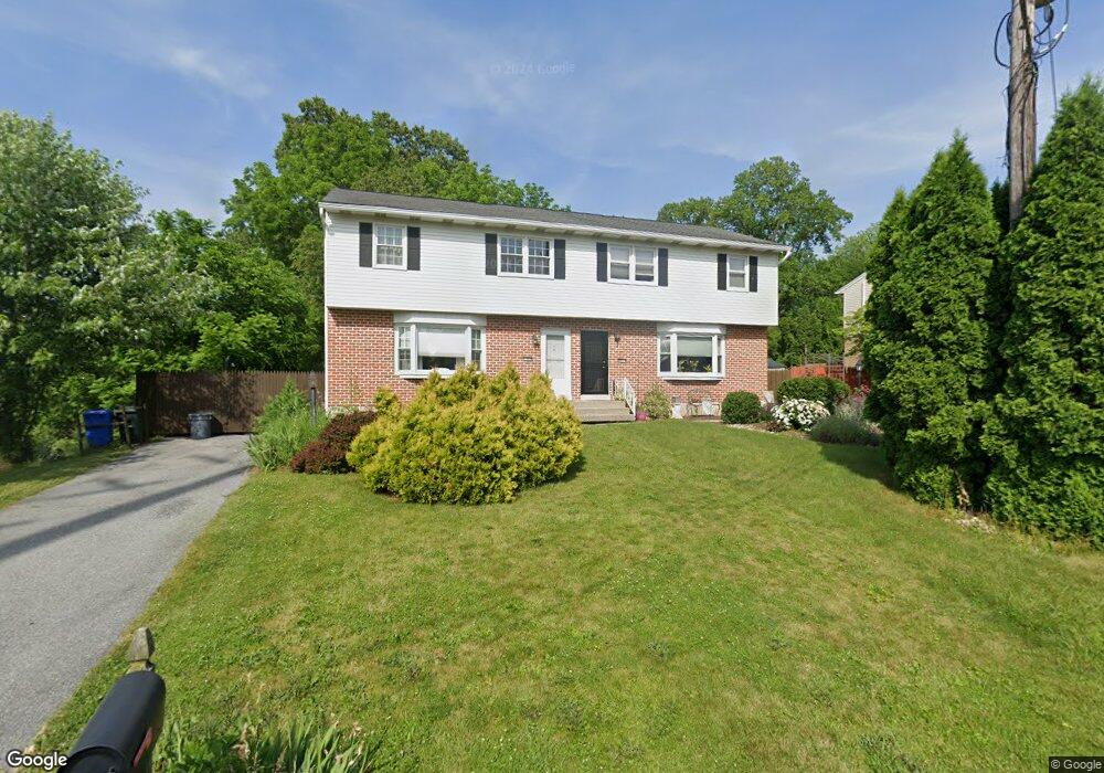
505 S 10th St Emmaus, PA 18049
Estimated Value: $334,837 - $346,000
3
Beds
2
Baths
1,392
Sq Ft
$246/Sq Ft
Est. Value
About This Home
This home is located at 505 S 10th St, Emmaus, PA 18049 and is currently estimated at $342,709, approximately $246 per square foot. 505 S 10th St is a home located in Lehigh County with nearby schools including Lincoln Elementary School, Lower Macungie Middle School, and Emmaus High School.
Ownership History
Date
Name
Owned For
Owner Type
Purchase Details
Closed on
Oct 15, 2004
Sold by
Harbits Curt M and Harbits Michele M
Bought by
Harbits Curt M
Current Estimated Value
Home Financials for this Owner
Home Financials are based on the most recent Mortgage that was taken out on this home.
Original Mortgage
$88,000
Outstanding Balance
$43,816
Interest Rate
5.85%
Mortgage Type
Stand Alone Refi Refinance Of Original Loan
Estimated Equity
$298,894
Purchase Details
Closed on
Jul 25, 2001
Sold by
Harbits Curt M and Harbits Michele M
Bought by
Harbits Curt M and Harbits Michele M
Purchase Details
Closed on
Dec 27, 1994
Sold by
Delaney John M and Deborah Rosbaugh
Bought by
Harbits Curt M and Johnson Michele M
Purchase Details
Closed on
Jun 27, 1987
Sold by
Lauer Victor R and Lauer Linda D
Bought by
Delaney John M and Deborah Rosbaugh
Purchase Details
Closed on
Sep 9, 1985
Bought by
Lauer Victor R and Lauer Linda D
Create a Home Valuation Report for This Property
The Home Valuation Report is an in-depth analysis detailing your home's value as well as a comparison with similar homes in the area
Home Values in the Area
Average Home Value in this Area
Purchase History
| Date | Buyer | Sale Price | Title Company |
|---|---|---|---|
| Harbits Curt M | -- | First American Title Ins Co | |
| Harbits Curt M | -- | -- | |
| Harbits Curt M | $89,900 | -- | |
| Delaney John M | $79,900 | -- | |
| Lauer Victor R | -- | -- |
Source: Public Records
Mortgage History
| Date | Status | Borrower | Loan Amount |
|---|---|---|---|
| Open | Harbits Curt M | $88,000 |
Source: Public Records
Tax History Compared to Growth
Tax History
| Year | Tax Paid | Tax Assessment Tax Assessment Total Assessment is a certain percentage of the fair market value that is determined by local assessors to be the total taxable value of land and additions on the property. | Land | Improvement |
|---|---|---|---|---|
| 2025 | $5,932 | $168,400 | $44,500 | $123,900 |
| 2024 | $5,434 | $168,400 | $44,500 | $123,900 |
| 2023 | $5,328 | $168,400 | $44,500 | $123,900 |
| 2022 | $5,152 | $168,400 | $123,900 | $44,500 |
| 2021 | $5,023 | $168,400 | $44,500 | $123,900 |
| 2020 | $4,980 | $168,400 | $44,500 | $123,900 |
| 2019 | $4,847 | $168,400 | $44,500 | $123,900 |
| 2018 | $4,664 | $168,400 | $44,500 | $123,900 |
| 2017 | $4,520 | $168,400 | $44,500 | $123,900 |
| 2016 | -- | $168,400 | $44,500 | $123,900 |
| 2015 | -- | $168,400 | $44,500 | $123,900 |
| 2014 | -- | $168,400 | $44,500 | $123,900 |
Source: Public Records
Map
Nearby Homes
- 339 Delong Ave Unit 343
- 97 Chestnut Hill Rd
- 659 Broad St
- 618 Broad St
- 521 Wood St
- 657 Walnut St
- 569 Chestnut St Unit 571
- 4109 Eveningstar Rd
- 3430 Gentlewind Way Unit IC 109
- 543 Long St
- 4088 Eveningstar Rd
- 120 N 2nd St
- 118 N 2nd St
- 4160 Newport Dr
- 3623 Daylily Dr
- 3810 Allen St
- 3989 Mink Rd
- 3703 Samantha Ln Unit Lot 70
- 3736 Samantha Ln Unit Lot 7
- 3748 Samantha Ln
- 507 S 10th St
- 790 Furnace St
- 515 S 10th St
- 517 S 10th St
- 525 S 10th St
- 1040 S 10th St
- 527 S 10th St
- 1018 S 10th St
- 754 Furnace St
- 750 Furnace St
- 748 Furnace St
- 748 1/2 Furnace St
- 746 Furnace St
- 734 Furnace St
- 1034 S 10th St
- 728 Furnace St Unit 730
- 1044 S 10th St
- 726 Furnace St
- 1028 S 10th St
- 1046 S 10th St