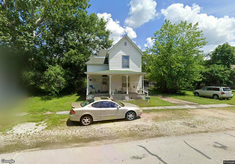
505 S Roney St Unit 1 Carl Junction, MO 64834
Estimated Value: $159,000 - $183,612
5
Beds
2
Baths
2,200
Sq Ft
$77/Sq Ft
Est. Value
About This Home
This home is located at 505 S Roney St Unit 1, Carl Junction, MO 64834 and is currently estimated at $170,403, approximately $77 per square foot. 505 S Roney St Unit 1 is a home located in Jasper County with nearby schools including Carl Junction Primary School (K-1), Carl Junction Intermediate School, and Carl Junction Primary School (2-3).
Ownership History
Date
Name
Owned For
Owner Type
Purchase Details
Closed on
Jan 30, 2008
Sold by
The Bank Of New York Trust Co Na
Bought by
Bittner Properties Llc
Current Estimated Value
Home Financials for this Owner
Home Financials are based on the most recent Mortgage that was taken out on this home.
Original Mortgage
$62,574
Interest Rate
6.15%
Mortgage Type
Unknown
Purchase Details
Closed on
Jul 11, 2007
Sold by
Armstrong Jennifer D and Armstrong William M
Bought by
The Bank Of New York Trust Co Na and Jpmorgan Chase Bank Na
Purchase Details
Closed on
Sep 22, 2004
Sold by
Hobbs Georgia A and Hobbs Leslie C
Bought by
Armstrong William M and Armstrong Jennifer D
Home Financials for this Owner
Home Financials are based on the most recent Mortgage that was taken out on this home.
Original Mortgage
$68,590
Interest Rate
8.5%
Mortgage Type
Unknown
Create a Home Valuation Report for This Property
The Home Valuation Report is an in-depth analysis detailing your home's value as well as a comparison with similar homes in the area
Home Values in the Area
Average Home Value in this Area
Purchase History
| Date | Buyer | Sale Price | Title Company |
|---|---|---|---|
| Bittner Properties Llc | -- | Fatco | |
| The Bank Of New York Trust Co Na | $64,175 | None Available | |
| Armstrong William M | -- | -- |
Source: Public Records
Mortgage History
| Date | Status | Borrower | Loan Amount |
|---|---|---|---|
| Closed | Bittner Properties Llc | $62,574 | |
| Previous Owner | Armstrong William M | $68,590 |
Source: Public Records
Tax History Compared to Growth
Tax History
| Year | Tax Paid | Tax Assessment Tax Assessment Total Assessment is a certain percentage of the fair market value that is determined by local assessors to be the total taxable value of land and additions on the property. | Land | Improvement |
|---|---|---|---|---|
| 2025 | $661 | $13,280 | $1,310 | $11,970 |
| 2024 | $665 | $11,300 | $810 | $10,490 |
| 2023 | $665 | $11,300 | $810 | $10,490 |
| 2022 | $665 | $11,270 | $810 | $10,460 |
| 2021 | $571 | $11,270 | $810 | $10,460 |
| 2020 | $534 | $10,370 | $810 | $9,560 |
| 2019 | $507 | $10,370 | $810 | $9,560 |
| 2018 | $496 | $10,160 | $0 | $0 |
| 2017 | $497 | $10,160 | $0 | $0 |
| 2016 | $496 | $10,240 | $0 | $0 |
| 2015 | $486 | $10,240 | $0 | $0 |
| 2014 | $486 | $10,240 | $0 | $0 |
Source: Public Records
Map
Nearby Homes
- TBD S Roney St
- 311 S Roney St
- 114 W Walton Ave
- 409 Gault St
- 409 W Gault St
- 408 W Walton Ave
- 505 W Walton Ave
- 106 S Roney St
- 205 Allen St
- 802 Aberdeen Ave
- 503 Valley View
- 105 Summit St
- 819 Delaney Dr
- 815 Delaney Dr
- 720 Sheridan Ave
- Tract 3 Prairie Ln
- Tract 2 Prairie Ln
- Tract 1 Prairie Ln
- Tract 4 Prairie Ln
- 711 Prairie Ln
- 505 S Roney St
- 509 S Roney St
- 501 S Roney St
- 511 S Roney St
- 508 S Cowgill St
- 515 S Roney St
- 512 S Cowgill St
- 512 S Roney St
- 512 S Roney St
- Xx S Roney St
- 502 S Cowgill St
- 504 S Roney St
- 502 S Roney St
- 502 S Roney St Unit 1
- 516 S Cowgill St
- 516 S Roney St
- 406 S Cowgill St
- 601 S Roney St
- 206 Lewis St
- 401 S Roney St