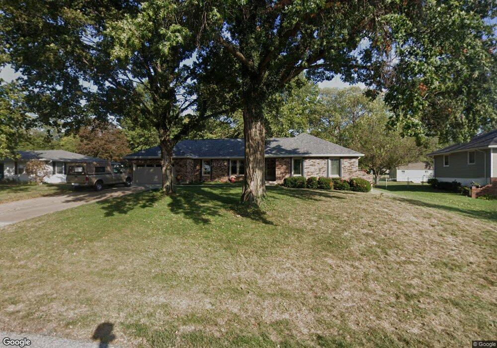
505 SW Maple Ln Oak Grove, MO 64075
Estimated Value: $279,000 - $399,000
3
Beds
4
Baths
1,965
Sq Ft
$163/Sq Ft
Est. Value
About This Home
This home is located at 505 SW Maple Ln, Oak Grove, MO 64075 and is currently estimated at $320,223, approximately $162 per square foot. 505 SW Maple Ln is a home located in Jackson County with nearby schools including Oak Grove Primary School, Oak Grove Elementary School, and Oak Grove Middle School.
Ownership History
Date
Name
Owned For
Owner Type
Purchase Details
Closed on
Sep 20, 1995
Sold by
Davis Leanne M and Davis Emmitt L
Bought by
Prescott Frank C and Prescott Pamela J
Current Estimated Value
Home Financials for this Owner
Home Financials are based on the most recent Mortgage that was taken out on this home.
Original Mortgage
$70,000
Interest Rate
7.77%
Mortgage Type
Purchase Money Mortgage
Create a Home Valuation Report for This Property
The Home Valuation Report is an in-depth analysis detailing your home's value as well as a comparison with similar homes in the area
Home Values in the Area
Average Home Value in this Area
Purchase History
| Date | Buyer | Sale Price | Title Company |
|---|---|---|---|
| Prescott Frank C | -- | -- |
Source: Public Records
Mortgage History
| Date | Status | Borrower | Loan Amount |
|---|---|---|---|
| Closed | Prescott Frank C | $70,000 |
Source: Public Records
Tax History Compared to Growth
Tax History
| Year | Tax Paid | Tax Assessment Tax Assessment Total Assessment is a certain percentage of the fair market value that is determined by local assessors to be the total taxable value of land and additions on the property. | Land | Improvement |
|---|---|---|---|---|
| 2025 | $2,952 | $43,700 | $5,284 | $38,416 |
| 2024 | $2,952 | $38,000 | $6,650 | $31,350 |
| 2023 | $2,924 | $38,000 | $6,650 | $31,350 |
| 2022 | $2,867 | $34,010 | $7,130 | $26,880 |
| 2021 | $2,805 | $34,010 | $7,130 | $26,880 |
| 2020 | $2,734 | $32,300 | $7,130 | $25,170 |
| 2019 | $3,367 | $41,806 | $7,130 | $34,676 |
| 2018 | $2,792 | $36,385 | $6,206 | $30,179 |
| 2017 | $2,586 | $36,385 | $6,206 | $30,179 |
| 2016 | $2,586 | $32,661 | $4,313 | $28,348 |
| 2014 | $2,499 | $31,479 | $4,307 | $27,172 |
Source: Public Records
Map
Nearby Homes
- TBD SW 5th St
- 704 SW Clinton St
- 1212 SW 5th St
- 1705 Locust St
- 400 SW Powell Dr
- 1001 SW Powell Dr
- 1106 SW 10th St
- 1312 SW Clinton St
- Lot 19 TBD SE Holstein Dr
- TBD N Broadway St
- 708 SW Whitetail Dr
- 113 N Austin St
- 1201 SW 4th St
- 508 SE 12th St
- The Franklin Plan at North Creek - Estate Homes
- The Chariton Plan at North Creek - Estate Homes
- The Ashton Plan at North Creek - Estate Homes
- 1501 SW Stonewall Dr
- 1700 SW Stonewall Dr
- 1606 SW Stonewall Dr
- 507 SW Maple Ln
- 503 SW Maple Ln
- 502 SW Maple Ln
- 506 SW Maple Ln
- 504 SW Maple Ln
- 501 SW Maple Ln
- 401 SW 5th St
- 500 SW Maple Ln
- 507 SW Station St
- 505 SW Station St
- 509 SW Station St
- 503 SW Station St
- 511 SW Station St
- 408 SW 5th St
- 504 SW Locust St
- 505 SW 5th St
- 502 SW Locust St
- 406 SW 5th St
- 513 SW Station St
- 500 SW Locust St