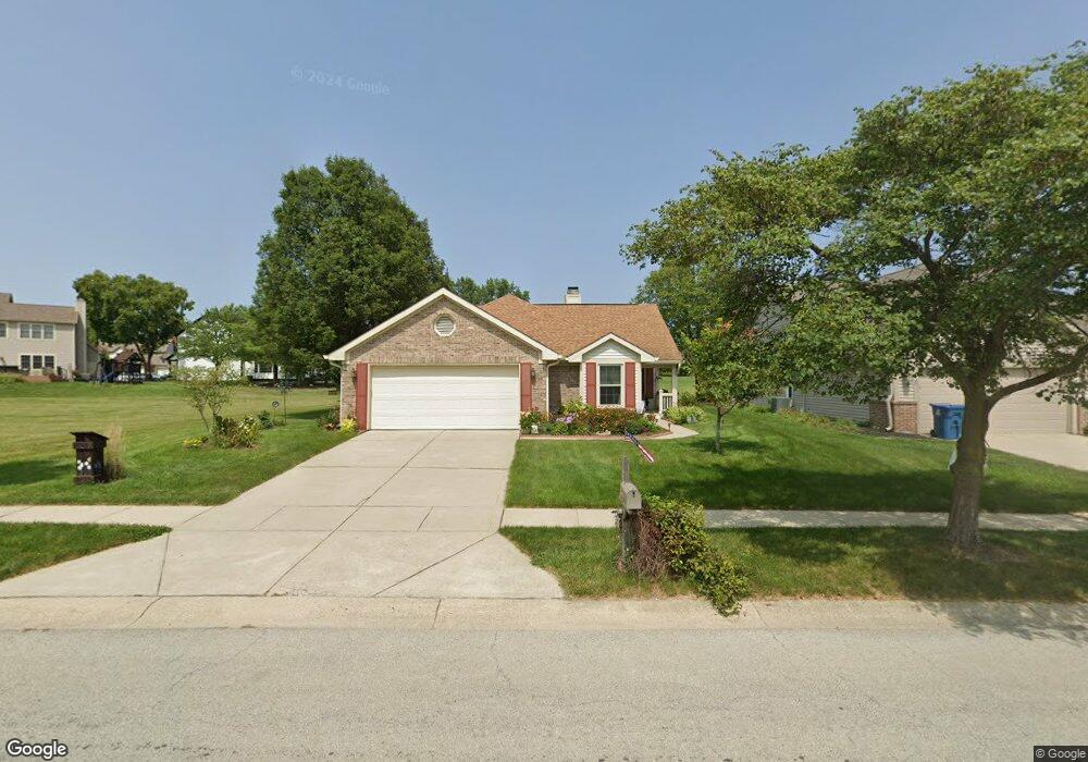
5052 Ashbrook Dr Noblesville, IN 46062
West Noblesville NeighborhoodEstimated Value: $295,000 - $327,000
2
Beds
2
Baths
1,450
Sq Ft
$212/Sq Ft
Est. Value
About This Home
This home is located at 5052 Ashbrook Dr, Noblesville, IN 46062 and is currently estimated at $308,115, approximately $212 per square foot. 5052 Ashbrook Dr is a home located in Hamilton County with nearby schools including Hazel Dell Elementary School, Noblesville West Middle School, and Noblesville High School.
Ownership History
Date
Name
Owned For
Owner Type
Purchase Details
Closed on
Jun 7, 2021
Sold by
White Elizabeth A
Bought by
Bankert Lora A
Current Estimated Value
Purchase Details
Closed on
Jun 4, 2021
Sold by
White Elizabeth A
Bought by
Bankert Lora A
Purchase Details
Closed on
Apr 11, 2009
Sold by
Gradwell Doris A
Bought by
Gradwell Doris A and White Elizabeth A
Purchase Details
Closed on
Oct 7, 2002
Sold by
Fleer Melva Lucille
Bought by
Gradwell Doris A
Create a Home Valuation Report for This Property
The Home Valuation Report is an in-depth analysis detailing your home's value as well as a comparison with similar homes in the area
Home Values in the Area
Average Home Value in this Area
Purchase History
| Date | Buyer | Sale Price | Title Company |
|---|---|---|---|
| Bankert Lora A | -- | None Listed On Document | |
| Bankert Lora A | $200,000 | Mtc | |
| Gradwell Doris A | -- | None Available | |
| Gradwell Doris A | -- | -- |
Source: Public Records
Tax History Compared to Growth
Tax History
| Year | Tax Paid | Tax Assessment Tax Assessment Total Assessment is a certain percentage of the fair market value that is determined by local assessors to be the total taxable value of land and additions on the property. | Land | Improvement |
|---|---|---|---|---|
| 2024 | $6,321 | $251,400 | $70,200 | $181,200 |
| 2023 | $6,386 | $256,300 | $70,200 | $186,100 |
| 2022 | $5,494 | $215,600 | $70,200 | $145,400 |
| 2021 | $5,064 | $198,800 | $70,200 | $128,600 |
| 2020 | $4,807 | $183,400 | $70,200 | $113,200 |
| 2019 | $2,180 | $172,500 | $33,600 | $138,900 |
| 2018 | $3,014 | $154,000 | $33,600 | $120,400 |
| 2017 | $1,923 | $151,900 | $33,600 | $118,300 |
| 2016 | $1,762 | $140,400 | $33,600 | $106,800 |
| 2014 | $1,574 | $133,800 | $32,300 | $101,500 |
| 2013 | $1,574 | $131,200 | $32,300 | $98,900 |
Source: Public Records
Map
Nearby Homes
- 5050 Trull Brook Dr
- 5287 Ashbrook Dr
- 4882 Gilet Dr
- 17717 Remy Rd
- 17712 Crown Pointe Ct
- 4883 Gilet Dr
- Meridian III Plan at Cranbrook Towns
- Talbott II Plan at Cranbrook Towns
- Lockerbie V Plan at Cranbrook Towns
- 4887 Gilet Dr
- 17902 Cristin Way
- 5237 Tulip Tree Dr
- 18229 Moontown Rd
- 4846 E Amesbury Place
- 4601 Amesbury Place
- 17506 Ebling Trail
- 17490 Ebling Trail
- 17451 Ebling Trail
- 17459 Ebling Trail
- 17514 Ebling Trail
- 5064 Ashbrook Dr
- 5078 Ashbrook Dr
- 17915 Hollow Brook Ct
- 17917 Hollow Brook Ct
- 5047 Ashbrook Dr
- 5061 Ashbrook Dr
- 17908 Albany Ct
- 17898 Albany Ct
- 5073 Ashbrook Dr
- 17907 Hollow Brook Ct
- 5089 Ashbrook Dr
- 5021 Trull Brook Dr
- 17918 Albany Ct
- 17930 Hollow Brook Ct
- 5121 Ashbrook Dr
- 17895 Hollow Brook Ct Unit 33
- 5025 Trull Brook Dr
- 17923 Albany Ct
- 17928 Hollow Brook Ct
- 5054 Trull Brook Dr