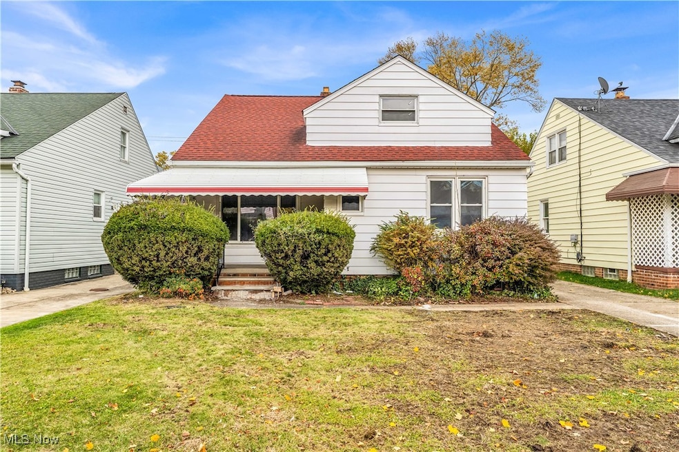
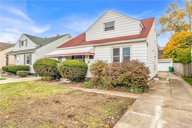
5053 Philip Ave Maple Heights, OH 44137
Highlights
- Cape Cod Architecture
- 2 Car Detached Garage
- Heating System Uses Gas
About This Home
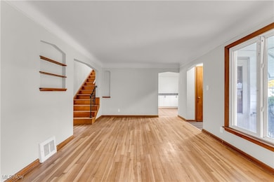
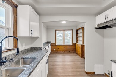
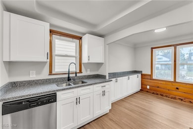
5053 Philip Ave, Maple Heights - Spacious 4-bed 2-bath single-family home! // $ 1,625 rent / $ 1,625 deposit //
$55 application fee per adult //
1-2 pets OK in this unit. After application pre-approval, a PetScreening is required for any animals to proceed with one of our properties; a PetScreening affidavit is still required if you have no pets. (Some breed restrictions apply per HUD guidelines). //
NO SMOKING //
1 time $199 non-refundable set up fee paid at lease signing // $35/month required resident benefit package; can include personal property/liability insurance for an additional $10/month for $45/month total. // ** CMHA OK - 4 bdrm voucher; must be prepared with reservation fee to hold the property and moving packet. ** // ** MOVE-IN DATE 21-60 DAYS OUT TO ACCOMMODATE REQUIRED CITY COMPLIANCE WITH CITY OF MAPLE HTS. - MOVE-IN DATE TBD, NO EXCEPTIONS. ** // After application Pre-Approval 1 applicant per household application is required to fill out a PetScreening application, before being about to proceed with placing a Reservation Fee for one of our properties. You will receive a pre-approval for your application and in order to proceed, the PetScreening is required. Even if you have NO pets - this application must be filled out. One time, non-refundable pet fee of $250-600 per animal applies to all pets & must be paid before or when you pay your first month rent. (No fee for qualified assistance animals). // Our application is processed through secure site: Findigs, and they require ID and income verification. Without this, your application will not be processed. They offer 24/7 chat support on their application directly if you have any questions. // BEDROOMS:4 //
BATHROOMS: 2 //
APPLIANCES PROVIDED:N/A //
UTILITIES / RESIDENT RESPONSIBILITY: Residents are responsible for all utilities including: water/sewer/trash, gas & electric & are responsible to maintain lawn care maintenance & snow removal. // Serious inquiries only.
Listing Agent
RE/MAX Haven Realty Brokerage Email: realestate@rentcle.com, 440-462-9453 License #2010002020 Listed on: 11/12/2025

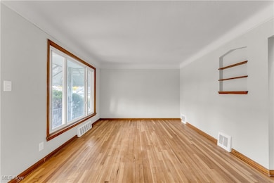
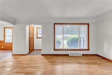
Home Details
Home Type
- Single Family
Est. Annual Taxes
- $3,124
Year Built
- Built in 1952
Lot Details
- 5,445 Sq Ft Lot
Parking
- 2 Car Detached Garage
- Off-Street Parking
Home Design
- Cape Cod Architecture
Interior Spaces
- 1,272 Sq Ft Home
- 2-Story Property
Bedrooms and Bathrooms
- 4 Bedrooms | 2 Main Level Bedrooms
- 2 Full Bathrooms
Basement
- Basement Fills Entire Space Under The House
- Laundry in Basement
Home Security
- Carbon Monoxide Detectors
- Fire and Smoke Detector
Utilities
- No Cooling
- Heating System Uses Gas
Listing and Financial Details
- Tenant pays for all utilities, electricity, gas, heat, hot water, sewer, trash collection, water
- 12 Month Lease Term
- Assessor Parcel Number 781-26-021
Map
Source: MLS Now
MLS Number: 5171523
APN: 781-26-021
Disclaimer: Certain information contained herein is derived from information provided by parties other than Homes.com. All information provided is deemed reliable, but is not guaranteed to be accurate and should be independently verified.
![]() IDX information is provided exclusively for personal, non-commercial use, and may not be used for any purpose other than to identify prospective properties consumers may be interested in purchasing. Information is deemed reliable but not guaranteed.
IDX information is provided exclusively for personal, non-commercial use, and may not be used for any purpose other than to identify prospective properties consumers may be interested in purchasing. Information is deemed reliable but not guaranteed.
- 5061 Philip Ave
- 5082 Philip Ave
- 5110 Philip Ave
- 5031 Cato St
- 5185 Clement Ave
- 5231 Philip Ave
- 5199 Arch St
- 5208 Clement Ave
- 5257 Philip Ave
- 5212 Catherine St
- 16712 Kollin Ave
- 5239 Arch St
- 5234 Erwin St
- 5210 Theodore St
- 16305 Raymond St
- 16241 Glenburn Ave
- 17916 North Blvd
- 17912 North Blvd
- 17204 Maple Heights Blvd
- 5247 Henry St
- 5061 Philip Ave
- 5200 Catherine St
- 17515 Libby Rd
- 5329 Vine St
- 17100 Maple Heights Blvd
- 4692 E 173rd St
- 17210 Mapleboro Ave
- 5339 Elmwood Ave
- 5171 Charles St
- 18113 Mapleboro Ave
- 5115 Stanley Ave
- 19600 Milan Dr
- 5161 Greenhurst Dr
- 5574 Waterbury Ave
- 5713 South Blvd
- 4400 Wyatt Rd
- 20801 Franklin Rd
- 4322 E 175th St
- 4468 E 156th St
- 4646 E 147th St Unit 1/DN