Estimated Value: $243,000 - $651,708
--
Bed
--
Bath
--
Sq Ft
6.24
Acres
About This Home
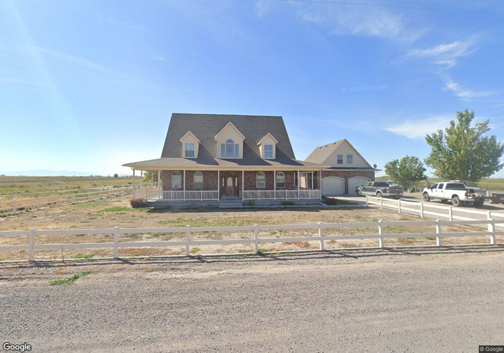
This home is located at 5053 W 2500 N, Delta, UT 84624 and is currently estimated at $447,354. 5053 W 2500 N is a home.
Ownership History
Date
Name
Owned For
Owner Type
Purchase Details
Closed on
Mar 31, 2017
Sold by
Gasser Wayne V and Gasser Pamela M
Bought by
Sorenson Richard C and Sorenson Melissa
Current Estimated Value
Home Financials for this Owner
Home Financials are based on the most recent Mortgage that was taken out on this home.
Original Mortgage
$273,946
Outstanding Balance
$227,674
Interest Rate
4.25%
Mortgage Type
FHA
Estimated Equity
$219,680
Create a Home Valuation Report for This Property
The Home Valuation Report is an in-depth analysis detailing your home's value as well as a comparison with similar homes in the area
Home Values in the Area
Average Home Value in this Area
Purchase History
| Date | Buyer | Sale Price | Title Company |
|---|---|---|---|
| Sorenson Richard C | -- | Atlas Title | |
| Sorenson Richard C | -- | Atlas Title |
Source: Public Records
Mortgage History
| Date | Status | Borrower | Loan Amount |
|---|---|---|---|
| Open | Sorenson Richard C | $273,946 | |
| Closed | Sorenson Richard C | $273,946 |
Source: Public Records
Tax History Compared to Growth
Tax History
| Year | Tax Paid | Tax Assessment Tax Assessment Total Assessment is a certain percentage of the fair market value that is determined by local assessors to be the total taxable value of land and additions on the property. | Land | Improvement |
|---|---|---|---|---|
| 2025 | $2,667 | $328,591 | $23,442 | $305,149 |
| 2024 | $2,667 | $388,826 | $18,312 | $370,514 |
| 2023 | $4,308 | $388,826 | $18,312 | $370,514 |
| 2022 | $2,861 | $252,301 | $15,584 | $236,717 |
| 2021 | $2,145 | $182,133 | $13,672 | $168,461 |
| 2020 | $1,995 | $171,372 | $17,340 | $154,032 |
| 2019 | $1,858 | $161,072 | $17,340 | $143,732 |
| 2018 | $2,007 | $178,837 | $18,756 | $160,081 |
| 2017 | $1,871 | $159,467 | $15,456 | $144,011 |
| 2016 | $1,788 | $159,467 | $15,456 | $144,011 |
| 2015 | $1,788 | $159,467 | $15,456 | $144,011 |
| 2014 | -- | $159,467 | $15,456 | $144,011 |
| 2013 | -- | $160,138 | $15,456 | $144,682 |
Source: Public Records
Map
Nearby Homes