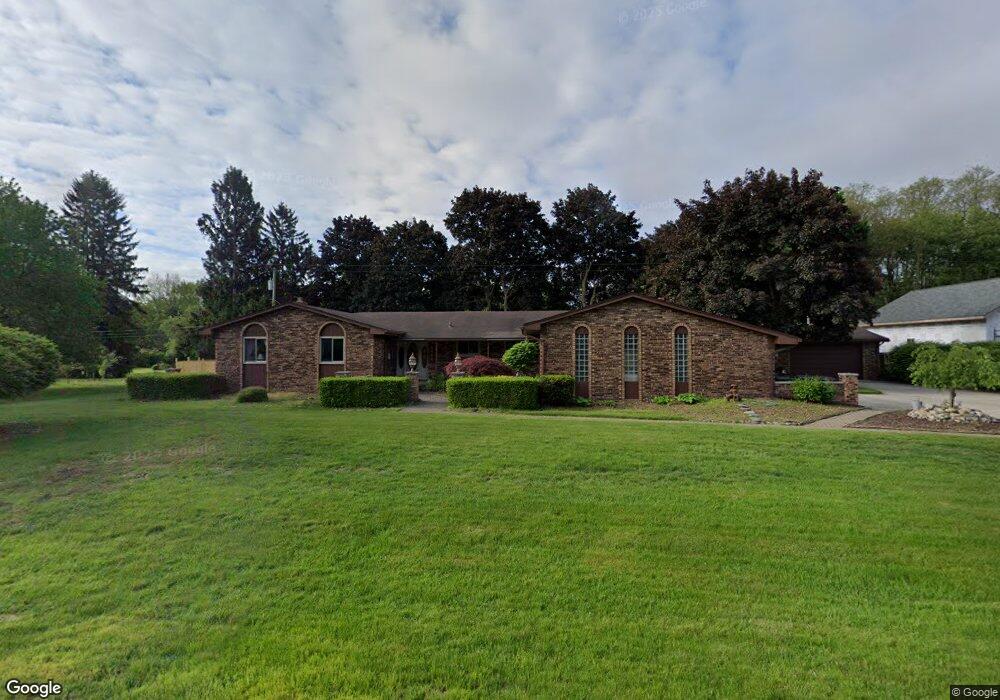
5054 Eastbrook Ct Shelby Township, MI 48316
Estimated Value: $358,000 - $443,000
3
Beds
3
Baths
2,112
Sq Ft
$192/Sq Ft
Est. Value
About This Home
This home is located at 5054 Eastbrook Ct, Shelby Township, MI 48316 and is currently estimated at $406,202, approximately $192 per square foot. 5054 Eastbrook Ct is a home with nearby schools including Switzer Elementary School, Malow Junior High School, and Eisenhower High School.
Ownership History
Date
Name
Owned For
Owner Type
Purchase Details
Closed on
Jan 23, 2023
Sold by
Uzelac Ian David
Bought by
Uzelac Ian David and Uzelac Kristyn
Current Estimated Value
Home Financials for this Owner
Home Financials are based on the most recent Mortgage that was taken out on this home.
Original Mortgage
$150,000
Outstanding Balance
$144,969
Interest Rate
6.15%
Estimated Equity
$261,233
Purchase Details
Closed on
Oct 22, 2012
Sold by
Howarth George E and Howarth Phyllis M
Bought by
Howarth Phyllis M
Create a Home Valuation Report for This Property
The Home Valuation Report is an in-depth analysis detailing your home's value as well as a comparison with similar homes in the area
Home Values in the Area
Average Home Value in this Area
Purchase History
| Date | Buyer | Sale Price | Title Company |
|---|---|---|---|
| Uzelac Ian David | -- | -- | |
| Uzelac Ian David | $300,000 | -- | |
| Howarth Phyllis M | -- | Land Title |
Source: Public Records
Mortgage History
| Date | Status | Borrower | Loan Amount |
|---|---|---|---|
| Open | Uzelac Ian David | $150,000 | |
| Closed | Uzelac Ian David | $150,000 |
Source: Public Records
Tax History Compared to Growth
Tax History
| Year | Tax Paid | Tax Assessment Tax Assessment Total Assessment is a certain percentage of the fair market value that is determined by local assessors to be the total taxable value of land and additions on the property. | Land | Improvement |
|---|---|---|---|---|
| 2025 | $6,519 | $228,100 | $0 | $0 |
| 2024 | $3,858 | $211,900 | $0 | $0 |
| 2023 | $2,264 | $192,600 | $0 | $0 |
| 2022 | $3,651 | $177,200 | $0 | $0 |
| 2021 | $3,551 | $180,200 | $0 | $0 |
| 2020 | $2,084 | $190,400 | $0 | $0 |
| 2019 | $3,251 | $173,000 | $0 | $0 |
| 2018 | $3,212 | $161,000 | $0 | $0 |
| 2017 | $3,154 | $152,250 | $38,150 | $114,100 |
| 2016 | $3,132 | $152,250 | $0 | $0 |
| 2015 | $3,086 | $141,400 | $0 | $0 |
| 2013 | $1,733 | $109,350 | $0 | $0 |
Source: Public Records
Map
Nearby Homes
- 53320 Franklin Dr
- 53223 Sophia Dr
- 53246 Sophia Dr
- 5577 Harlowe Dr
- 53162 Briar Dr
- 52461 Pappy Ln
- 5781 Harlowe Dr
- 3479 Forster Ln Unit Lot 19
- 3371 Forster Ln Unit Lot 16
- 3335 Forster Ln Unit Lot 15
- 5633 Debra Rd
- 52811 Heatherway Dr
- 3191 Forster Ln Unit Lot 11
- 3252 Forster Ln
- 53588 Bruce Hill Dr
- 5961 Woodmire Dr
- 6308 Donnybrook Dr
- 54011 Mound Rd
- 51341 Neumaier Dr
- 51281 Shelby Rd
- 5031 Brookside Dr
- 5020 Eastbrook Ct
- 5055 Eastbrook Ct
- 5090 Eastbrook Ct
- 5021 Eastbrook Ct
- 5061 Brookside Dr
- 4960 24 Mile Rd
- 5000 Eastbrook Ct
- 5001 Eastbrook Ct
- 5089 Eastbrook Ct
- 5122 Eastbrook Ct
- 4836 24 Mile Rd
- 5005 Brookside Dr
- 5123 Eastbrook Ct
- 5095 Brookside Dr
- 5000 Brookside Dr
- 5030 Brookside Dr
- 5024 24 Mile Rd
- 52800 Shelby Rd
- 52700 Shelby Rd