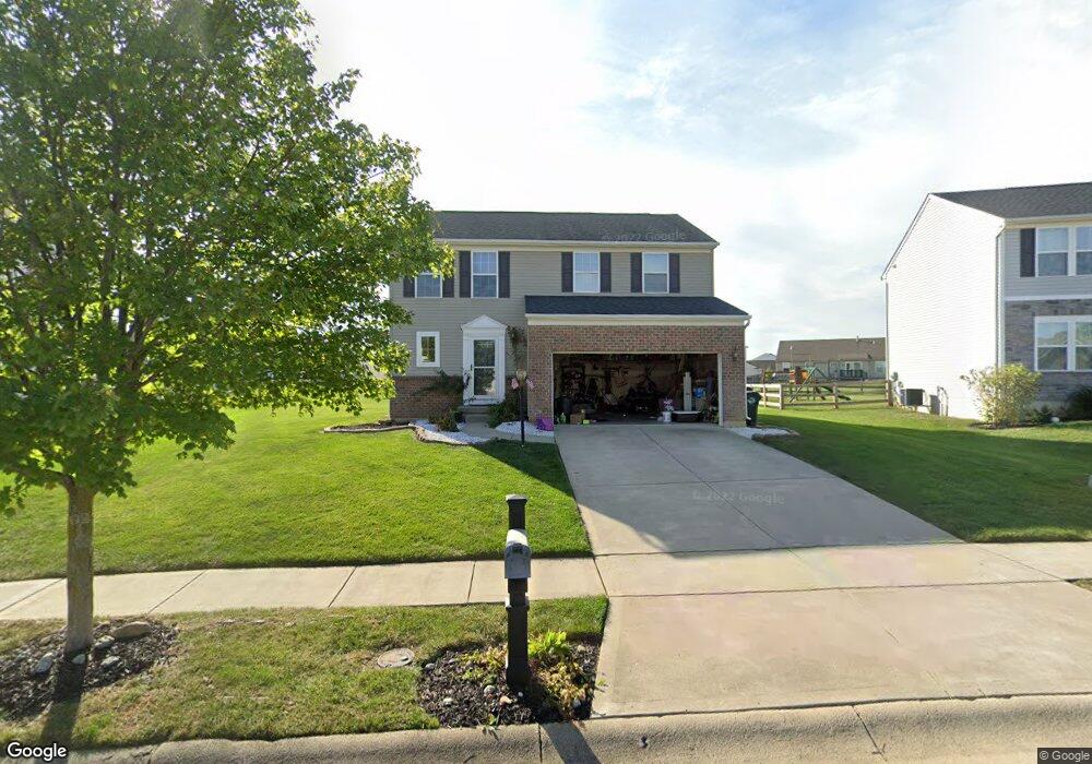
5054 Sullivans Ridge Dr Morrow, OH 45152
Salem Township NeighborhoodEstimated Value: $333,000 - $356,000
3
Beds
3
Baths
1,720
Sq Ft
$201/Sq Ft
Est. Value
About This Home
This home is located at 5054 Sullivans Ridge Dr, Morrow, OH 45152 and is currently estimated at $345,967, approximately $201 per square foot. 5054 Sullivans Ridge Dr is a home located in Warren County with nearby schools including Little Miami High School.
Ownership History
Date
Name
Owned For
Owner Type
Purchase Details
Closed on
Jun 23, 2011
Sold by
Nvr Inc
Bought by
Allen Kelly E
Current Estimated Value
Home Financials for this Owner
Home Financials are based on the most recent Mortgage that was taken out on this home.
Original Mortgage
$149,948
Outstanding Balance
$103,371
Interest Rate
4.63%
Mortgage Type
New Conventional
Estimated Equity
$242,596
Purchase Details
Closed on
Apr 15, 2011
Sold by
Nathaniel Development Co Inc
Bought by
Nvr Inc and Ryan Homes
Create a Home Valuation Report for This Property
The Home Valuation Report is an in-depth analysis detailing your home's value as well as a comparison with similar homes in the area
Home Values in the Area
Average Home Value in this Area
Purchase History
| Date | Buyer | Sale Price | Title Company |
|---|---|---|---|
| Allen Kelly E | $149,933 | First Title Agency | |
| Nvr Inc | $15,000 | First Title Agency |
Source: Public Records
Mortgage History
| Date | Status | Borrower | Loan Amount |
|---|---|---|---|
| Open | Allen Kelly E | $149,948 |
Source: Public Records
Tax History Compared to Growth
Tax History
| Year | Tax Paid | Tax Assessment Tax Assessment Total Assessment is a certain percentage of the fair market value that is determined by local assessors to be the total taxable value of land and additions on the property. | Land | Improvement |
|---|---|---|---|---|
| 2024 | $4,098 | $91,090 | $24,500 | $66,590 |
| 2023 | $3,588 | $71,064 | $14,455 | $56,609 |
| 2022 | $3,551 | $71,064 | $14,455 | $56,609 |
| 2021 | $3,393 | $71,064 | $14,455 | $56,609 |
| 2020 | $3,379 | $60,225 | $12,250 | $47,975 |
| 2019 | $3,439 | $60,225 | $12,250 | $47,975 |
| 2018 | $3,496 | $60,225 | $12,250 | $47,975 |
| 2017 | $2,925 | $49,406 | $10,210 | $39,197 |
| 2016 | $2,985 | $49,406 | $10,210 | $39,197 |
| 2015 | $2,796 | $49,406 | $10,210 | $39,197 |
| 2014 | $2,916 | $46,170 | $9,540 | $36,630 |
| 2013 | $2,868 | $59,280 | $12,250 | $47,030 |
Source: Public Records
Map
Nearby Homes
- 5143 Sullivans Ridge Dr
- 5714 Anne Marie Dr
- 5700 Anne Marie Dr
- 4813 Allens Ridge Dr
- 3155 Rosemary Ct Unit Lot 94
- 3155 Rosemary Ct
- 4836 Jessica Suzanne Dr
- 4921 Jessica Suzanne Dr
- Aspen with Included Basement Plan at Woodlands at Morrow
- Tupelo with Included Basement Plan at Woodlands at Morrow
- Cedar with Included Basement Plan at Woodlands at Morrow
- Birch with Included Basement Plan at Woodlands at Morrow
- Hazel with Included Basement Plan at Woodlands at Morrow
- 5688 Alpine Heights Dr
- 350 2nd St
- 251 Westview Dr
- 6448 Cooper Grace Ln
- 6466 Copper Grace Ln
- 3172 Sage Ct
- 5177 Lucy Games Ct
- 5046 Sullivans Ridge Dr
- 4760 Jacob Andrew Ct
- 5062 Sullivans Ridge Dr
- 5038 Sullivans Ridge Dr
- 4746 Jacob Andrew Ct
- 5826 Anne Marie Dr
- 5840 Anne Marie Dr
- 5049 Sullivans Ridge Dr Unit 162
- 5049 Sullivans Ridge Dr Unit DRIVE
- 5049 Sullivans Ridge Dr
- 5812 Anne Marie Dr
- 5065 Sullivans Ridge Dr
- 5063 Sullivans Ridge Dr
- 139 Sullivans Ridge Dr
- 5798 Anne Marie Dr
- 4731 Jacob Andrew Ct
- 5070 Sullivans Ridge Dr
- 5854 Anne Marie Dr
- 5067 Sullivans Ridge Dr
- 4731 Jacob Andrew Ct