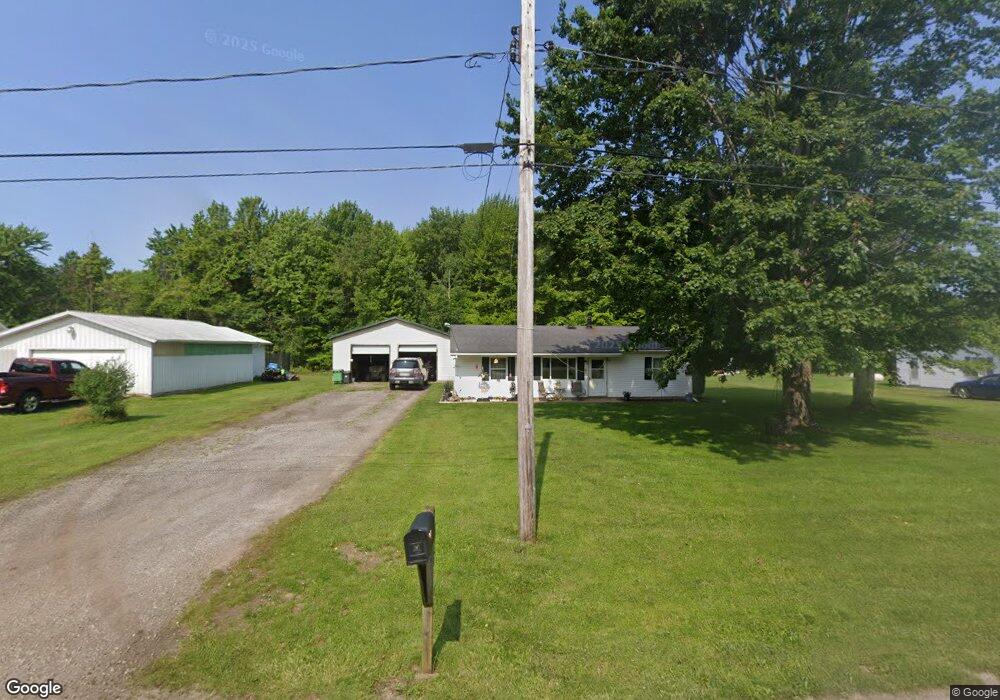
5055 State Line Rd Conneaut, OH 44030
Estimated Value: $119,344 - $194,000
2
Beds
1
Bath
960
Sq Ft
$152/Sq Ft
Est. Value
About This Home
This home is located at 5055 State Line Rd, Conneaut, OH 44030 and is currently estimated at $146,336, approximately $152 per square foot. 5055 State Line Rd is a home located in Ashtabula County with nearby schools including Lakeshore Primary Elementary School, Gateway Elementary School, and Conneaut Middle School.
Ownership History
Date
Name
Owned For
Owner Type
Purchase Details
Closed on
Aug 8, 2024
Sold by
Montagano John J
Bought by
Smith Ladonna J
Current Estimated Value
Purchase Details
Closed on
Feb 4, 2022
Sold by
Pope Jr William D
Bought by
Montagano John J
Purchase Details
Closed on
Feb 8, 2021
Sold by
Westbay Dorothea
Bought by
Depope William
Create a Home Valuation Report for This Property
The Home Valuation Report is an in-depth analysis detailing your home's value as well as a comparison with similar homes in the area
Home Values in the Area
Average Home Value in this Area
Purchase History
| Date | Buyer | Sale Price | Title Company |
|---|---|---|---|
| Smith Ladonna J | $55,000 | None Listed On Document | |
| Smith Ladonna J | $55,000 | None Listed On Document | |
| Montagano John J | $60,700 | Hamper Carmen M | |
| Montagano John J | $60,700 | Hamper Carmen M | |
| Depope William | $80,000 | None Available |
Source: Public Records
Tax History Compared to Growth
Tax History
| Year | Tax Paid | Tax Assessment Tax Assessment Total Assessment is a certain percentage of the fair market value that is determined by local assessors to be the total taxable value of land and additions on the property. | Land | Improvement |
|---|---|---|---|---|
| 2024 | $2,004 | $29,190 | $4,060 | $25,130 |
| 2023 | $1,266 | $29,190 | $4,060 | $25,130 |
| 2022 | $1,037 | $21,080 | $3,120 | $17,960 |
| 2021 | $1,064 | $21,080 | $3,120 | $17,960 |
| 2020 | $1,064 | $21,080 | $3,120 | $17,960 |
| 2019 | $1,031 | $19,920 | $3,780 | $16,140 |
| 2018 | $995 | $19,920 | $3,780 | $16,140 |
| 2017 | $497 | $19,920 | $3,780 | $16,140 |
| 2016 | $838 | $18,210 | $3,470 | $14,740 |
| 2015 | $837 | $18,210 | $3,470 | $14,740 |
| 2014 | $808 | $18,210 | $3,470 | $14,740 |
| 2013 | $908 | $19,990 | $1,860 | $18,130 |
Source: Public Records
Map
Nearby Homes
- 5091 State Line Rd
- 9455 State Line Rd
- 5761 Furnace Rd
- 4361 Middle Rd
- 7238 Hatches Corners Rd
- 6421 Weaver Rd
- 5958 Weaver Rd
- 5051 Center Rd
- 0 Griffey Rd
- 3037 Philadelphia Rd
- 5581 Hatches Corners Rd
- 5264 Middle Rd
- 370 E Underridge Rd
- 593 Furnace Rd
- 5315 Wetmore Rd
- 6874 Hammond Corners Rd
- 0 Center Rd
- 3029 Sweet Rd
- 522 Furnace Rd
- 136 W Under Ridge Rd
- 5071 State Line Rd
- 5055 5071 State Line Rd
- 5041 State Line Rd
- 9875 State Line Rd
- 16101 Pennsylvania 226
- 7330 State Line Rd
- 7265 Bushnell Rd
- 5179 State Line Rd
- 7278 Bushnell Rd
- 9797 State Line Rd
- 7242 Bushnell Rd
- 4925 State Line Rd
- 7200 Bushnell Rd
- 7190 Bushnell Rd
- 7302 Pitts Rd
- 7145 Bushnell Rd
- 7284 Pitts Rd
- 4869 State Line Rd
- 7150 Bushnell Rd
- 7130 Bushnell Rd