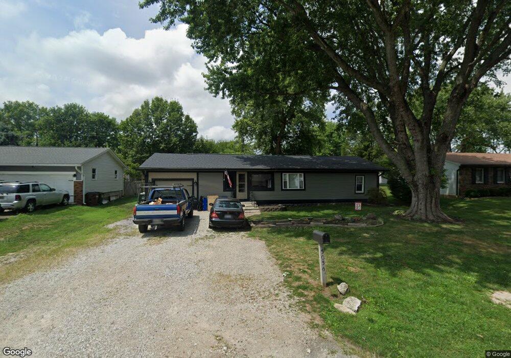
5056 Cook Rd South Bloomfield, OH 43103
Estimated Value: $182,096 - $274,000
2
Beds
1
Bath
1,222
Sq Ft
$175/Sq Ft
Est. Value
About This Home
This home is located at 5056 Cook Rd, South Bloomfield, OH 43103 and is currently estimated at $214,274, approximately $175 per square foot. 5056 Cook Rd is a home located in Pickaway County.
Ownership History
Date
Name
Owned For
Owner Type
Purchase Details
Closed on
Aug 3, 2013
Sold by
Roof Michael A and Roof Lynne M
Bought by
Poole Steven
Current Estimated Value
Home Financials for this Owner
Home Financials are based on the most recent Mortgage that was taken out on this home.
Original Mortgage
$75,000
Outstanding Balance
$18,230
Interest Rate
3.93%
Mortgage Type
Seller Take Back
Estimated Equity
$196,044
Purchase Details
Closed on
May 24, 1999
Sold by
Osborne Harry B
Bought by
Roof Michael A and Roof Lynne M
Create a Home Valuation Report for This Property
The Home Valuation Report is an in-depth analysis detailing your home's value as well as a comparison with similar homes in the area
Home Values in the Area
Average Home Value in this Area
Purchase History
| Date | Buyer | Sale Price | Title Company |
|---|---|---|---|
| Poole Steven | $75,000 | Attorney | |
| Roof Michael A | $46,000 | -- |
Source: Public Records
Mortgage History
| Date | Status | Borrower | Loan Amount |
|---|---|---|---|
| Open | Poole Steven | $75,000 |
Source: Public Records
Tax History Compared to Growth
Tax History
| Year | Tax Paid | Tax Assessment Tax Assessment Total Assessment is a certain percentage of the fair market value that is determined by local assessors to be the total taxable value of land and additions on the property. | Land | Improvement |
|---|---|---|---|---|
| 2024 | -- | $37,570 | $9,030 | $28,540 |
| 2023 | $1,477 | $37,570 | $9,030 | $28,540 |
| 2022 | $1,197 | $28,080 | $7,530 | $20,550 |
| 2021 | $1,136 | $28,080 | $7,530 | $20,550 |
| 2020 | $1,139 | $28,080 | $7,530 | $20,550 |
| 2019 | $969 | $23,650 | $7,530 | $16,120 |
| 2018 | $1,001 | $23,650 | $7,530 | $16,120 |
| 2017 | $1,027 | $23,650 | $7,530 | $16,120 |
| 2016 | $954 | $21,860 | $7,440 | $14,420 |
| 2015 | $954 | $21,860 | $7,440 | $14,420 |
| 2014 | $955 | $21,860 | $7,440 | $14,420 |
| 2013 | $1,054 | $23,310 | $7,440 | $15,870 |
Source: Public Records
Map
Nearby Homes
- 5069 Ashville Rd
- 5050 S Walnut St
- 0 U S 23
- The Daffodil Plan at Riverbend at Scioto Landing
- The Daisy Plan at Riverbend at Scioto Landing
- The Avalon Plan at Riverbend at Scioto Landing
- The Aster Plan at Riverbend at Scioto Landing
- 51 Henderson Ln
- Aspire Plan at Bloomfield Hills
- Hampton Plan at Bloomfield Hills
- Mitchell Plan at Bloomfield Hills
- Crisfield Plan at Bloomfield Hills
- Sereneda Plan at Bloomfield Hills
- Oakdale Plan at Bloomfield Hills
- 5009 Roese Ave
- 14337 Us Highway 23
- 14337 Us Highway 23
- 30 Bazler Ln
- 127 Boutot St
- 92 Richard Ave