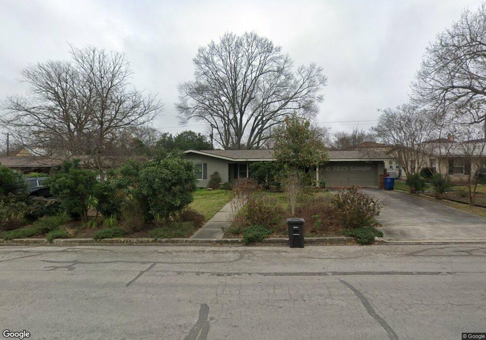
506 Burnside Dr San Antonio, TX 78209
Oak Park-Northwood NeighborhoodEstimated Value: $388,878 - $531,000
2
Beds
2
Baths
1,710
Sq Ft
$272/Sq Ft
Est. Value
About This Home
This home is located at 506 Burnside Dr, San Antonio, TX 78209 and is currently estimated at $465,720, approximately $272 per square foot. 506 Burnside Dr is a home located in Bexar County with nearby schools including Northwood Elementary School, Garner Middle School, and MacArthur High School.
Ownership History
Date
Name
Owned For
Owner Type
Purchase Details
Closed on
Oct 30, 2002
Sold by
Hardaway Thomas Gray and Hardaway Julie Greig
Bought by
Morris Kelly G
Current Estimated Value
Home Financials for this Owner
Home Financials are based on the most recent Mortgage that was taken out on this home.
Original Mortgage
$121,520
Outstanding Balance
$50,862
Interest Rate
6.01%
Estimated Equity
$414,858
Purchase Details
Closed on
Jun 9, 1999
Sold by
Davis Kenneth P and Davis Angela D
Bought by
Hardaway Thomas Gray and Hardaway Julie Greig
Home Financials for this Owner
Home Financials are based on the most recent Mortgage that was taken out on this home.
Original Mortgage
$113,950
Interest Rate
7.02%
Purchase Details
Closed on
Aug 15, 1994
Sold by
Gill Helen D and Gill Linda L
Bought by
Davis Kenneth P and Davis Angela D
Home Financials for this Owner
Home Financials are based on the most recent Mortgage that was taken out on this home.
Original Mortgage
$80,000
Interest Rate
5.62%
Create a Home Valuation Report for This Property
The Home Valuation Report is an in-depth analysis detailing your home's value as well as a comparison with similar homes in the area
Home Values in the Area
Average Home Value in this Area
Purchase History
| Date | Buyer | Sale Price | Title Company |
|---|---|---|---|
| Morris Kelly G | -- | -- | |
| Hardaway Thomas Gray | -- | Alamo Title | |
| Davis Kenneth P | -- | -- |
Source: Public Records
Mortgage History
| Date | Status | Borrower | Loan Amount |
|---|---|---|---|
| Open | Morris Kelly G | $121,520 | |
| Previous Owner | Hardaway Thomas Gray | $113,950 | |
| Previous Owner | Davis Kenneth P | $80,000 |
Source: Public Records
Tax History Compared to Growth
Tax History
| Year | Tax Paid | Tax Assessment Tax Assessment Total Assessment is a certain percentage of the fair market value that is determined by local assessors to be the total taxable value of land and additions on the property. | Land | Improvement |
|---|---|---|---|---|
| 2025 | $4,637 | $367,000 | $157,140 | $209,860 |
| 2024 | $4,637 | $367,000 | $157,140 | $209,860 |
| 2023 | $4,637 | $344,850 | $157,140 | $196,860 |
| 2022 | $7,736 | $313,500 | $136,640 | $230,140 |
| 2021 | $7,281 | $285,000 | $118,890 | $166,110 |
| 2020 | $7,417 | $272,000 | $105,290 | $166,710 |
| 2019 | $6,925 | $260,000 | $105,290 | $154,710 |
| 2018 | $6,996 | $262,000 | $84,240 | $177,760 |
| 2017 | $6,872 | $255,000 | $84,240 | $170,760 |
| 2016 | $6,629 | $246,000 | $51,930 | $194,070 |
| 2015 | $5,503 | $225,000 | $51,930 | $173,070 |
| 2014 | $5,503 | $207,000 | $0 | $0 |
Source: Public Records
Map
Nearby Homes
- 510 Burnside Dr
- 530 Burnside Dr
- 510 Woodcrest Dr
- 419 Woodcrest Dr
- 2603 Brookhurst Dr
- 351 Northridge Dr
- 318 Northridge Dr
- 215 Oakleaf Dr
- 315 Tophill Rd
- 446 Forrest Hill Dr
- 134 Rockhill Dr
- 623 E Nottingham Dr
- 2434 Toftrees Dr
- 210 Laramie Dr
- 631 Robinhood Place
- 7606 N Vandiver Rd
- 205 Larkwood Dr
- 127 Larkwood Dr
- 215 Tophill Rd
- 7238 Seidel Rd
- 502 Burnside Dr
- 515 Oakleaf Dr
- 519 Oakleaf Dr
- 507 Oakleaf Dr
- 514 Burnside Dr
- 507 Burnside Dr
- 503 Burnside Dr
- 523 Oakleaf Dr
- 511 Burnside Dr
- 503 Oakleaf Dr
- 455 Burnside Dr
- 518 Burnside Dr
- 450 Burnside Dr
- 515 Burnside Dr
- 527 Oakleaf Dr
- 451 Burnside Dr
- 514 Oakleaf Dr
- 270 Forrest Hill Dr
- 510 Oakleaf Dr
- 522 Burnside Dr