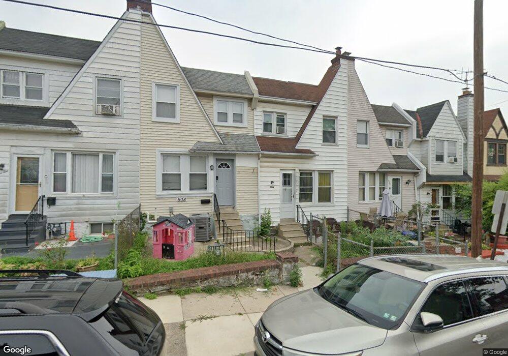
506 Glendale Rd Upper Darby, PA 19082
Estimated Value: $141,900 - $200,000
3
Beds
2
Baths
1,204
Sq Ft
$139/Sq Ft
Est. Value
About This Home
This home is located at 506 Glendale Rd, Upper Darby, PA 19082 and is currently estimated at $166,975, approximately $138 per square foot. 506 Glendale Rd is a home located in Delaware County with nearby schools including Upper Darby Kdg Center, Upper Darby High School, and Philadelphia Christian Academy.
Ownership History
Date
Name
Owned For
Owner Type
Purchase Details
Closed on
Nov 9, 2021
Sold by
Raphiatou Noumbissi
Bought by
Noumbissi Raphiatou
Current Estimated Value
Purchase Details
Closed on
Jan 11, 2006
Sold by
Noumbissi Raphiatou and Estate Of Amadou Noumbissi
Bought by
Noumbissi Raphiatou
Purchase Details
Closed on
Aug 10, 1999
Sold by
Limburg Steven G and Thomas Limburg Karen E
Bought by
Noumbissi Amadou
Home Financials for this Owner
Home Financials are based on the most recent Mortgage that was taken out on this home.
Original Mortgage
$43,609
Interest Rate
7.65%
Mortgage Type
FHA
Purchase Details
Closed on
Mar 10, 1998
Sold by
Russell Dolores C
Bought by
Limburg Steven G and Thomas Limburg Karen E
Create a Home Valuation Report for This Property
The Home Valuation Report is an in-depth analysis detailing your home's value as well as a comparison with similar homes in the area
Home Values in the Area
Average Home Value in this Area
Purchase History
| Date | Buyer | Sale Price | Title Company |
|---|---|---|---|
| Noumbissi Raphiatou | -- | None Listed On Document | |
| Noumbissi Raphiatou | -- | None Available | |
| Noumbissi Amadou | $44,000 | Commonwealth Land Title Ins | |
| Limburg Steven G | -- | -- |
Source: Public Records
Mortgage History
| Date | Status | Borrower | Loan Amount |
|---|---|---|---|
| Previous Owner | Noumbissi Amadou | $43,609 |
Source: Public Records
Tax History Compared to Growth
Tax History
| Year | Tax Paid | Tax Assessment Tax Assessment Total Assessment is a certain percentage of the fair market value that is determined by local assessors to be the total taxable value of land and additions on the property. | Land | Improvement |
|---|---|---|---|---|
| 2025 | $2,910 | $68,810 | $13,440 | $55,370 |
| 2024 | $2,910 | $68,810 | $13,440 | $55,370 |
| 2023 | $2,883 | $68,810 | $13,440 | $55,370 |
| 2022 | $2,805 | $68,810 | $13,440 | $55,370 |
| 2021 | $3,782 | $68,810 | $13,440 | $55,370 |
| 2020 | $2,963 | $45,800 | $12,220 | $33,580 |
| 2019 | $2,911 | $45,800 | $12,220 | $33,580 |
| 2018 | $2,877 | $45,800 | $0 | $0 |
| 2017 | $2,802 | $45,800 | $0 | $0 |
| 2016 | $256 | $45,800 | $0 | $0 |
| 2015 | $251 | $45,800 | $0 | $0 |
| 2014 | $256 | $45,800 | $0 | $0 |
Source: Public Records
Map
Nearby Homes
- 346 Long Ln
- 7139 Guilford Rd
- 418 Hampden Rd
- 414 Glendale Rd
- 432 Grace Rd
- 404 Croyden Rd
- 504 Woodcliffe Rd
- 607 Littlecroft Rd
- 513 Woodcliffe Rd
- 424 Woodcliffe Rd
- 351 Long Ln
- 669 Long Ln
- 7216 Clinton Rd
- 7114 Locust St
- 7155 Radbourne Rd
- 7162 Radbourne Rd
- 7265 Calvin Rd
- 517 Wiltshire Rd
- 525 Wiltshire Rd
- 726 Copley Rd
- 530 Glendale Rd
- 528 Glendale Rd
- 526 Glendale Rd
- 522 Glendale Rd
- 520 Glendale Rd
- 516 Glendale Rd
- 514 Glendale Rd
- 512 Glendale Rd
- 508 Glendale Rd
- 504 Glendale Rd
- 502 Glendale Rd
- 524 Glendale Rd
- 518 Glendale Rd
- 538 Glendale Rd
- 534 Glendale Rd
- 529 Glendale Rd
- 525 Glendale Rd
- 523 Glendale Rd
- 521 Glendale Rd
- 519 Glendale Rd