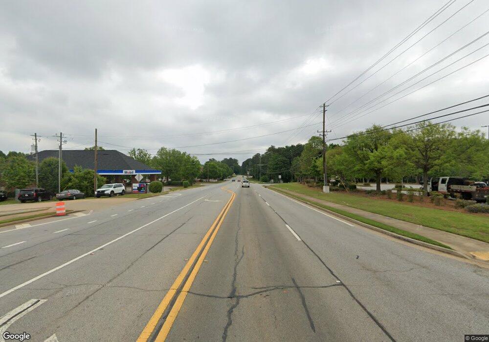
506 Highway 29 Palmetto, GA 30268
Estimated Value: $402,000
--
Bed
--
Bath
784
Sq Ft
$513/Sq Ft
Est. Value
About This Home
This home is located at 506 Highway 29, Palmetto, GA 30268 and is currently priced at $402,000, approximately $512 per square foot. 506 Highway 29 is a home located in Coweta County with nearby schools including Brooks Elementary School, Madras Middle School, and Northgate High School.
Ownership History
Date
Name
Owned For
Owner Type
Purchase Details
Closed on
Jul 2, 2020
Sold by
Ptw Properties Llc
Bought by
Nestlehutt Rachel
Current Estimated Value
Purchase Details
Closed on
Jul 24, 2019
Sold by
Bd Stiehl Office Properties Llc
Bought by
Ptw Properties Llc
Purchase Details
Closed on
Feb 10, 2016
Sold by
Thompson John F Iii Estate
Bought by
Bd Stiehl Office Properties Llc
Purchase Details
Closed on
Sep 14, 2009
Sold by
Thompson John F
Bought by
Thompson John F Iii Estate
Purchase Details
Closed on
Jun 8, 1990
Bought by
Bishop Paul E and Bishop J
Create a Home Valuation Report for This Property
The Home Valuation Report is an in-depth analysis detailing your home's value as well as a comparison with similar homes in the area
Home Values in the Area
Average Home Value in this Area
Purchase History
| Date | Buyer | Sale Price | Title Company |
|---|---|---|---|
| Nestlehutt Rachel | $20,000 | -- | |
| Ptw Properties Llc | $200,000 | -- | |
| Bd Stiehl Office Properties Llc | $78,000 | -- | |
| Thompson John F Iii Estate | -- | -- | |
| Bishop Paul E | $65,000 | -- |
Source: Public Records
Tax History Compared to Growth
Tax History
| Year | Tax Paid | Tax Assessment Tax Assessment Total Assessment is a certain percentage of the fair market value that is determined by local assessors to be the total taxable value of land and additions on the property. | Land | Improvement |
|---|---|---|---|---|
| 2024 | $2,534 | $88,611 | $9,900 | $78,711 |
| 2023 | $2,534 | $88,611 | $9,900 | $78,711 |
| 2022 | $1,886 | $88,611 | $9,900 | $78,711 |
| 2021 | $2,065 | $88,611 | $9,900 | $78,711 |
| 2020 | $561 | $23,538 | $7,920 | $15,618 |
| 2019 | $635 | $24,378 | $7,920 | $16,458 |
| 2018 | $639 | $24,378 | $7,920 | $16,458 |
| 2017 | $639 | $24,378 | $7,920 | $16,458 |
| 2016 | $635 | $24,378 | $7,920 | $16,458 |
| 2015 | $637 | $24,378 | $7,920 | $16,458 |
| 2014 | $807 | $24,378 | $7,920 | $16,458 |
Source: Public Records
Map
Nearby Homes
- 0 Tommy Lee Cook Rd Unit 7623171
- 518 Main St
- 205 Cobb St
- 504 Snowfall Terrace
- 215 Forrest Run
- 518 Toombs St
- 135 Church St
- 250 Forrest Dr
- 2460 N Highway 29 Unit 2
- 512 Bradley Dr
- 205 Cranford St
- 207 Hill St
- 215 Sims St
- 204 Elm St
- 212 Sims St
- 508 Palmetto Oaks Trail
- 355 Tiffany Ln
- 594 Collinsworth Rd
- 207 Morris St
- 212 Greensprings Ct Unit 2
- 0 Tommy Lee Cook Rd Unit TR 3 7091820
- 0 Tommy Lee Cook Rd Unit 7414182
- 0 Tommy Lee Cook Rd Unit 7451470
- 0 Tommy Lee Cook Rd Unit 7452429
- 0 Tommy Lee Cook Rd Unit 8689499
- 0 Tommy Lee Cook Rd Unit 9014045
- 0 Tommy Lee Cook Rd Unit 6908128
- 0 Tommy Lee Cook Rd Unit 8942382
- 0 Tommy Lee Cook Rd Unit 8945715
- 0 Tommy Lee Cook Rd Unit 7201524
- 0 Tommy Lee Cook Rd Unit 8406028
- 0 Tommy Lee Cook Rd Unit 45.202+/- Acres
- 0 N Highway 29 Unit 8021261
- 0 N Highway 29 Unit 8122188
- 0 N Highway 29 Unit 8837592
- 0 N Highway 29 Unit 8712051
- 0 N Highway 29 Unit 8465870
- 0 N Highway 29 Unit 8564274
- 509 Main St
- 502 Brooks St
