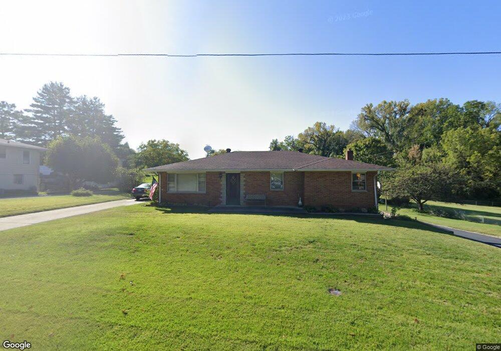
506 Johann Dr Collinsville, IL 62234
Estimated Value: $162,905 - $234,000
3
Beds
1
Bath
676
Sq Ft
$285/Sq Ft
Est. Value
About This Home
This home is located at 506 Johann Dr, Collinsville, IL 62234 and is currently estimated at $192,726, approximately $285 per square foot. 506 Johann Dr is a home located in Madison County with nearby schools including John A Renfro Elementary School, Dorris Intermediate School, and Collinsville Middle School.
Ownership History
Date
Name
Owned For
Owner Type
Purchase Details
Closed on
May 27, 2016
Sold by
Tottleben Patricia Lynn and Hawkins Marie Antoinette
Bought by
Furfaro Vincent James
Current Estimated Value
Purchase Details
Closed on
Jul 24, 2008
Sold by
Furaro Verna E and Tottleben Patricia
Bought by
Furfaro Verna E and Tottleben Patricia Lynn
Purchase Details
Closed on
Jul 7, 2005
Sold by
Furfaro Verna E
Bought by
Furfaro Verna E and Tottleben Patricia Lynn
Create a Home Valuation Report for This Property
The Home Valuation Report is an in-depth analysis detailing your home's value as well as a comparison with similar homes in the area
Home Values in the Area
Average Home Value in this Area
Purchase History
| Date | Buyer | Sale Price | Title Company |
|---|---|---|---|
| Furfaro Vincent James | -- | Madison County Title Company | |
| Furfaro Verna E | $8,000 | Attorneys Title | |
| Furfaro Verna E | -- | -- |
Source: Public Records
Tax History Compared to Growth
Tax History
| Year | Tax Paid | Tax Assessment Tax Assessment Total Assessment is a certain percentage of the fair market value that is determined by local assessors to be the total taxable value of land and additions on the property. | Land | Improvement |
|---|---|---|---|---|
| 2024 | $2,421 | $71,530 | $15,510 | $56,020 |
| 2023 | $2,421 | $66,210 | $14,360 | $51,850 |
| 2022 | $2,492 | $61,230 | $13,280 | $47,950 |
| 2021 | $2,616 | $56,460 | $12,220 | $44,240 |
| 2020 | $2,643 | $53,870 | $11,660 | $42,210 |
| 2019 | $2,664 | $52,030 | $11,260 | $40,770 |
| 2018 | $2,686 | $49,290 | $10,670 | $38,620 |
| 2017 | $3,118 | $47,900 | $20,930 | $26,970 |
| 2016 | $3,274 | $47,900 | $20,930 | $26,970 |
| 2015 | $3,569 | $53,680 | $20,390 | $33,290 |
| 2014 | $3,569 | $53,680 | $20,390 | $33,290 |
| 2013 | $3,569 | $53,680 | $20,390 | $33,290 |
Source: Public Records
Map
Nearby Homes
- 10 White Lily Dr
- 0 N Keebler Ave
- 414 Bunker Hill Dr
- 203 Greenfield Dr
- 22 Brookwood Dr
- 1224 Cedar Ridge Ct
- 625 W Country Ln
- 5 Brookwood Dr
- 2007 Belt Line Rd
- 1120 Williams St
- 102 Toni Ct
- 2 Chelsea Rd
- 1210 Constance St
- 308 Brown Ave
- 706 Illinois Ave
- 1121 Carraway Ct
- 617 N Morrison Ave
- 1227 Ridge Ave
- 123 Elliot St
- 0 Strong Ave