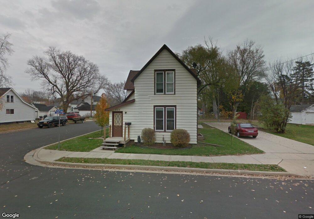
506 Juneau Ave Mauston, WI 53948
Estimated Value: $150,000 - $185,000
--
Bed
--
Bath
--
Sq Ft
10,000
Acres
About This Home
This home is located at 506 Juneau Ave, Mauston, WI 53948 and is currently estimated at $170,066. 506 Juneau Ave is a home located in Juneau County with nearby schools including West Side Elementary School, Lyndon Station Elementary School, and Grayside Elementary School.
Ownership History
Date
Name
Owned For
Owner Type
Purchase Details
Closed on
Apr 30, 2018
Sold by
Benson Brian R and Benson Vonda K
Bought by
Dawson Paul and Dawson Rebecca
Current Estimated Value
Purchase Details
Closed on
Apr 18, 2016
Sold by
Nelson Joan M
Bought by
Benson Brian R and Benson Vonda K
Purchase Details
Closed on
Feb 22, 2008
Sold by
The Bank Of New York As Successor In Int
Bought by
Nelsen Joan M
Purchase Details
Closed on
Aug 7, 2007
Sold by
Haagenson Adam
Bought by
Jpmorgan Chase Bank National Association
Purchase Details
Closed on
Dec 4, 2006
Sold by
Haagenson Melissa K
Bought by
Haagenson Adam J
Purchase Details
Closed on
Jun 24, 2005
Sold by
Buelow Donald L
Bought by
Haagenson Adam
Create a Home Valuation Report for This Property
The Home Valuation Report is an in-depth analysis detailing your home's value as well as a comparison with similar homes in the area
Home Values in the Area
Average Home Value in this Area
Purchase History
| Date | Buyer | Sale Price | Title Company |
|---|---|---|---|
| Dawson Paul | $55,000 | -- | |
| Benson Brian R | $30,000 | -- | |
| Nelsen Joan M | $29,500 | -- | |
| Jpmorgan Chase Bank National Association | $56,300 | -- | |
| Haagenson Adam J | $45,500 | -- | |
| Haagenson Adam | $80,000 | -- |
Source: Public Records
Tax History Compared to Growth
Tax History
| Year | Tax Paid | Tax Assessment Tax Assessment Total Assessment is a certain percentage of the fair market value that is determined by local assessors to be the total taxable value of land and additions on the property. | Land | Improvement |
|---|---|---|---|---|
| 2024 | $1,761 | $82,000 | $13,200 | $68,800 |
| 2023 | $1,518 | $82,000 | $13,200 | $68,800 |
| 2022 | $1,532 | $82,000 | $13,200 | $68,800 |
| 2021 | $1,340 | $53,000 | $11,000 | $42,000 |
| 2020 | $1,487 | $53,000 | $11,000 | $42,000 |
| 2019 | $1,299 | $53,000 | $11,000 | $42,000 |
| 2018 | $1,079 | $39,900 | $11,000 | $28,900 |
| 2017 | $1,072 | $39,900 | $11,000 | $28,900 |
| 2016 | $1,532 | $60,000 | $11,000 | $49,000 |
| 2015 | $1,827 | $60,000 | $11,000 | $49,000 |
| 2014 | $1,569 | $60,000 | $11,000 | $49,000 |
| 2013 | $1,631 | $60,000 | $11,000 | $49,000 |
Source: Public Records
Map
Nearby Homes
- 202 Wisconsin St
- 415 West Ave
- 234 Tremont St
- 318 Tremont St
- 120 W Milwaukee St
- 0 Fleet St Unit 1978417
- 108 Hanover St
- L5 Buttner Ct
- 12.35 AC Highway 58 Trunk
- 506 W State St
- 914 Marshall Dr
- Lot 47 Turner Dr
- 810 S Hickory St
- 813 S Hickory St
- 207 Highview Ave
- L31 Heath Ct
- 722 E State St
- 420 E Monroe St
- 0.3 acres Lincoln St
- 1.6 acres Prospect and Lincoln St